Perry-Castañeda Library
Map Collection
United Kingdom Maps
The following maps were produced by the U.S. Central Intelligence Agency, unless otherwise indicated.
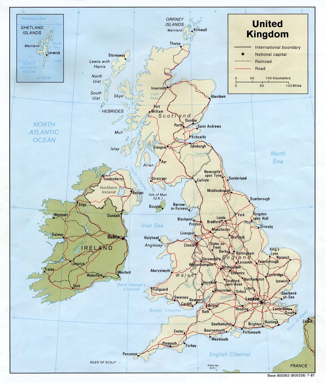
Country Maps- United Kingdom (Political) 1987 (229K) and pdf format (241K)
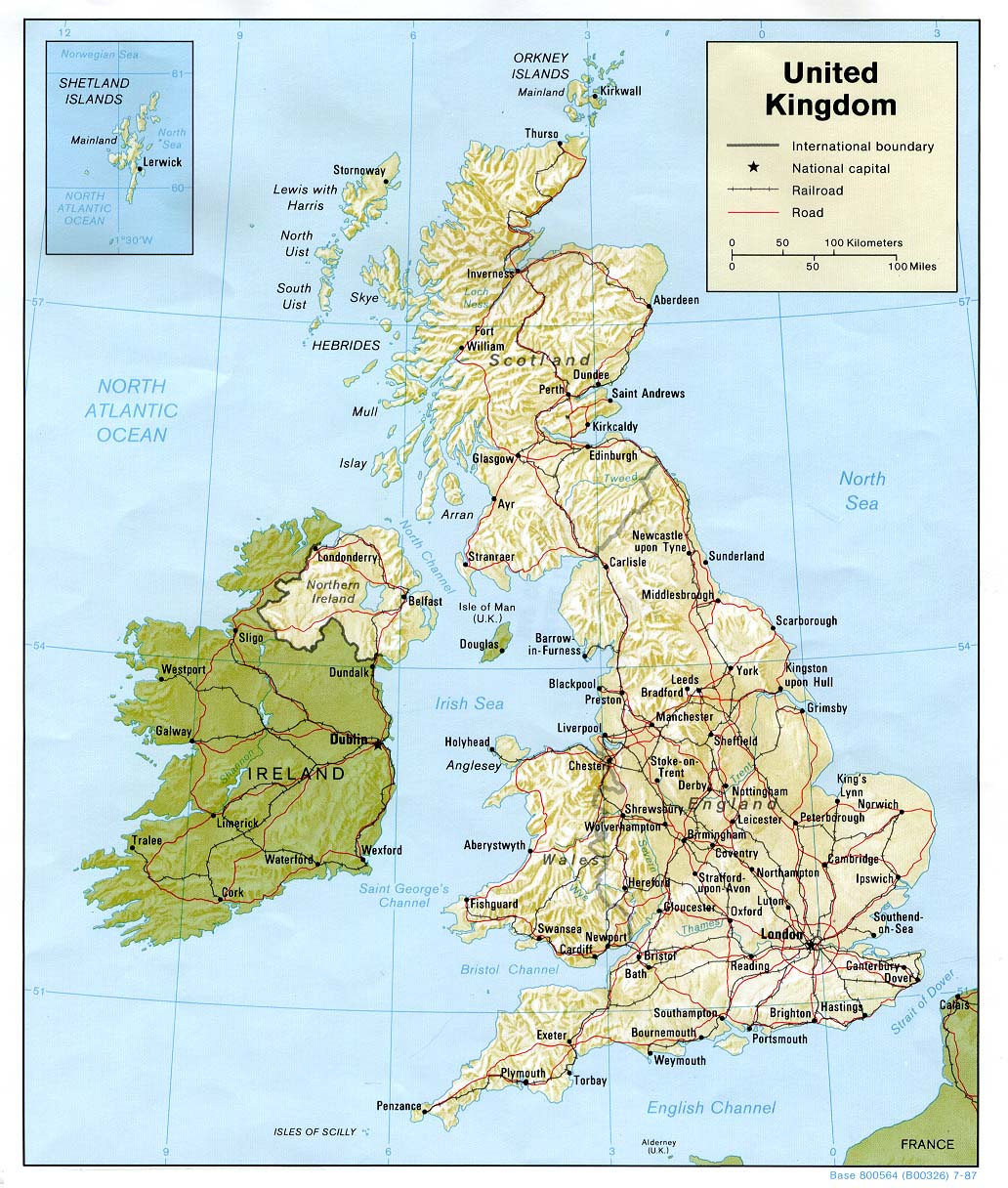
- United Kingdom (Shaded Relief) 1987 (268K) and pdf format (274K)
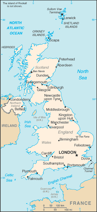
- United Kingdom (Small Map) 2016 (23K)
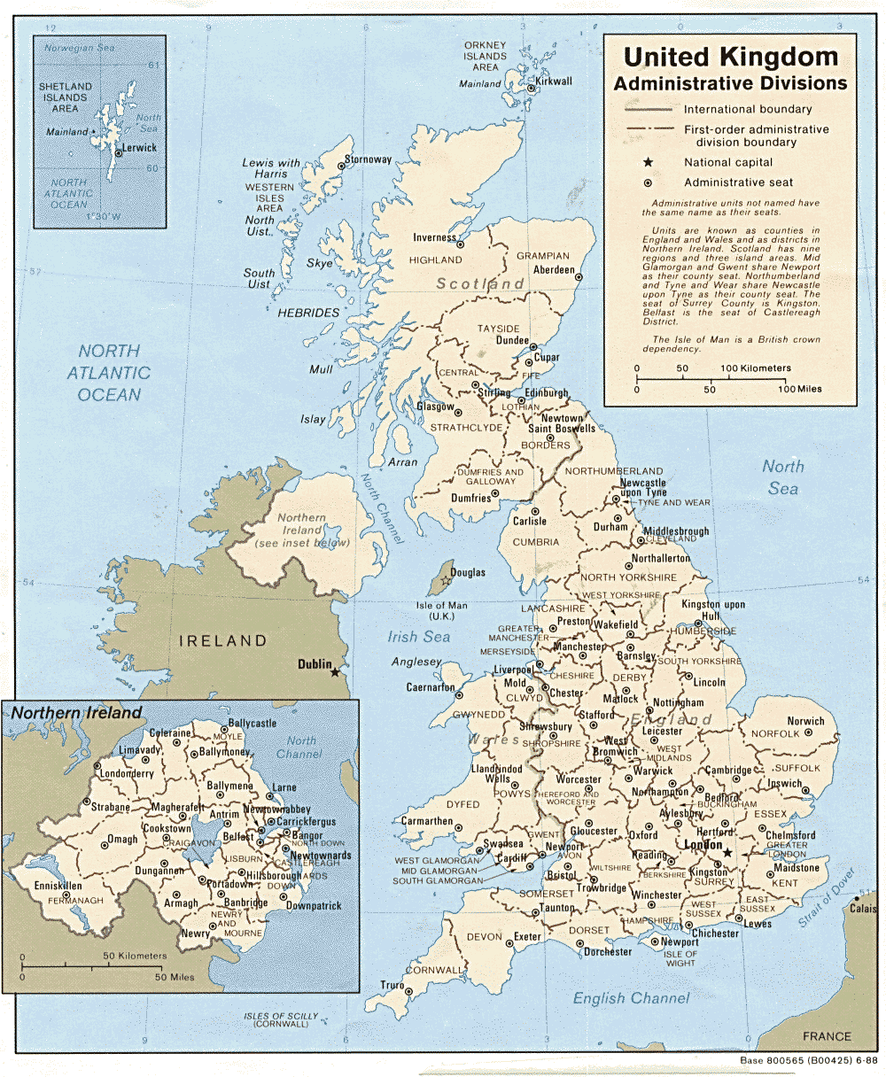
- United Kingdom: Admininistrative Divisions 1988 (317K) and pdf format (325K) Note: The United Kingdom map does not reflect current administrative divisions.
- 1:2,000,000 - Europe Series 4464, Great Britain War Office, 1965
- This series covers the United Kingdom
- 1:1,000,000 - Operational Navigation Chart Series U.S. Defense Mapping Agency Aerospace Center. Not for navigational use
- This series includes all of the United Kingdom
- 1:500,000 - Tactical Pilotage Charts U.S. Defense Mapping Agency Aerospace Center. Not for navigational use
- This series includes all of the United Kingdom
- 1:500,000 - World Series 1404, Great Britain. War Office and Air Ministry. 1958-
- This series includes parts of England and Scotland
- 1:500,000 - Aeronautical Series M422 (4369), U.S. Army Map Service, 1944 Not for navigational use
- This series includes most of Great Britain
- 1:253,440 - British Isles Series M521, U.S. Army Map Service (Ordnance Survey), 1942-
- This series covers Scotland
- 1:250,000 - Great Britain Series M523, U.S. Army Map Service, 1960-
- This series covers all of Great Britain
- This series covers the United Kingdom
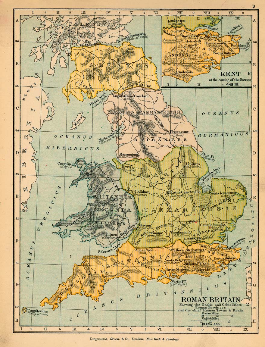
- Roman Britain Circa 400 (307K)
- From "The Public Schools Historical Atlas" by Charles Colbeck, 1905.
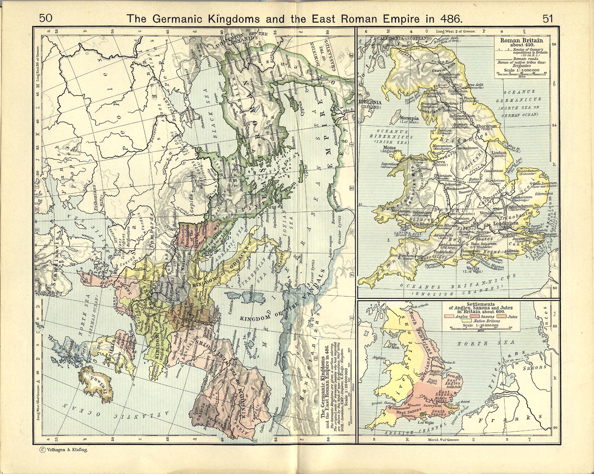
- Roman Britain About 410 (770K)
- From The Historical Atlas by William R. Shepherd, 1911.
- Settlements of Angles, Saxons and Jutes in Britain about 600 (770K)
- From The Historical Atlas by William R. Shepherd, 1911.
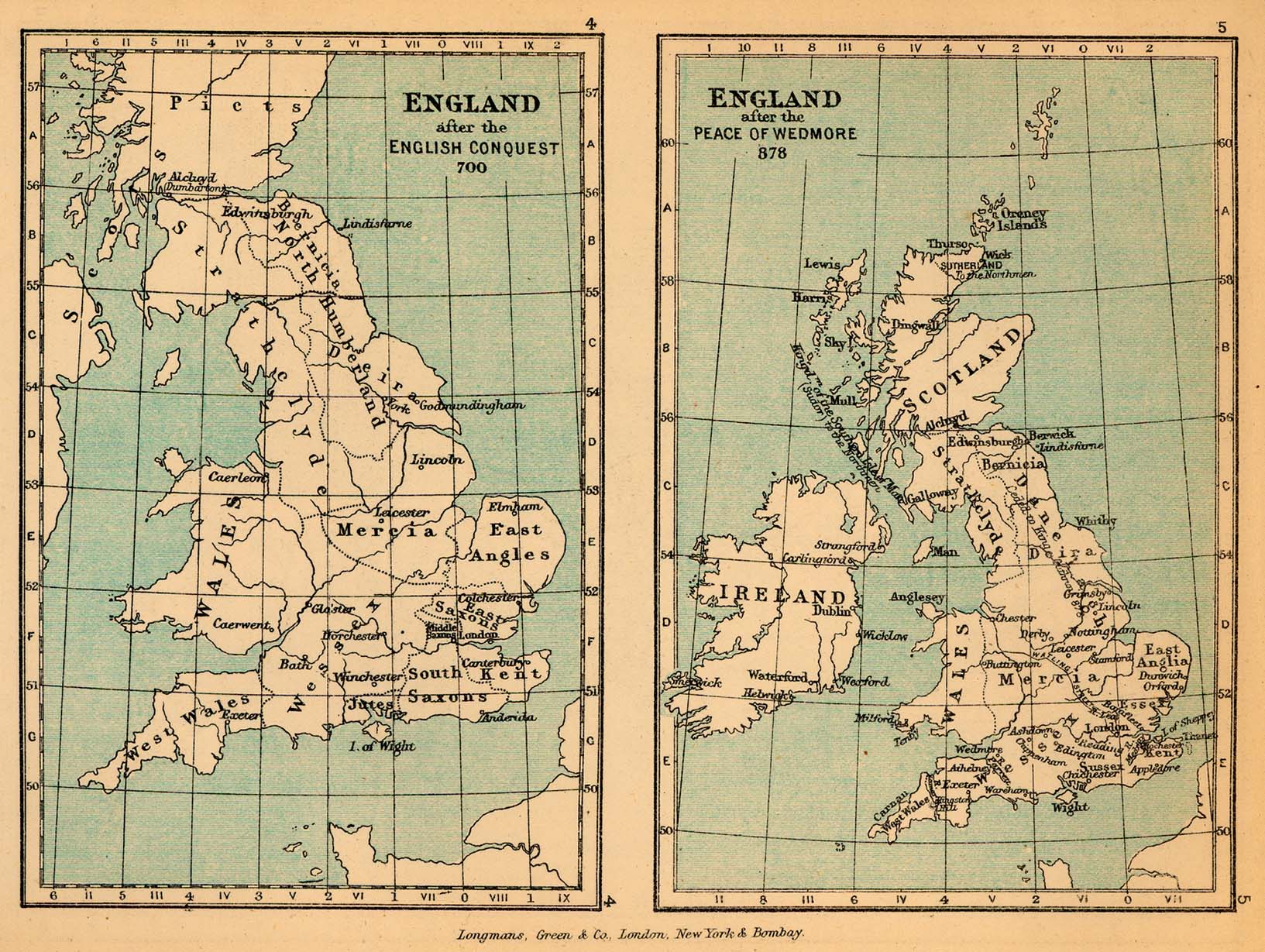
- England in 700 and 878 (409K)
- From "The Public Schools Historical Atlas" by Charles Colbeck, 1905.
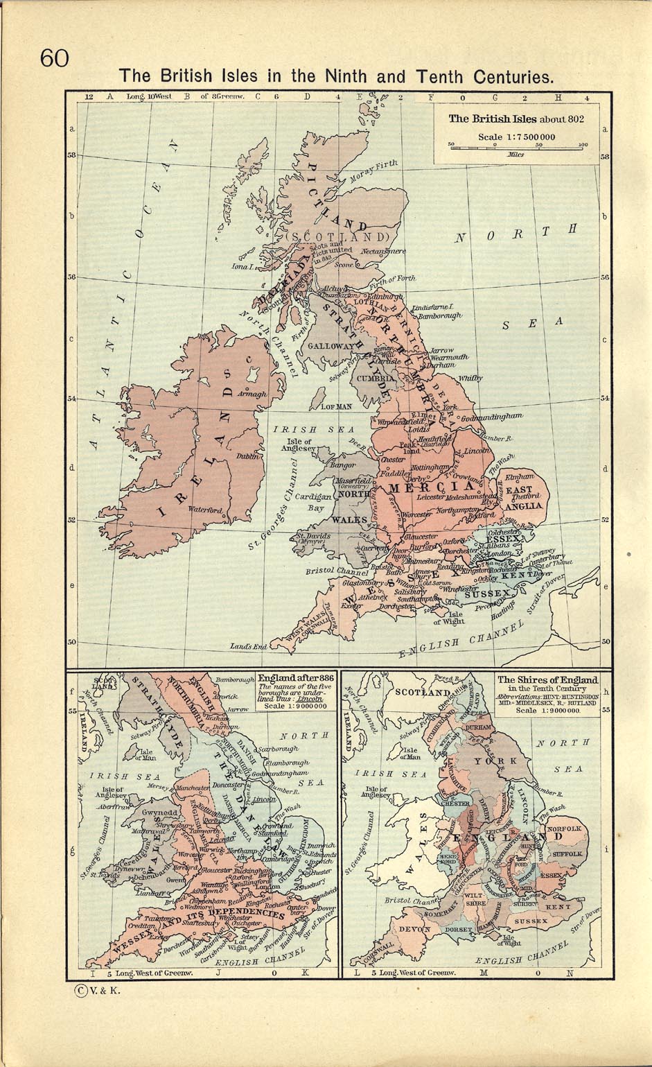
- The British Isles about 802 (332K)
- From The Historical Atlas by William R. Shepherd, 1911.
- England after 886 (332K)
- From The Historical Atlas by William R. Shepherd, 1911.
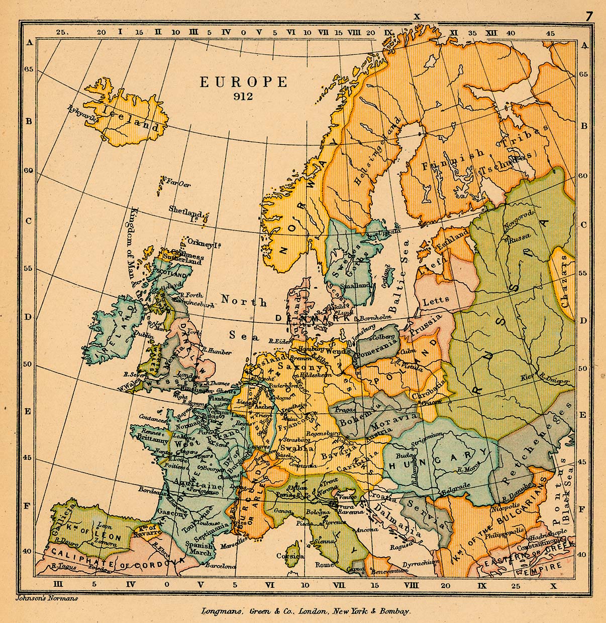
- Europe in 912 (529K)
- From "The Public Schools Historical Atlas" by Charles Colbeck, 1905.
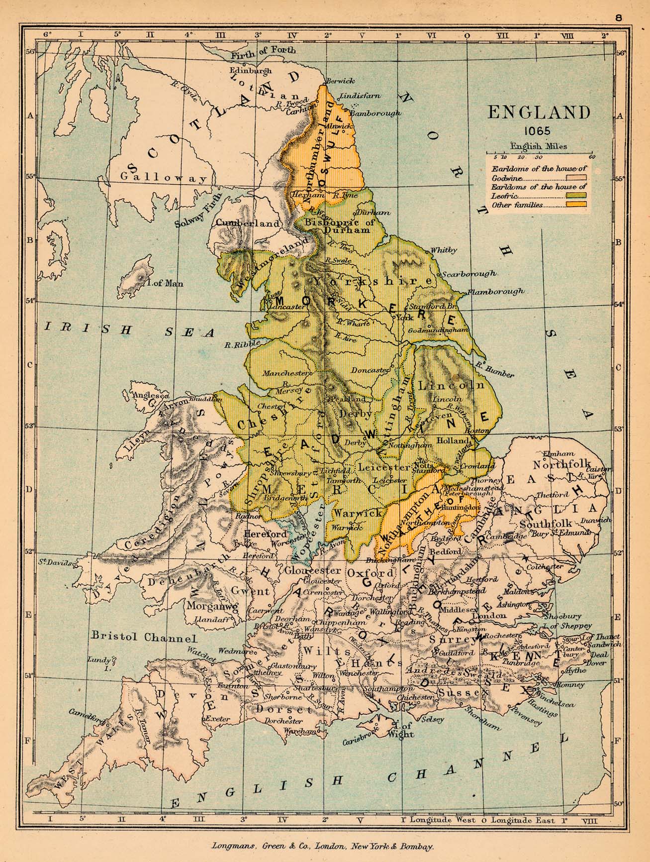
- England in 1065 (513K)
- From "The Public Schools Historical Atlas" by Charles Colbeck, 1905.
- The Shires of England in the Tenth Century (332K)
- The Shires of England in the Tenth Century. From The Historical Atlas by William R. Shepherd, 1911.
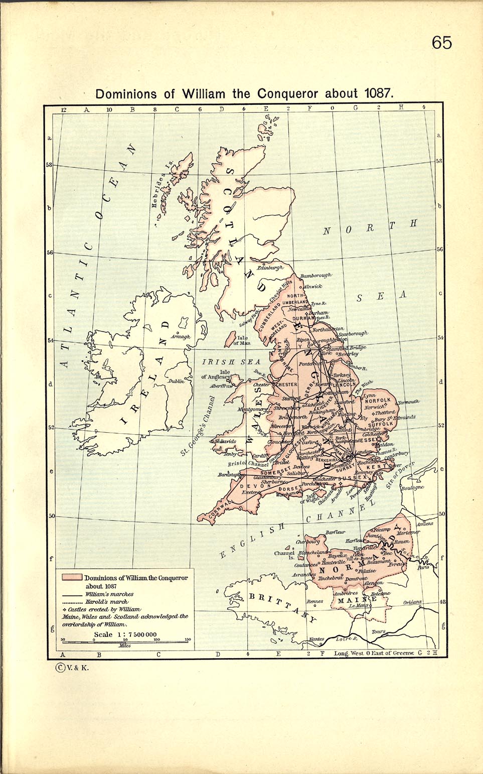
- Dominions of William the Conqueror about 1087 (273K)
- From The Historical Atlas by William R. Shepherd, 1911.
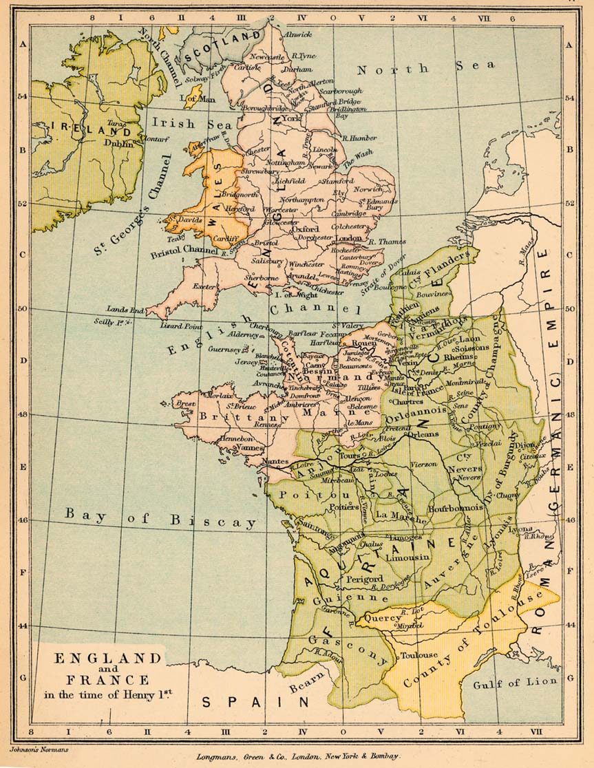
- England and France in the time of Henry I (257K)
- From "The Public Schools Historical Atlas" by Charles Colbeck, 1905.
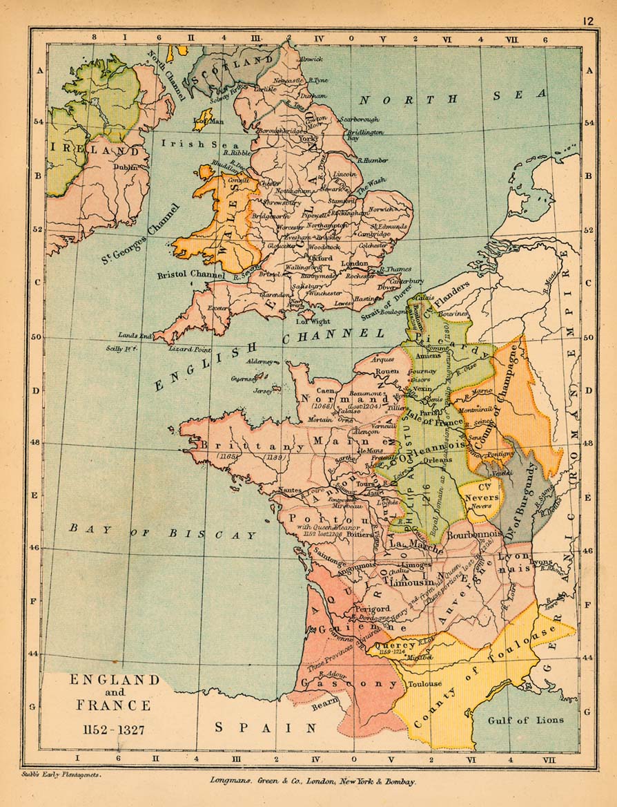
- England and France, 1152-1327 (264K)
- From "The Public Schools Historical Atlas" by Charles Colbeck, 1905.
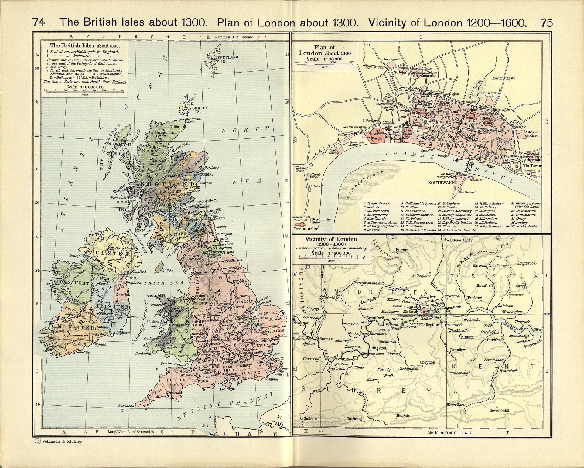
- Vicinity of London, 1200-1600 (687K)
- From The Historical Atlas by William R. Shepherd, 1911.
- The British Isles about 1300 (687K)
- From The Historical Atlas by William R. Shepherd, 1911.
- Plan of London about 1300 (687K)
- From The Historical Atlas by William R. Shepherd, 1911.
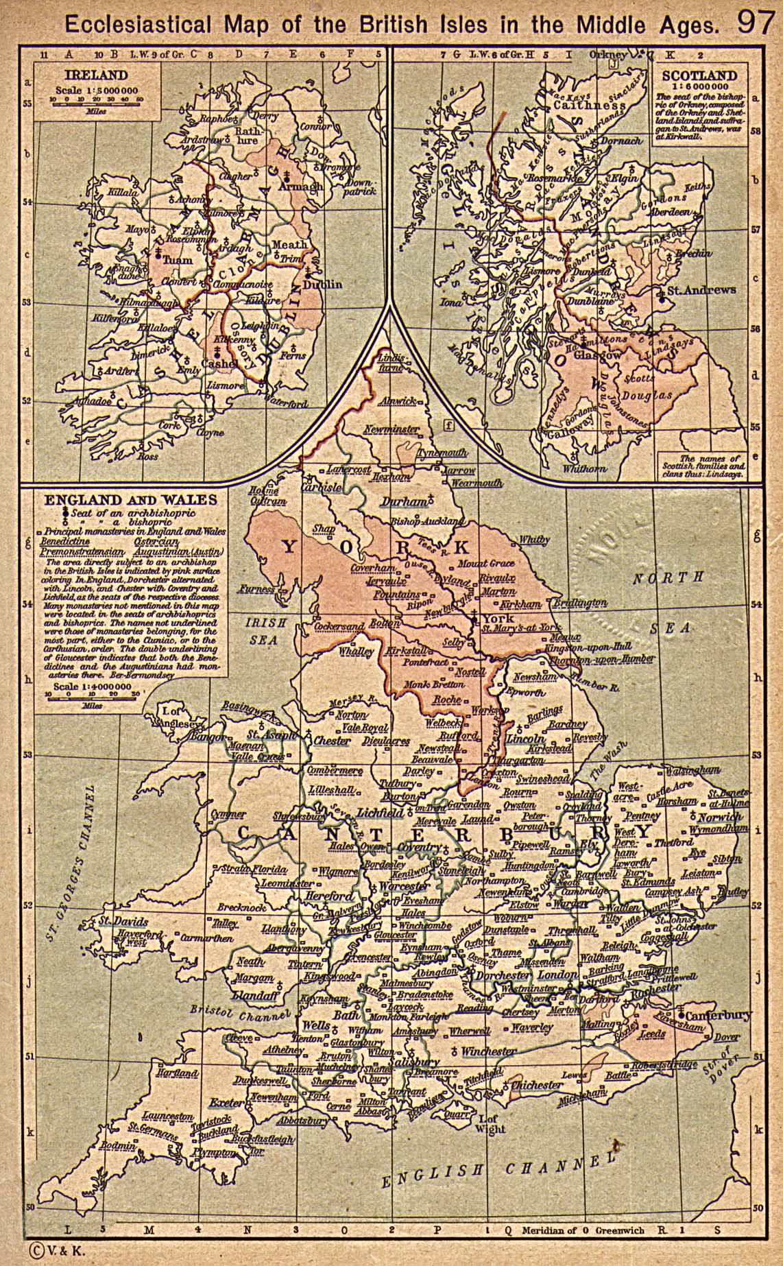
- British Isles Ecclesiastical Map (645K)
- Ecclesiastical Map of the British Isles in the Middle Ages. From The Historical Atlas by William R. Shepherd, 1923.
- England during the Wars of the Roses [1445-1485] (246K)
- From "The Public Schools Historical Atlas" by Charles Colbeck, 1905.
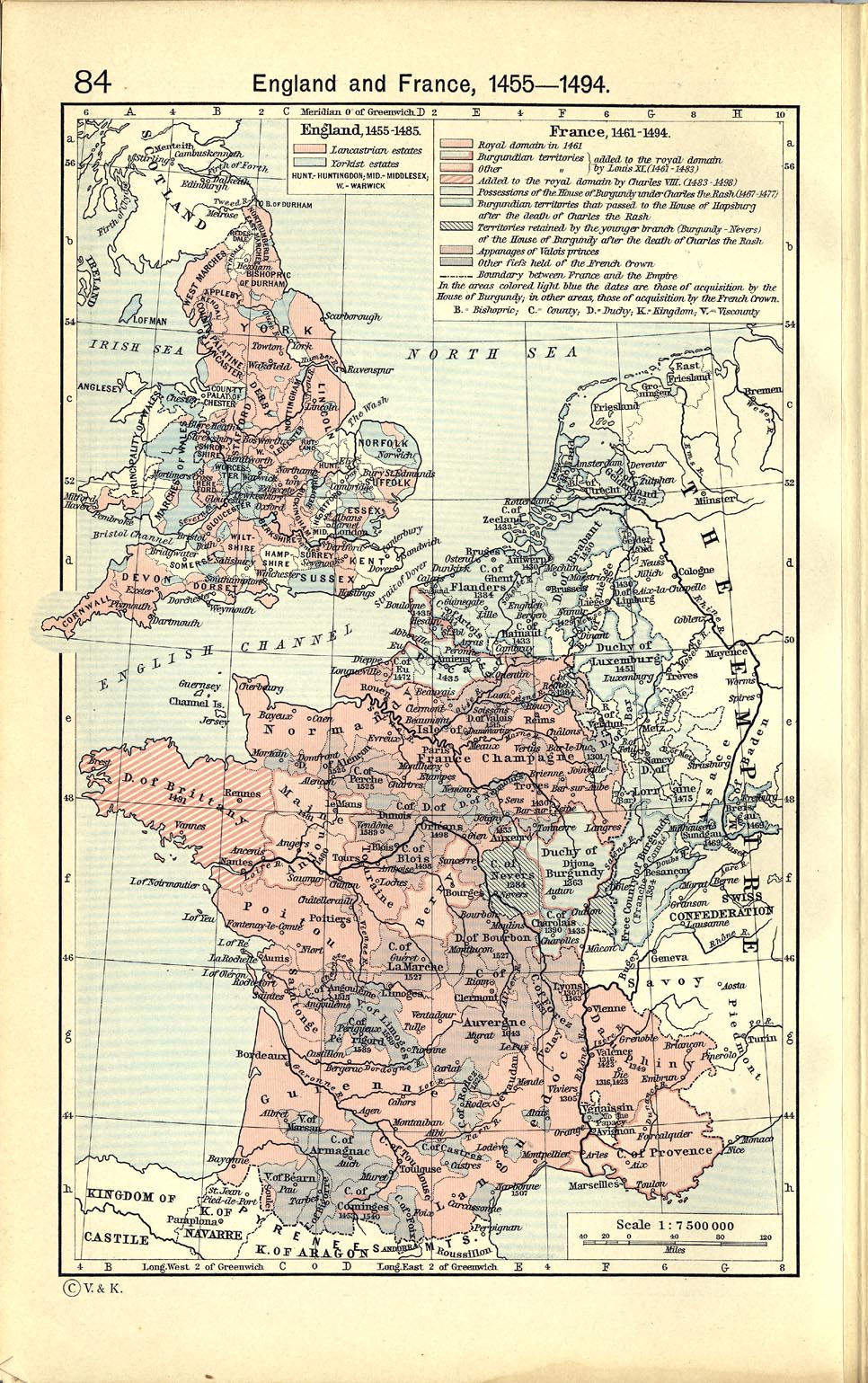
- England and France, 1455-1494 (440K)
- From The Historical Atlas by William R. Shepherd, 1911.
- England and Wales under the Tudors [1485-1603] (877K)
- From "The Cambridge Modern History Atlas", 1912.
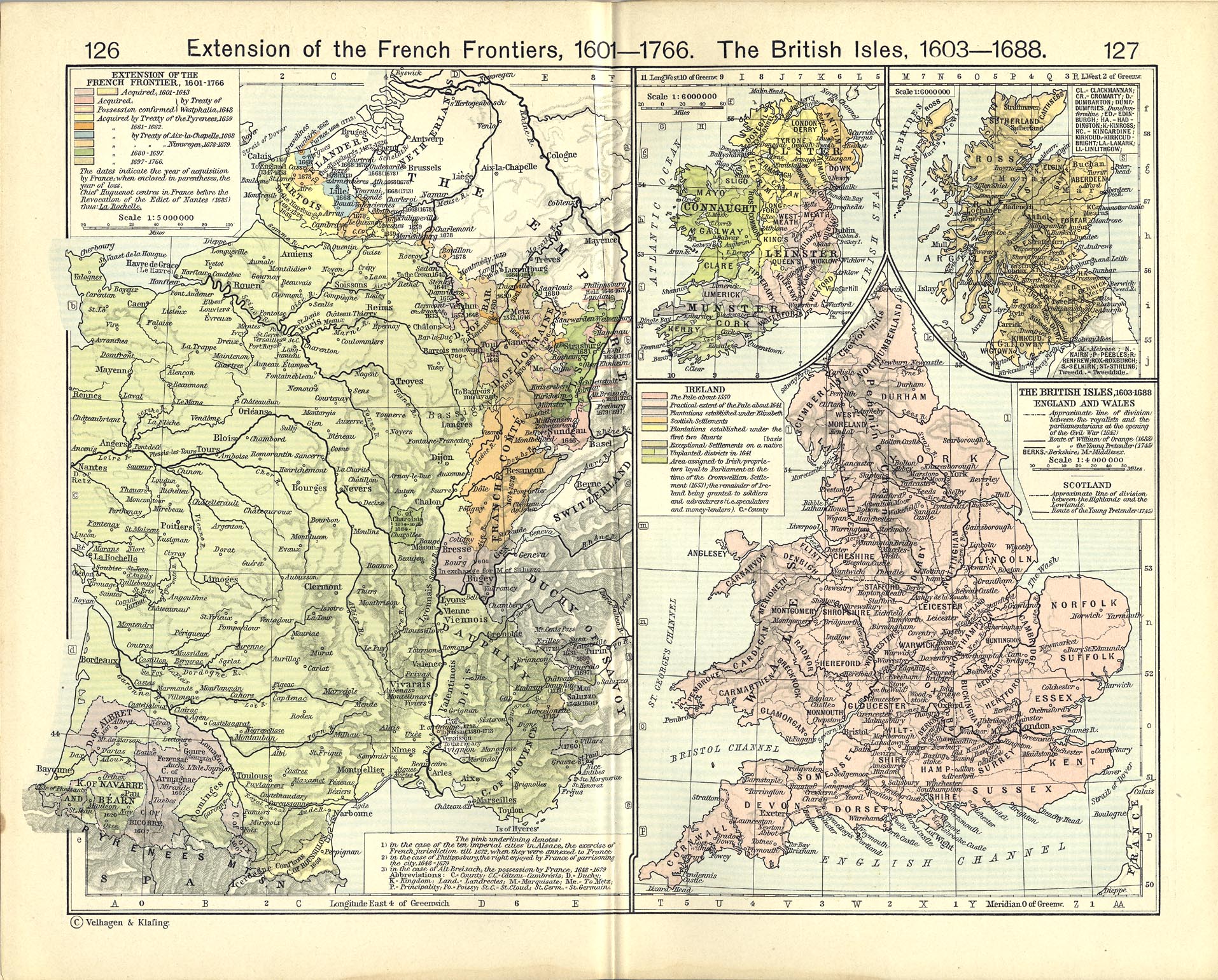
- The British Isles, 1603-1688 (904K)
- From The Historical Atlas by William R. Shepherd, 1911.
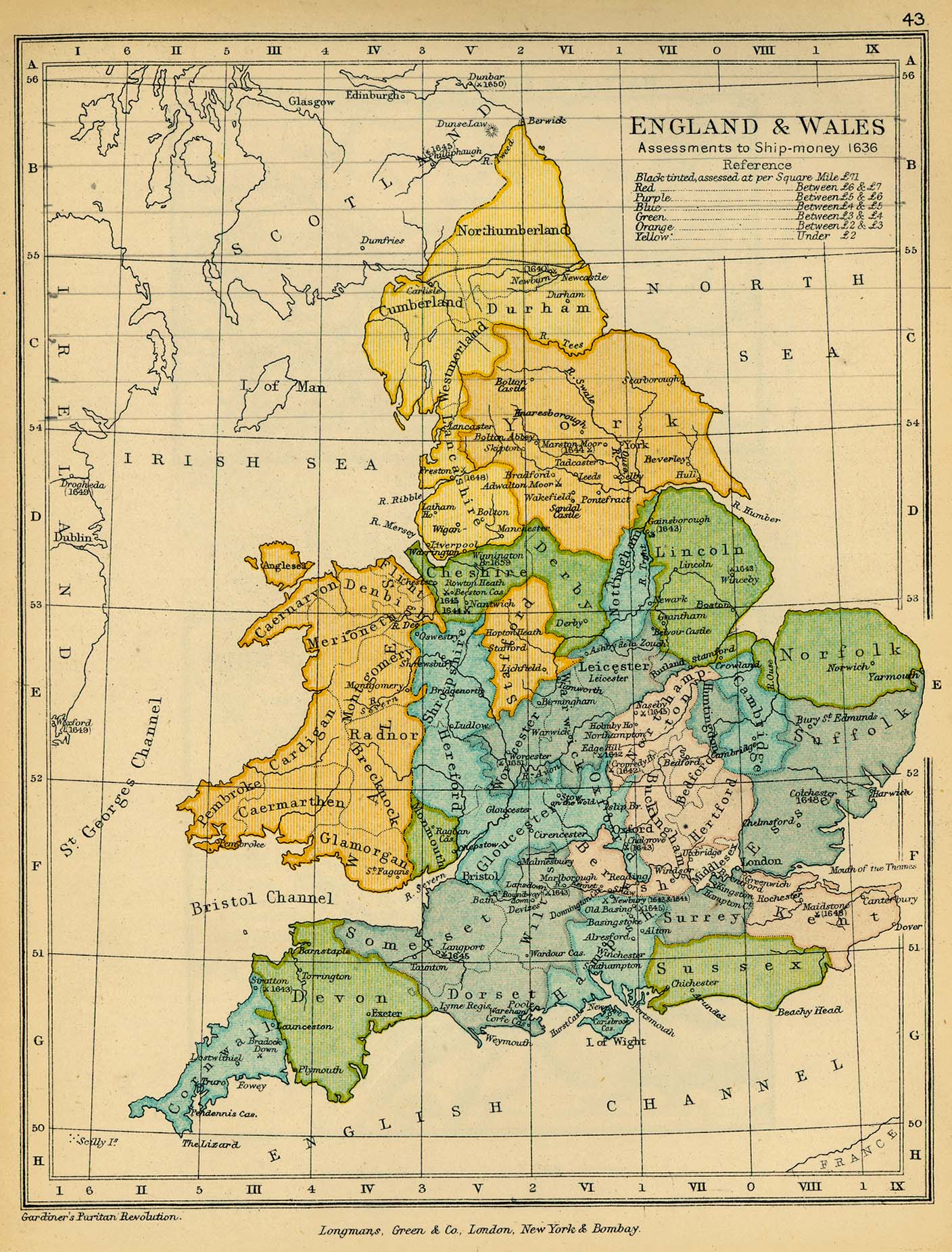
- England and Wales. Assessments to Ship-money, 1636 (514K)
- From "The Public Schools Historical Atlas" by Charles Colbeck, 1905.
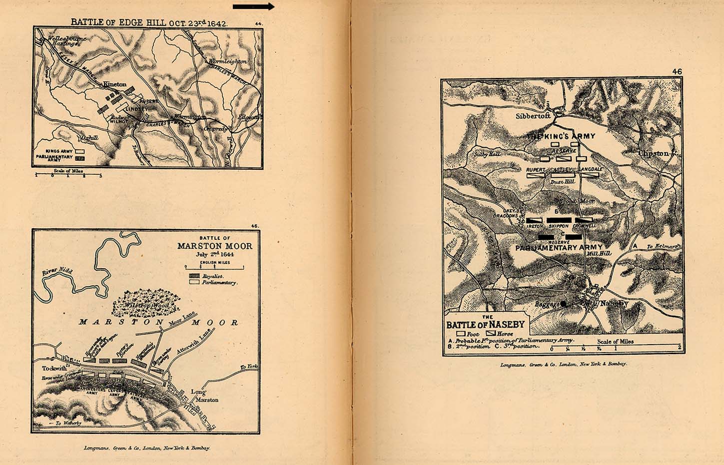
- Battles of Edge Hill, Marston Moor, Naseby (254K)
- From "The Public Schools Historical Atlas" by Charles Colbeck, 1905.
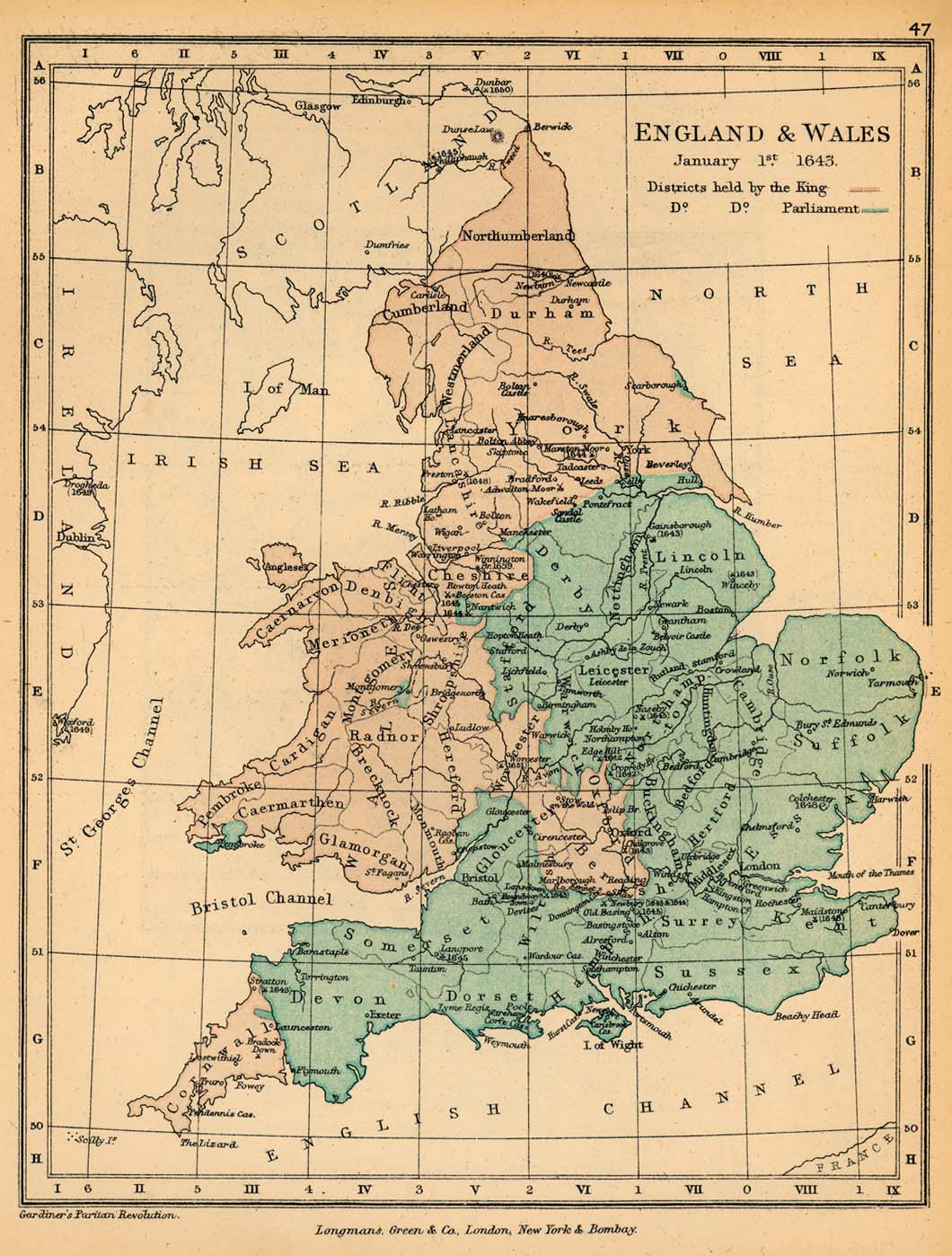
- England and Wales, January 1, 1643 (254K)
- From "The Public Schools Historical Atlas" by Charles Colbeck, 1905.
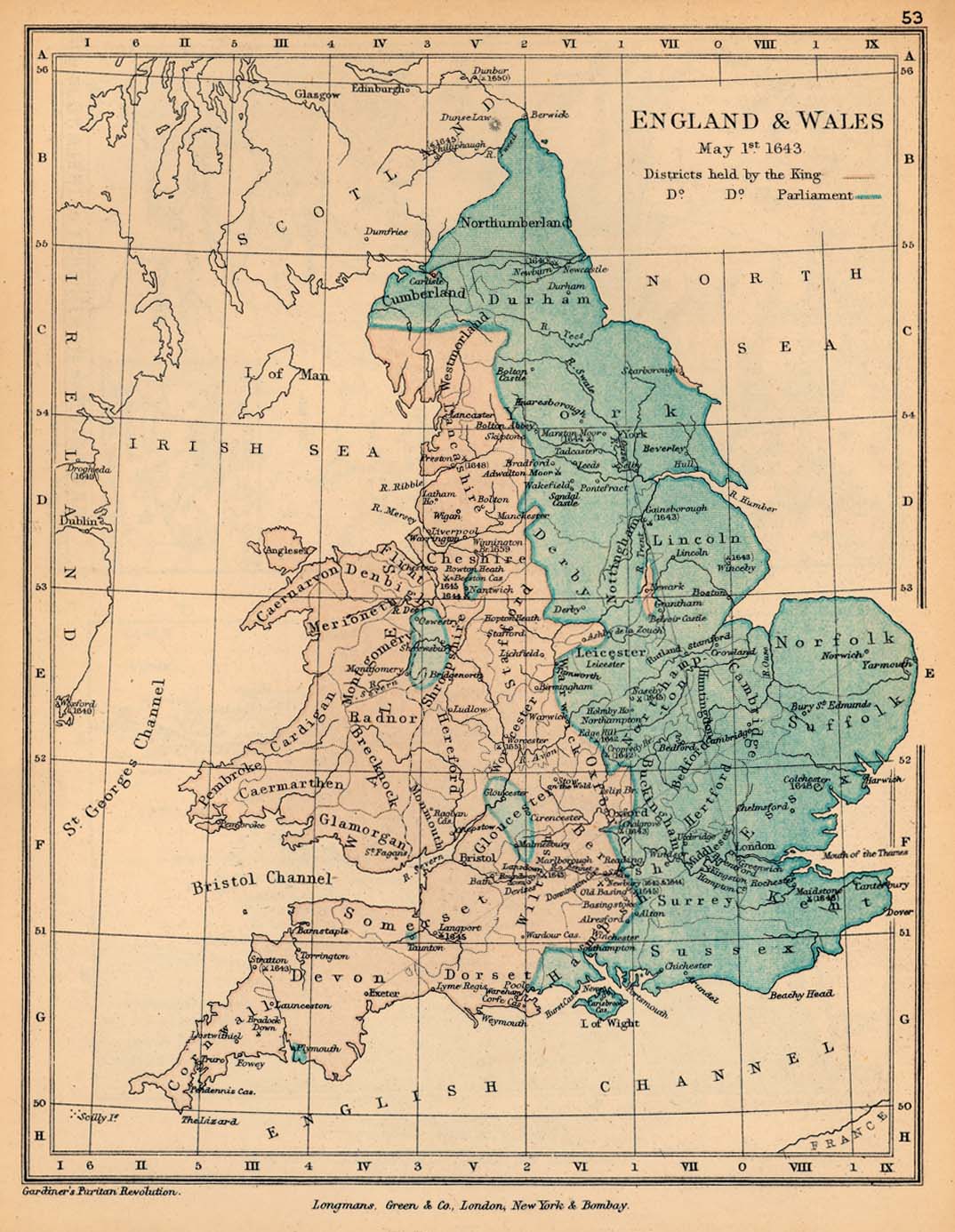
- England and Wales, May 1, 1643 (254K)
- From "The Public Schools Historical Atlas" by Charles Colbeck, 1905.
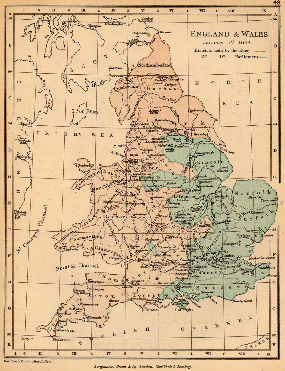
- England and Wales, January 1, 1644 (328K)
- From "The Public Schools Historical Atlas" by Charles Colbeck, 1905.
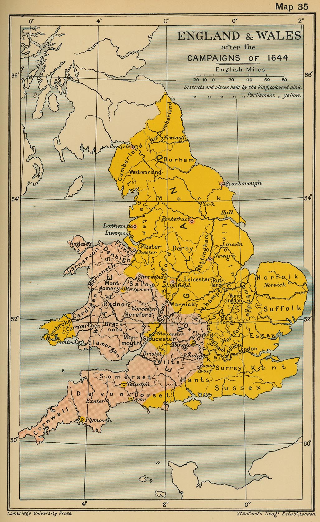
- England and Wales after the Campaigns of 1644 (426K)
- From "The Cambridge Modern History Atlas", 1912.
- England and Wales: The Civil War [1642-1651] (1006K)
- From "The Cambridge Modern History Atlas", 1912.
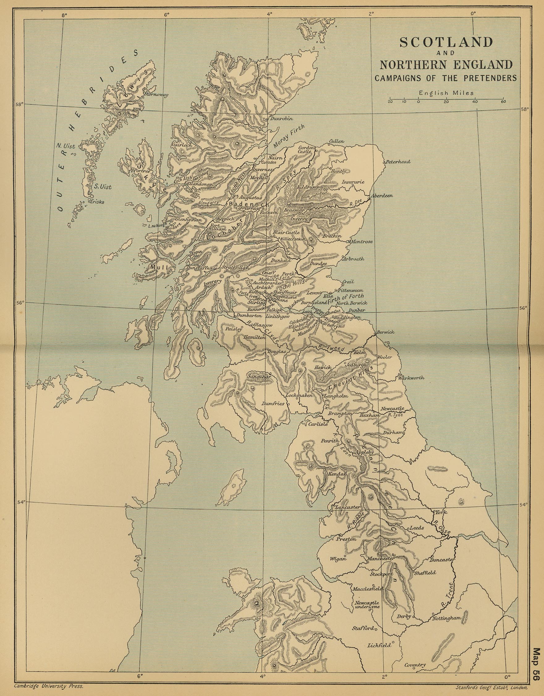
- Scotland and Northern England: Campaigns of the Pretenders (847K)
- From "The Cambridge Modern History Atlas", 1912.
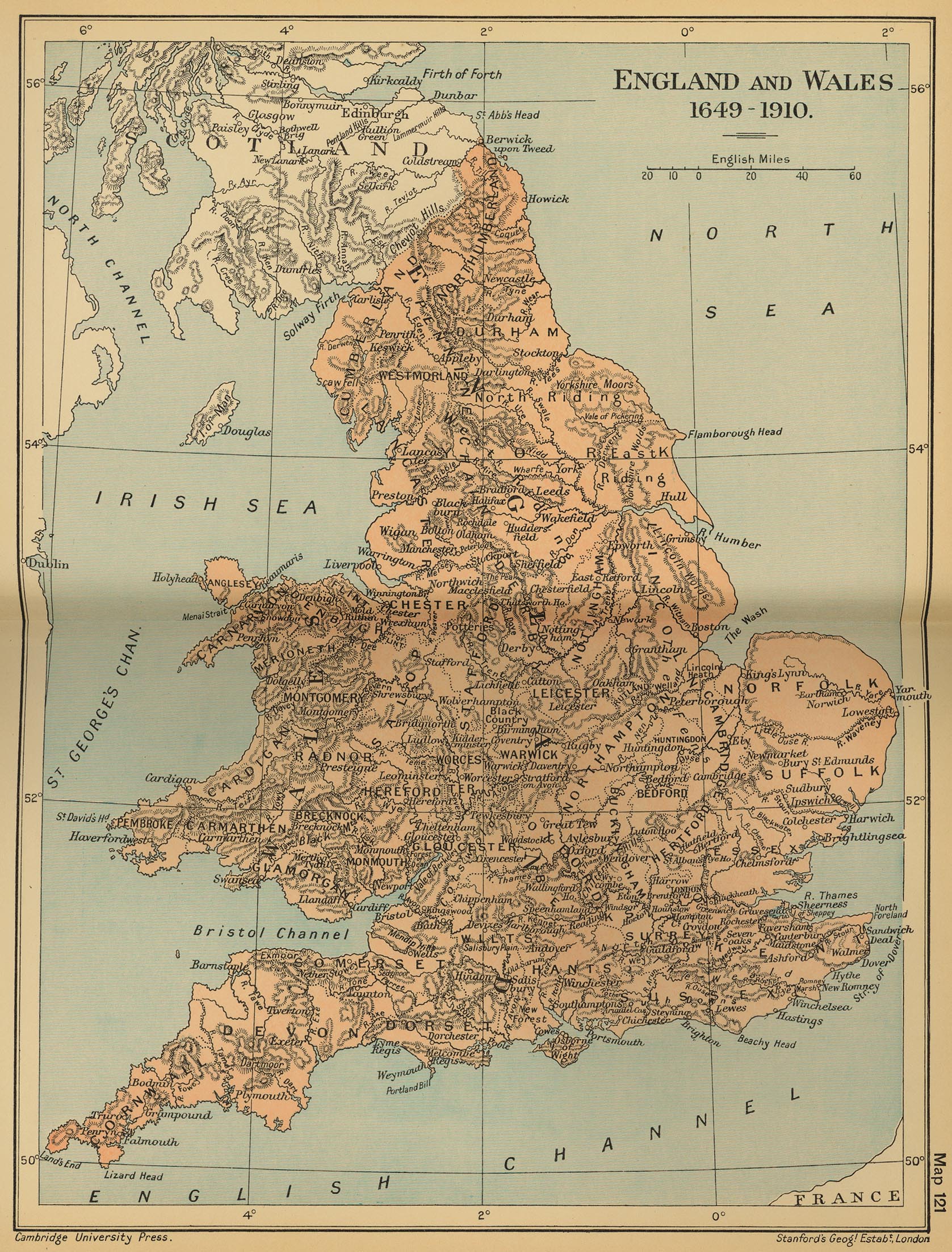
- England and Wales 1649-1910 (932K)
- From "The Cambridge Modern History Atlas", 1912.
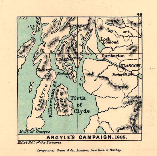
- Argyle's Campaign, 1685 (102K)
- From "The Public Schools Historical Atlas" by Charles Colbeck, 1905.
- Sedgemoor [1685] (98K)
- From "The Public Schools Historical Atlas" by Charles Colbeck, 1905.
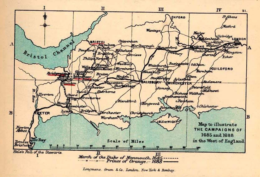
- South-West England, to illustrate the Campaign of 1685-1688 (131K)
- From "The Public Schools Historical Atlas" by Charles Colbeck, 1905.
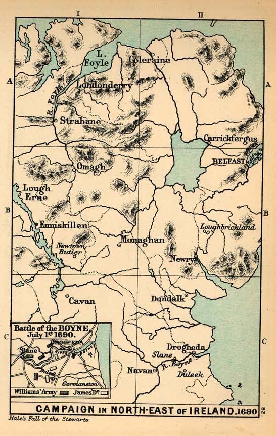
- Campaign in the North-East of Ireland and Battle of the Boyne, 1690 (157K)
- From "The Public Schools Historical Atlas" by Charles Colbeck, 1905.
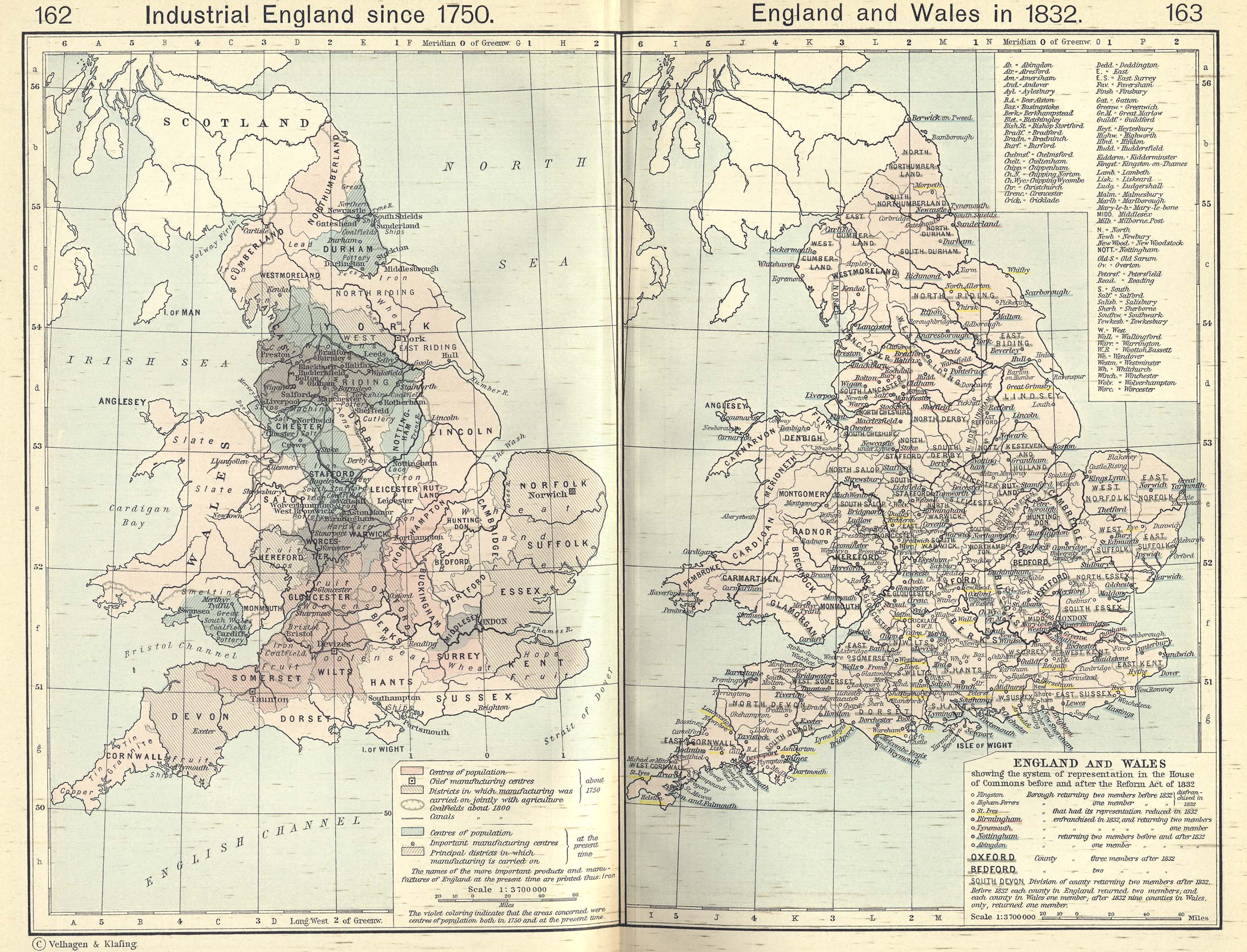
- Industrial England since 1750 (1.01MB)
- From The Historical Atlas by William R. Shepherd, 1911.
- England and Wales in 1832/Industrial England since 1750 (1.10MB)
- From The Historical Atlas by William R. Shepherd, 1911.
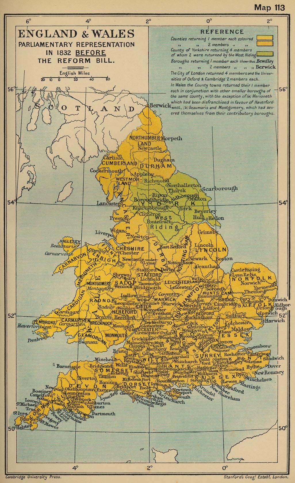
- England and Wales: Parliamentary Representation in 1832 Before the Reform Bill (519K)
- From "The Cambridge Modern History Atlas", 1912.
- London - Thames River 1882 (982K)
- "River Thames with the Docks from Woolwich to the Tower" from A Dictionary Practical, Theoretical, and Historical of Commerce and Commercial Navigation by J.R. M'Culloch. Longmans, Green and Co. London, 1882.
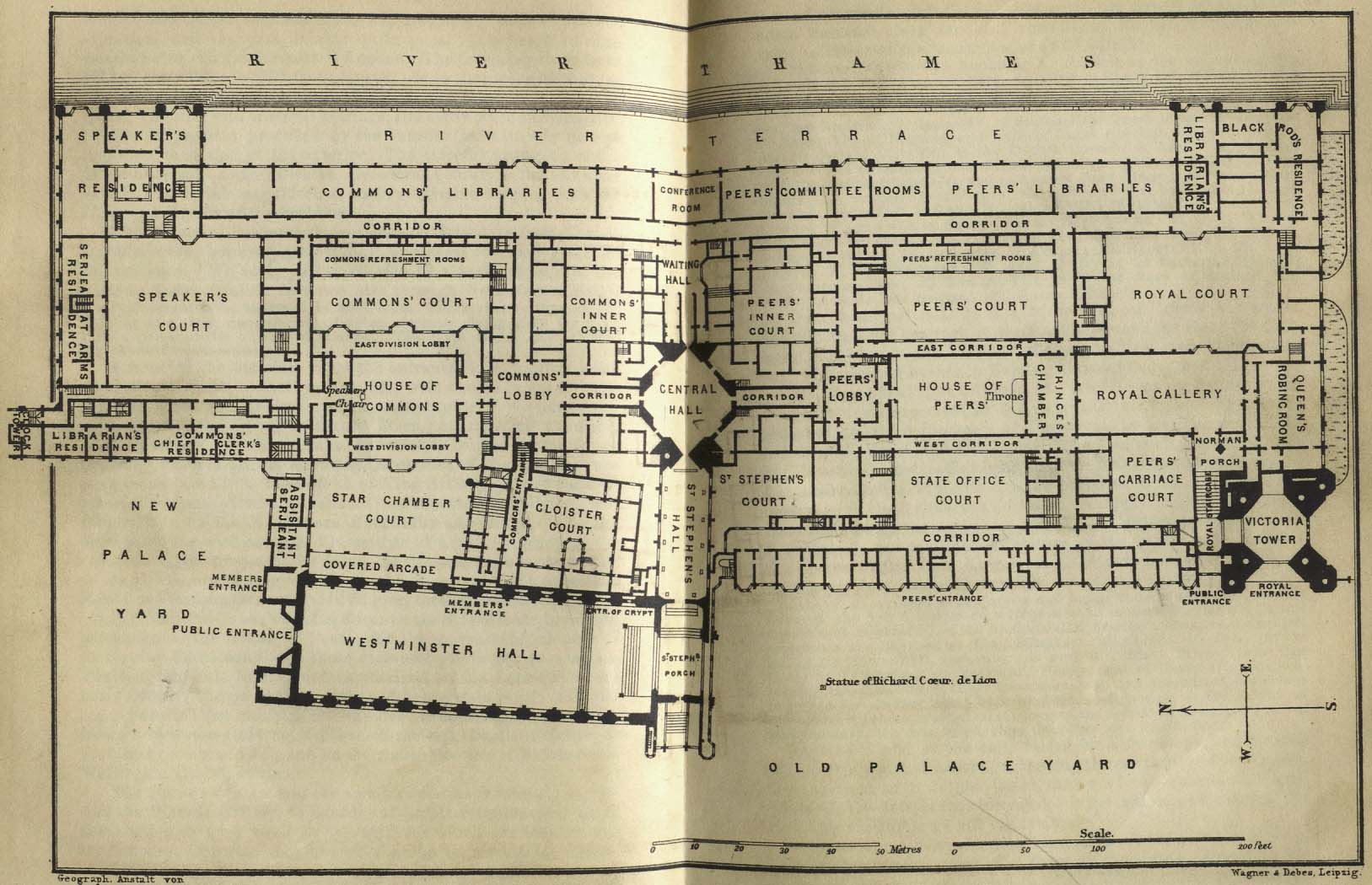
- London - Houses of Parliment 1894 (225K)
- "Old Palace Yard" from Baedeker, Karl. Baedeker's London and Its Environs. Ninth Revised Edition. Leipsic, 1894.
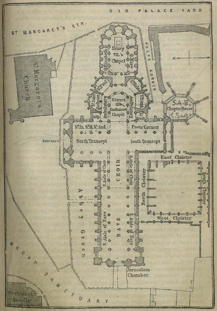
- London - Westminster Abbey 1894 (341K)
- "Westminster Abbey" from Baedeker, Karl. Baedeker's London and Its Environs. Ninth Revised Edition. Leipsic, 1894.
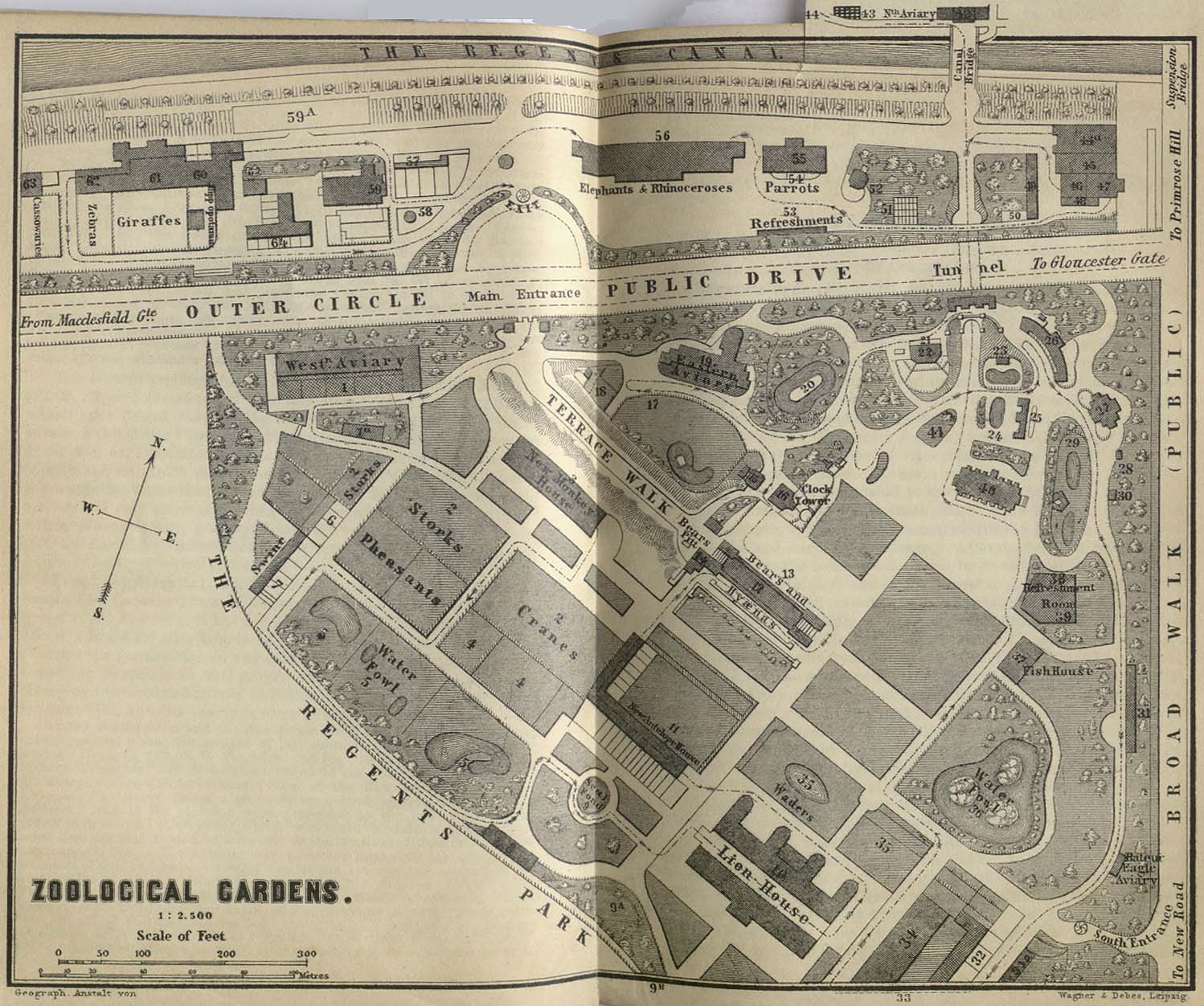
- London - Zoological Gardens 1894 (309K)
- "Zoological Gardens" from Baedeker, Karl. Baedeker's London and Its Environs. Ninth Revised Edition. Leipsic, 1894.
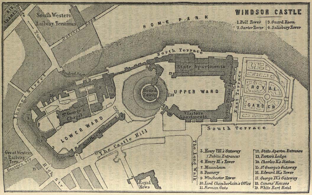
- London Area - Windsor Castle 1894 (203K)
- "Windsor Castle" from Baedeker, Karl. Baedeker's London and Its Environs. Ninth Revised Edition. Leipsic, 1894.
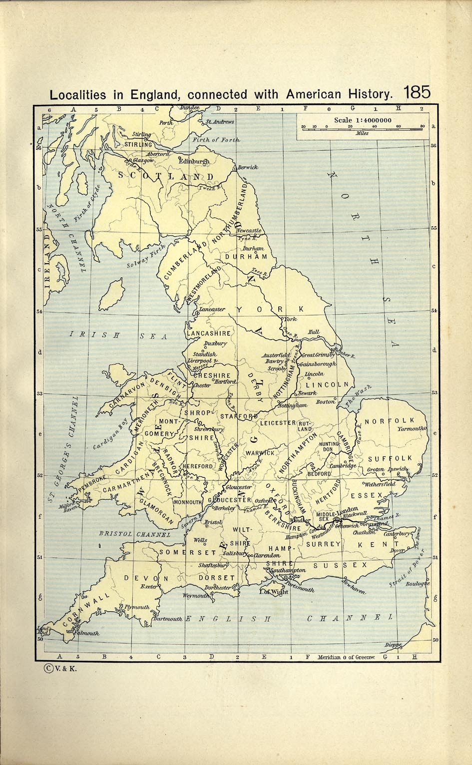
- Localities in England connected with American History (296K)
- From The Historical Atlas by William R. Shepherd, 1911.
- From "The Public Schools Historical Atlas" by Charles Colbeck, 1905.
![England during the Wars of the Roses [1445-1485]](historical/colbeck/england_wars_of_the_roses.jpg)
![England and Wales under the Tudors [1485-1603]](historical/ward_1912/england_wales_tudor_1485.jpg)
![England and Wales: The Civil War [1642-1651]](historical/ward_1912/england_wales_civil_war_large.jpg)
![Sedgemoor [1685]](historical/colbeck/battle_of_sedgemoor_1685.jpg)