Perry-Castañeda Library
Map Collection
Ukraine Maps
The following maps were produced by the U.S. Central Intelligence Agency, unless otherwise indicated.
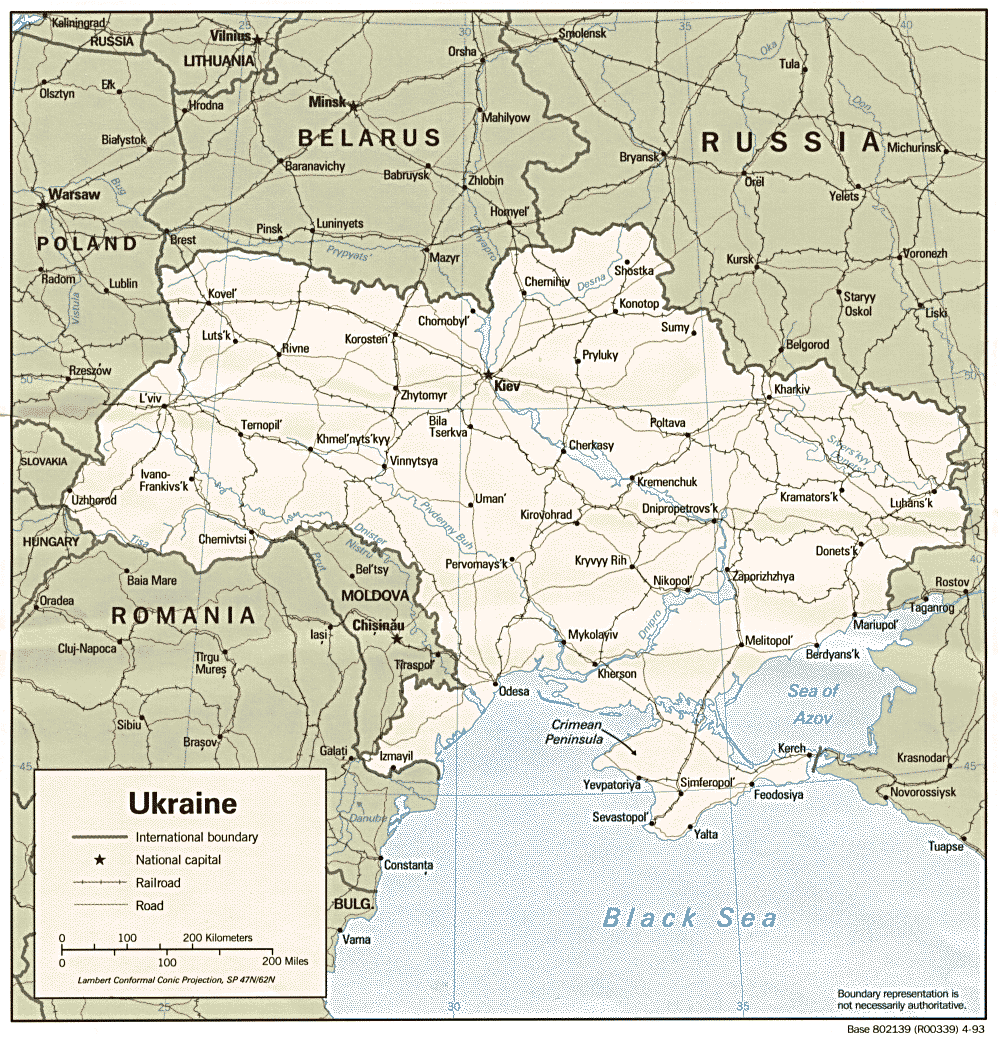
Ukraine Maps- Ukraine (Political) 1993 (268K) and pdf format (271K)
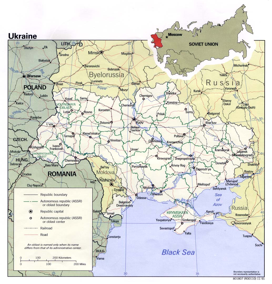
- Ukraine (Political) 1991 (245K) and pdf format (253K)
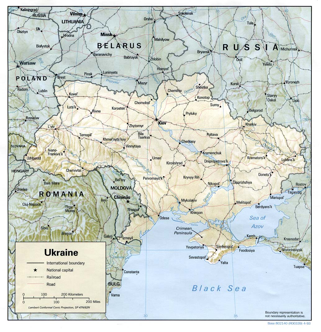
- Ukraine (Shaded Relief) 1993 (261K) and pdf format (287K)
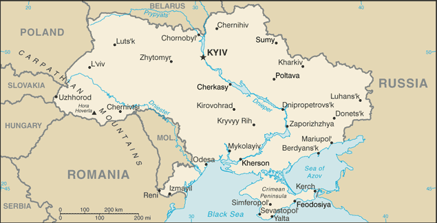
- Ukraine (Small Map) 2016 (31.7K)
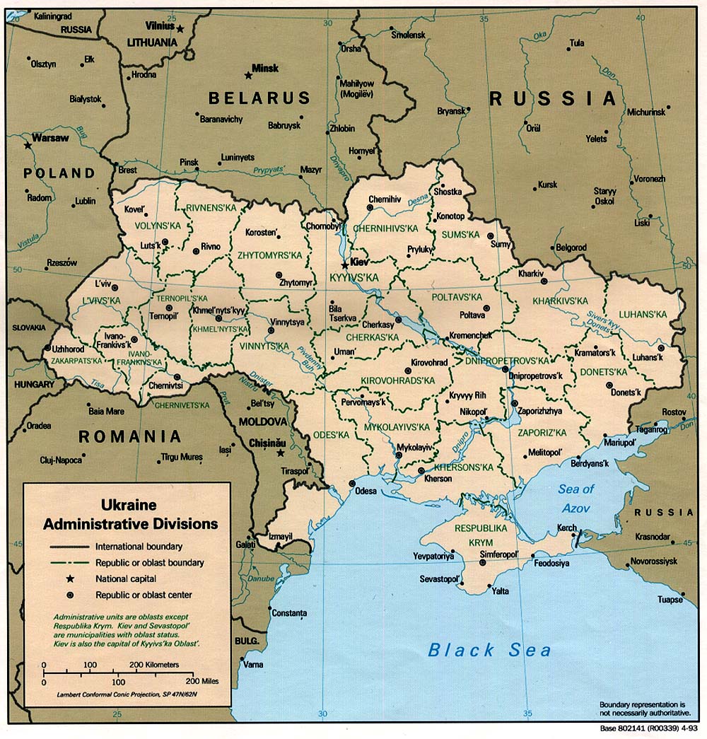
- Ukraine Administrative Divisions 1993 (323K) and pdf format (257K)
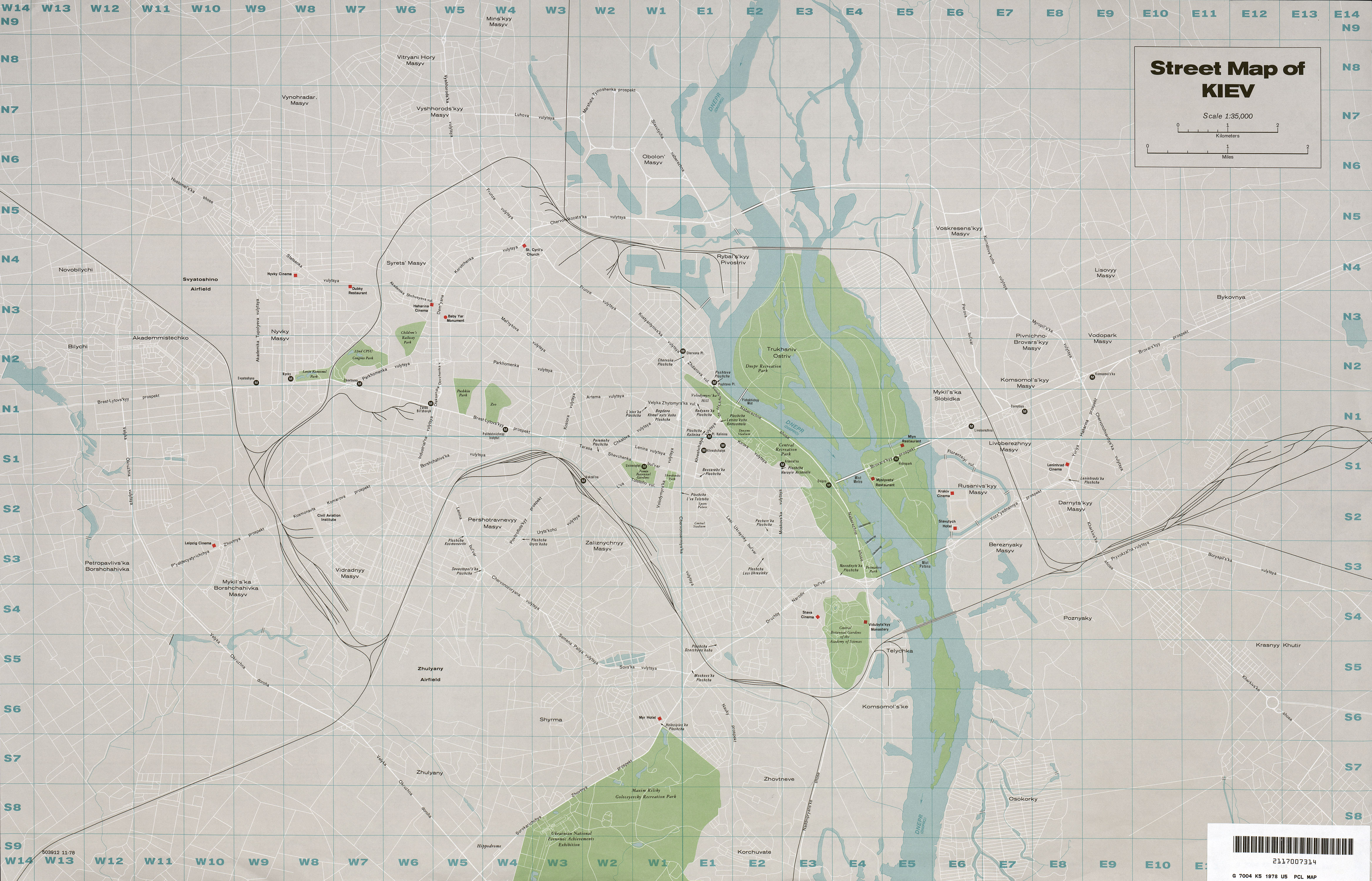
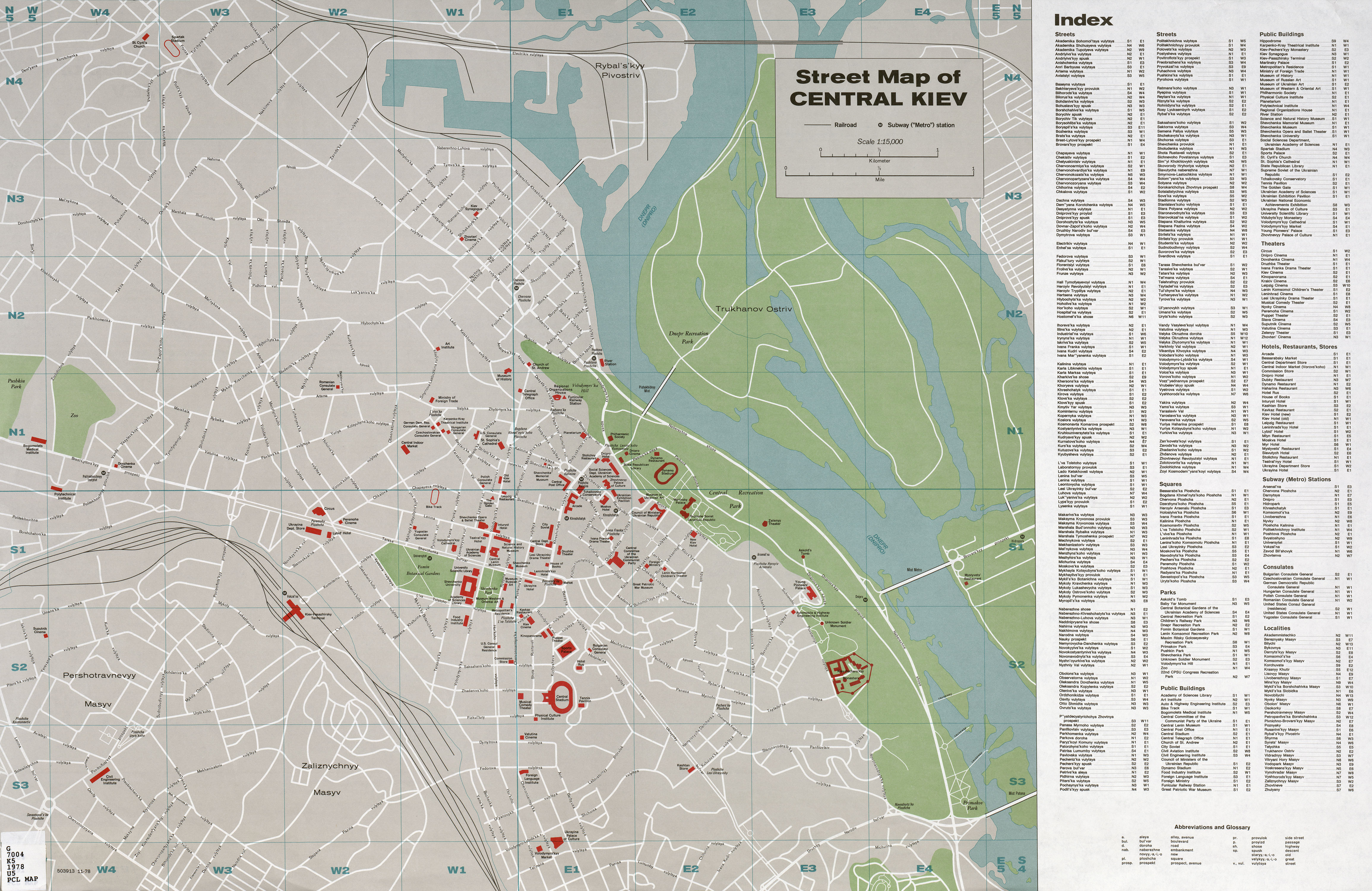
- Kiev 1:35,000 1978 (2.4 MB) and verso Central Kiev Street Map and Index 1:15,000 1978 (2.9 MB)
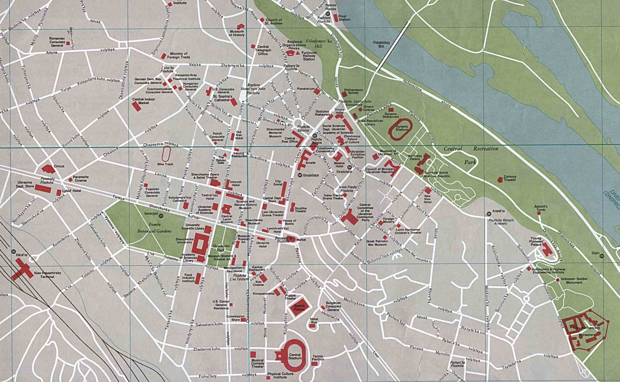
- Central Kiev [detail of central area] 1978 (223K)
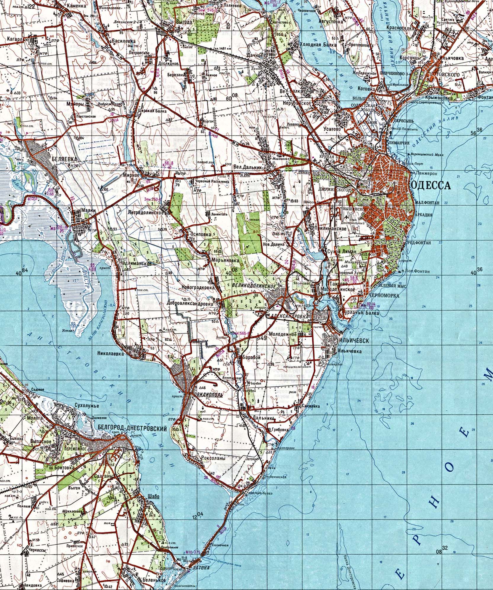
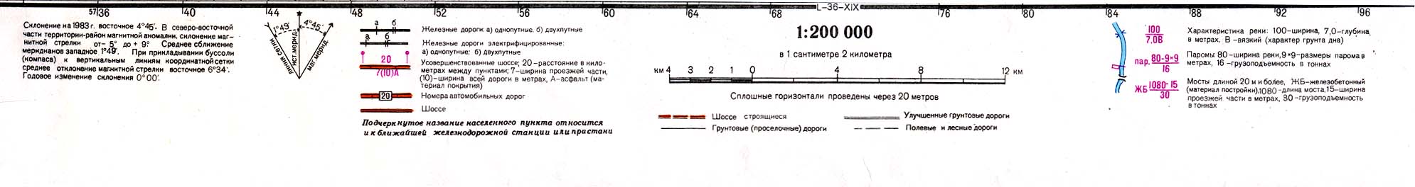
- Odessa (topographic map in Russian) original scale 1:200,000 Portion of Soviet General Staff map L-36-XIII 1984 (783K) and Map Legend (77K)
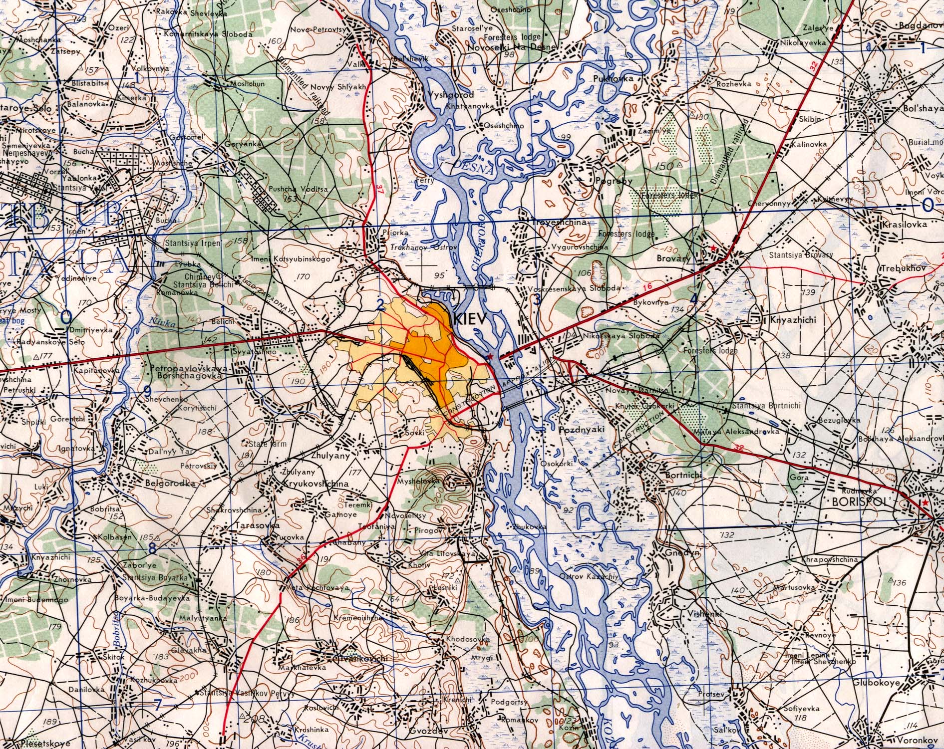
- Kiev Area 1953 original scale 1:250,000 printed by the Army Map Service 1960 (968K)
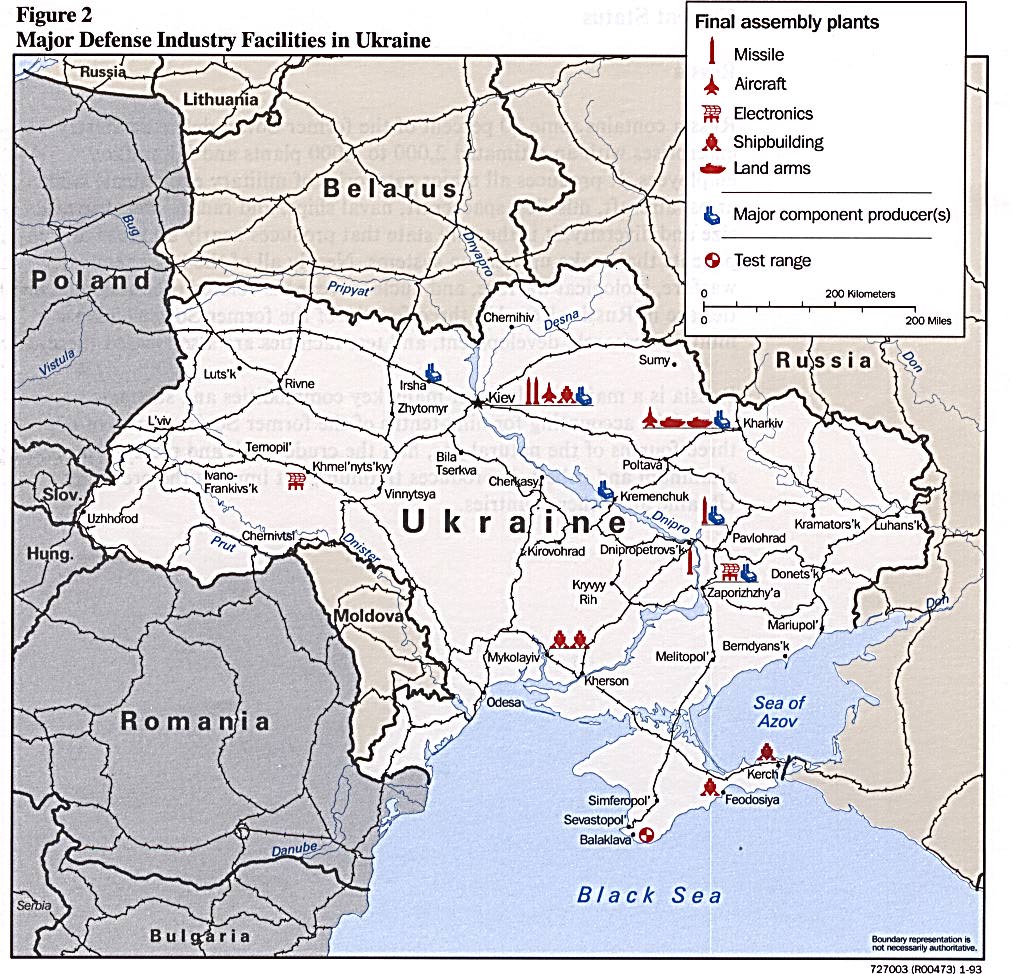
- Major Defense Industry Facilities in Ukraine from Defense Industries of the Newly Independent States of Eurasia. 1993 (240K)
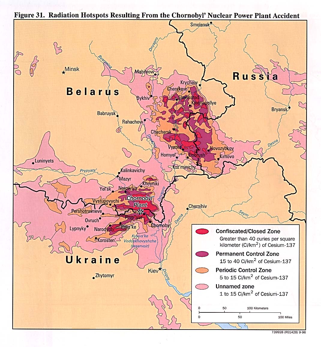
- Radiation Hotspots Resulting From the Chornobyl' Nuclear Power Plant Accident from Handbook of International Economic Statistics 1996 (273K)
- 1:1,000,000 - Operational Navigation Chart Series U.S. Defense Mapping Agency Aerospace Center.
- This series covers all of Ukraine. Not for navigational use
- 1:1,000,000 - International Map of the World U.S. Army Map Service.
- This series covers East Ukraine near the border with Russia.
- 1:500,000 - Tactical Pilotage Charts U.S. National Imagery and Mapping Agency. Not for navigational use
- This series covers Ukraine
- 1:250,000 - Russia Joint Operations Graphic U.S. National Imagery and Mapping Agency.
- This series covers most of southern and eastern Ukraine. Not for navigational use
- This series covers all of Ukraine. Not for navigational use
Maps on Other Web Sites
- City Maps
- Country Maps
2015: - Ukraine - Situation [November 2] (Ministry of Defense of Ukraine)
- Ukraine Cease-Fire and Withdrawal Demarcation Lines [September 15] (Stratfor)
- Ukraine - Situation [August 27] (Ministry of Defense of Ukraine)
- Ukraine - Situation [August 19] (Ministry of Defense of Ukraine)
- Ukraine - Situation [June 8] (Ministry of Defense of Ukraine)
- Ukraine - Situation [February 17] (Washington Post)
- Ukraine - The Situation East of Mariupol [February 14, 2015] (Conflict Report)
- Ukraine - Situation [February 12] (BBC News
- Ukraine - Approximate Areas Under Rebel Control [February 9] (BBC News)
- Ukraine Situation [January 15] (BBC News)
2014: - Ukraine - Maps (ReliefWeb)
- Ukraine in Maps (BBC News)
- Ukraine in Maps (New York Times)
- Ukraine - Rebels Make Gains During Cease Fire [September 30] (Washington Post)
- Ukraine Situation Map [September 5, 2014] (ForeignPolicyWatcher)
- Ukraine Situation [September 1] (BBC News)
- Ukraine - Humanitarian Snapshot [September 1] (OCHA/ReliefWeb)
- Ukraine - Situation in Eastern Ukraine [August 25] (Thomas van Linge)
2004: - Ukraine - Election Map - November 2004 (BBC News)
![Ukraine - Situation [November 2] (Ministry of Defense of Ukraine)](http://mediarnbo.org/wp-content/uploads/2015/11/02-11_eng.jpg)
![Ukraine Cease-Fire and Withdrawal Demarcation Lines [September 15] (Stratfor)](https://www.stratfor.com/sites/default/files/styles/stratfor_full/public/main/images/ukraine%20ceasefire%20withdrawal%2010-11-15_0.png?itok=pyxhyp00)
![Ukraine - Situation [August 27] (Ministry of Defense of Ukraine)](http://mediarnbo.org/wp-content/uploads/2015/08/27-08_eng.jpg)
![Ukraine - Situation [August 19] (Ministry of Defense of Ukraine)](http://mediarnbo.org/wp-content/uploads/2015/08/19-08_eng.jpg)
![Ukraine - Situation [June 8] (Ministry of Defense of Ukraine)](http://mediarnbo.org/wp-content/uploads/2015/06/08-06_eng.jpg)
![Ukraine - Situation [February 17] (Washington Post)](http://img.washingtonpost.com/rf/image_1484w/2010-2019/WashingtonPost/2015/02/18/Foreign/Graphics/ukraine-war-2-17-15.jpg?uuid=euR6KrcOEeS8MKTnVQOUig)
![Ukraine - The Situation East of Mariupol [February 14, 2015] (Conflict Report)](https://conflictreportdotinfo.files.wordpress.com/2015/02/mariupol1.png)
![Ukraine - Situation [February 12] (BBC News](http://news.bbcimg.co.uk/media/images/80980000/gif/_80980240_ukraine_ceasefire_lines_12.02.2015_624map.gif)
![Ukraine - Approximate Areas Under Rebel Control [February 9] (BBC News)](http://news.bbcimg.co.uk/media/images/80908000/gif/_80908355_ukraine_rebel_held_areas_09.2014_02.2015_624map.gif)
![Ukraine Situation [January 15] (BBC News)](http://news.bbcimg.co.uk/media/images/80244000/gif/_80244400_ukraine_rebel_forces_13_01_15.gif)
![Ukraine Situation [September 1] (BBC News)](http://news.bbcimg.co.uk/media/images/77299000/jpg/_77299929_ukraine_rebel_forces_20140901_624.jpg)