Perry-Castañeda Library
Map Collection
Sweden Maps
The following maps were produced by the U.S. Central Intelligence Agency, unless otherwise indicated.
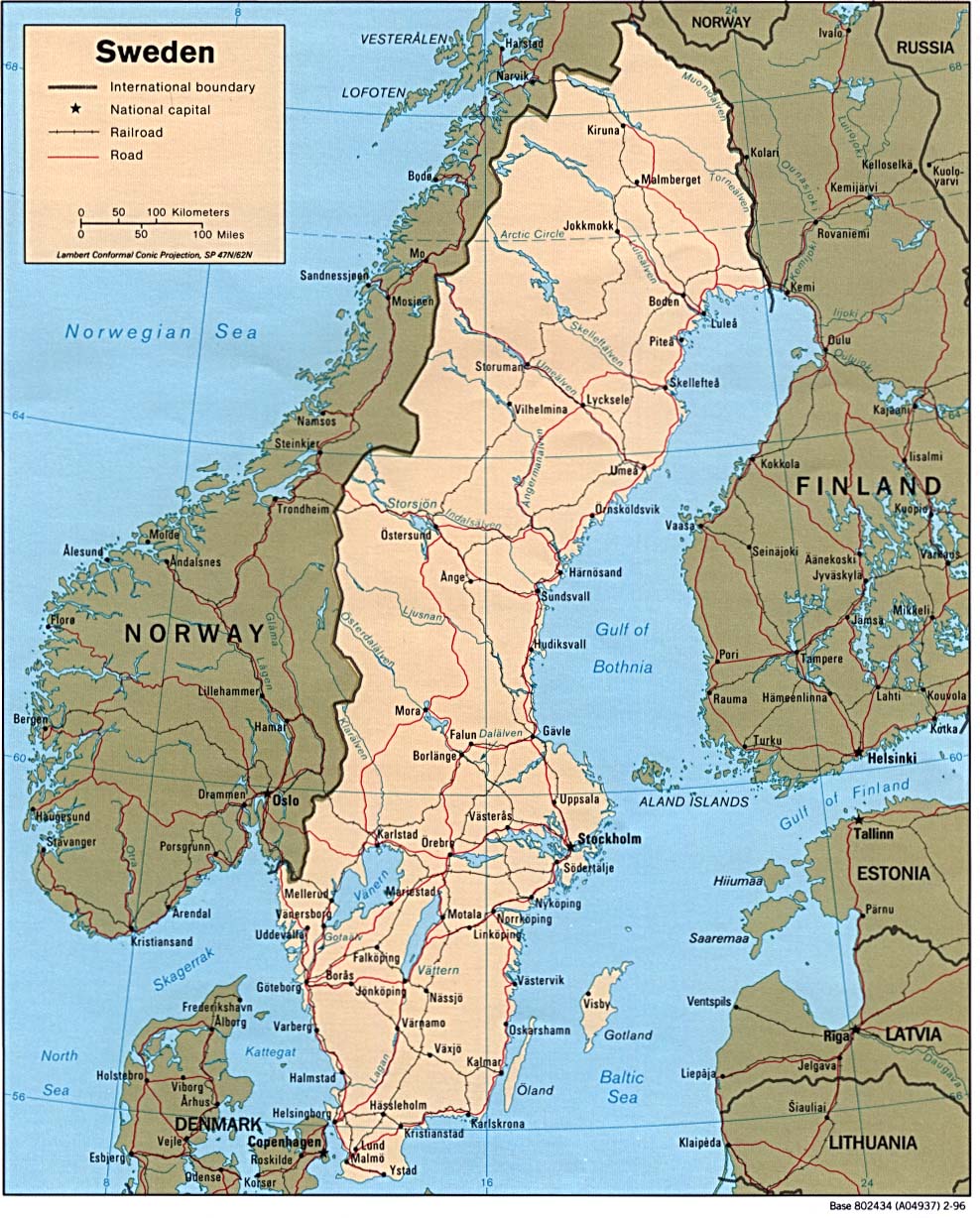
Country Maps- Sweden (Political) 1996 (275K) and pdf format (273K)
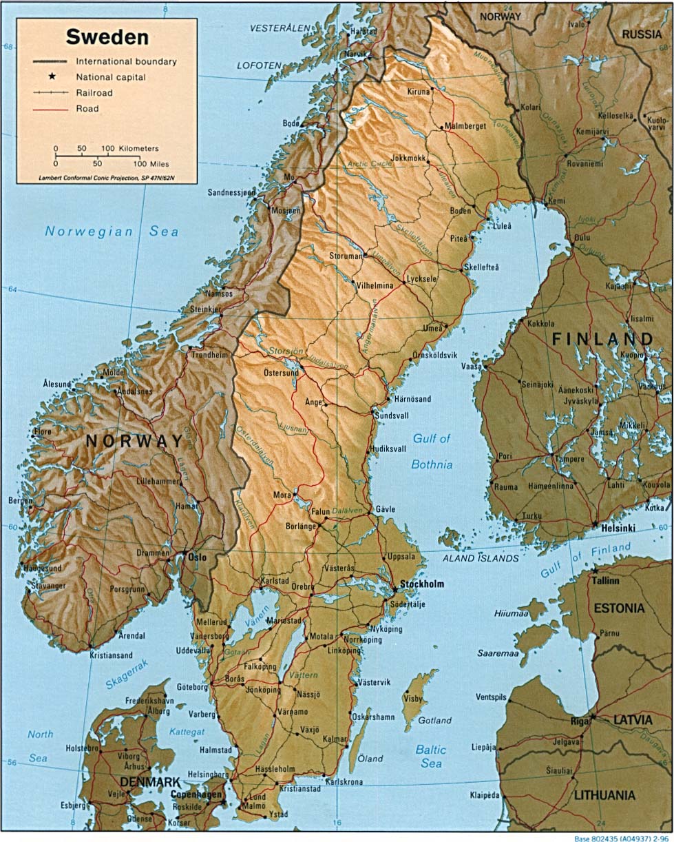
- Sweden (Shaded Relief) 1996 (270K) and pdf format (278K)
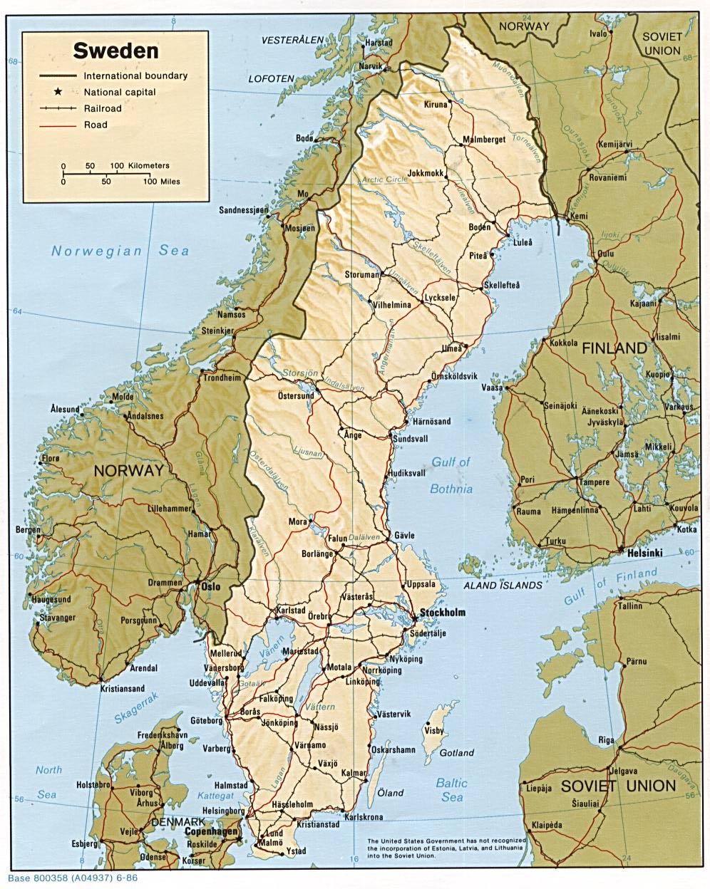
- Sweden (Shaded Relief) 1986 (269K)
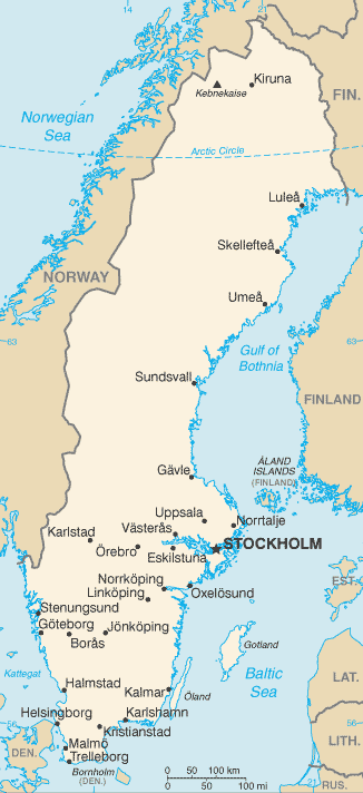
- Sweden (Small Map) 2016 (27.2K)
- Baltic Lands Circa 1000 A.D. - 1809 A.D. (12 Maps) Atlas to Freeman's Historical Geography, Edited by J.B. Bury, Longmans Green and Co. Third Edition 1903.
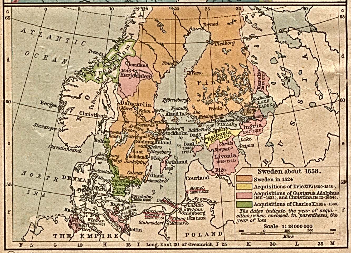
- Sweden about 1658 From The Historical Atlas by William R. Shepherd, 1923. (387K)
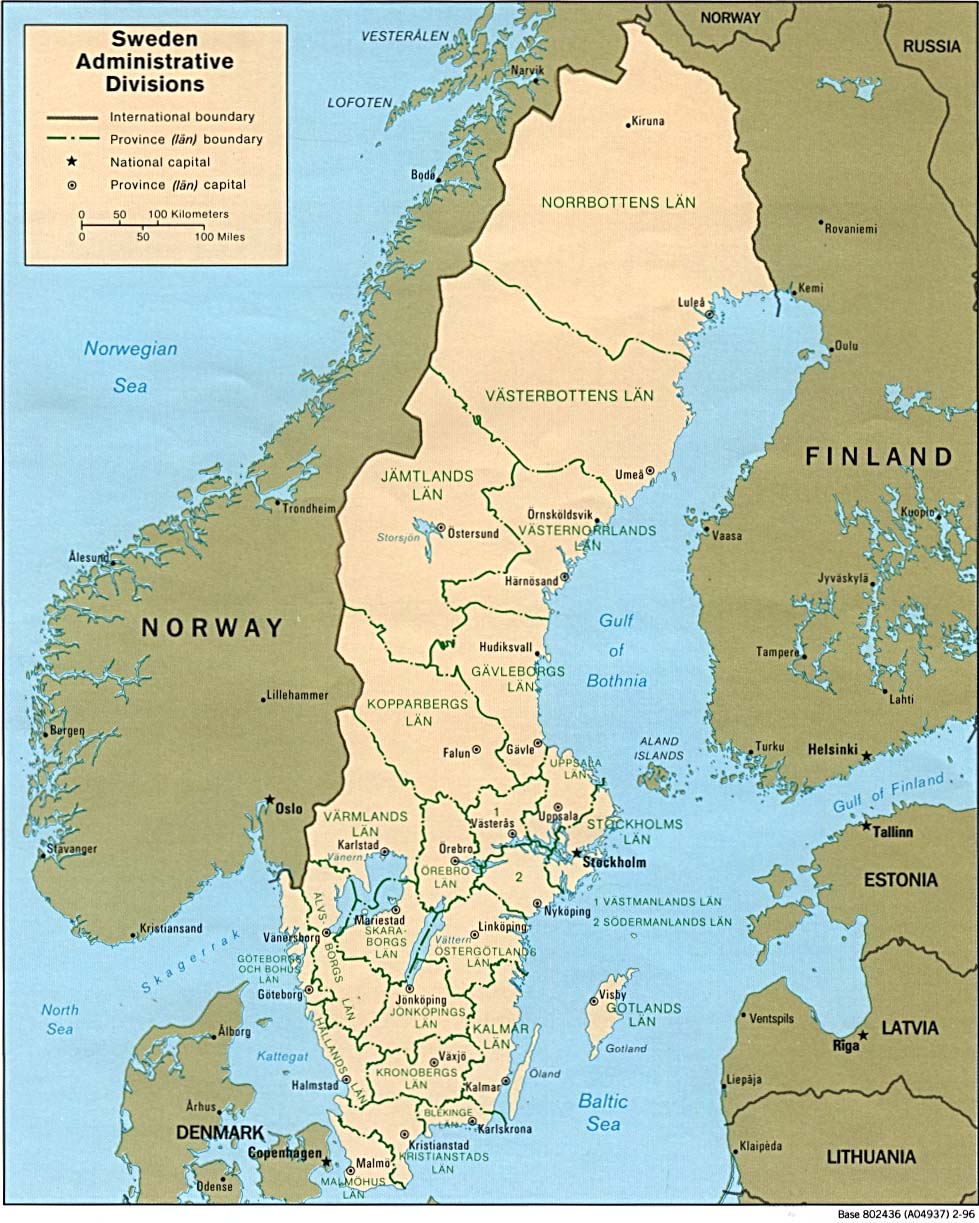
- Sweden: Administrative Divisions 1996 (212K) Note: This map on does not reflect current administrative divisions.
- 1:250,000 - Northern Europe Series M515, U.S. Army Map Service. 1951-
- This series covers almost all of Sweden
- 1:1,000,000 - Operational Navigation Chart Series [aeronautical charts] U.S. Defense Mapping Agency Aerospace Center Not for navigational use
- This series covers all of Sweden on sheets C-2, D-2 and E-2
- 1:1,000,000 - International Map of the World
- This series includes parts of Sweden. Clickable map
- 1:500,000 - Europe Series M404 (4072), Great Britain War Office, 1942-
- This series covers parts of Sweden
- 1:500,000 - Tactical Pilotage Charts U.S. National Imagery and Mapping Agency. Not for navigational use
- This series covers Sweden
- 1:500,000 - World Series 1404, Great Britain. War Office and Air Ministry. 1958-
- This series covers all of Sweden
- This series covers almost all of Sweden
Maps on Other Web Sites