Perry-Castañeda Library
Map Collection
Portugal Maps
The following maps were produced by the U.S. Central Intelligence Agency, unless otherwise indicated.
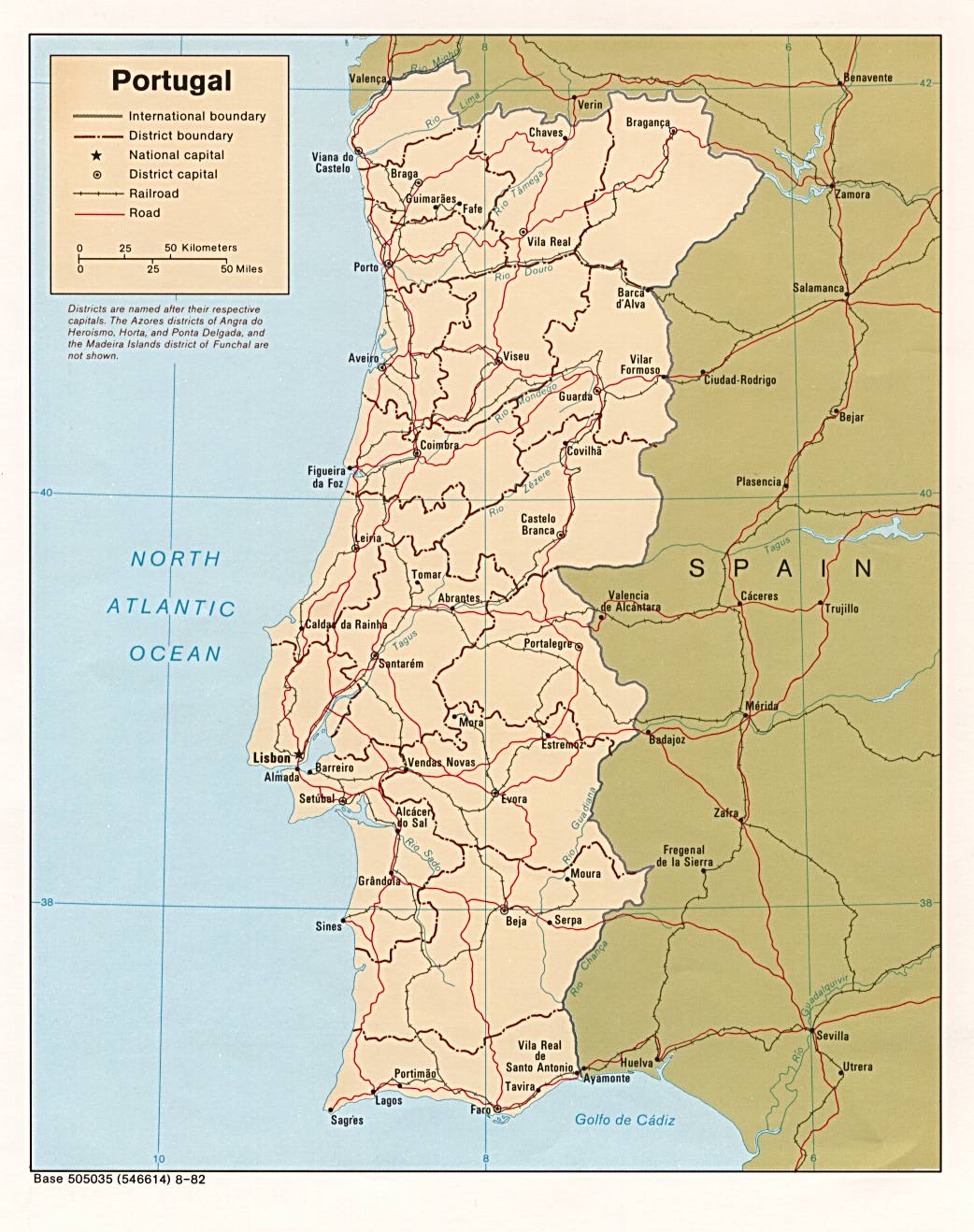
Country Maps- Portugal (Political) 1982 (213K) and pdf format (215K)
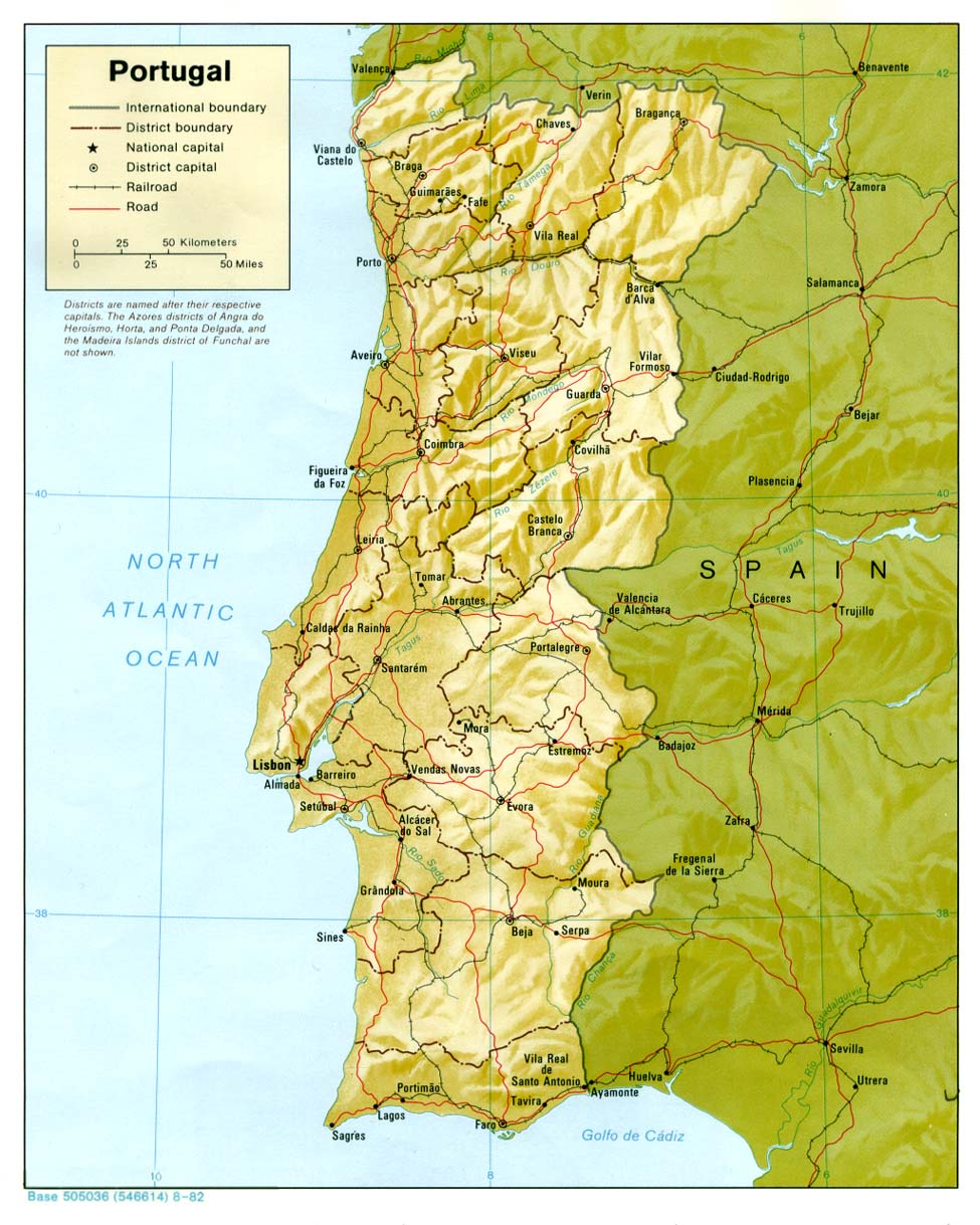
- Portugal (Shaded Relief) 1982 (209K) and pdf format (217K)
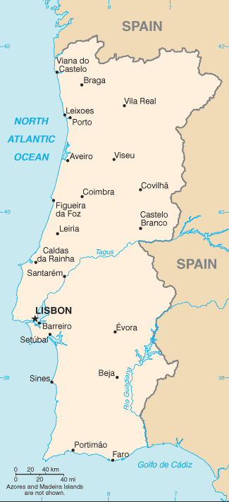
- Portugal (Small Map) 2016 (17.1K)
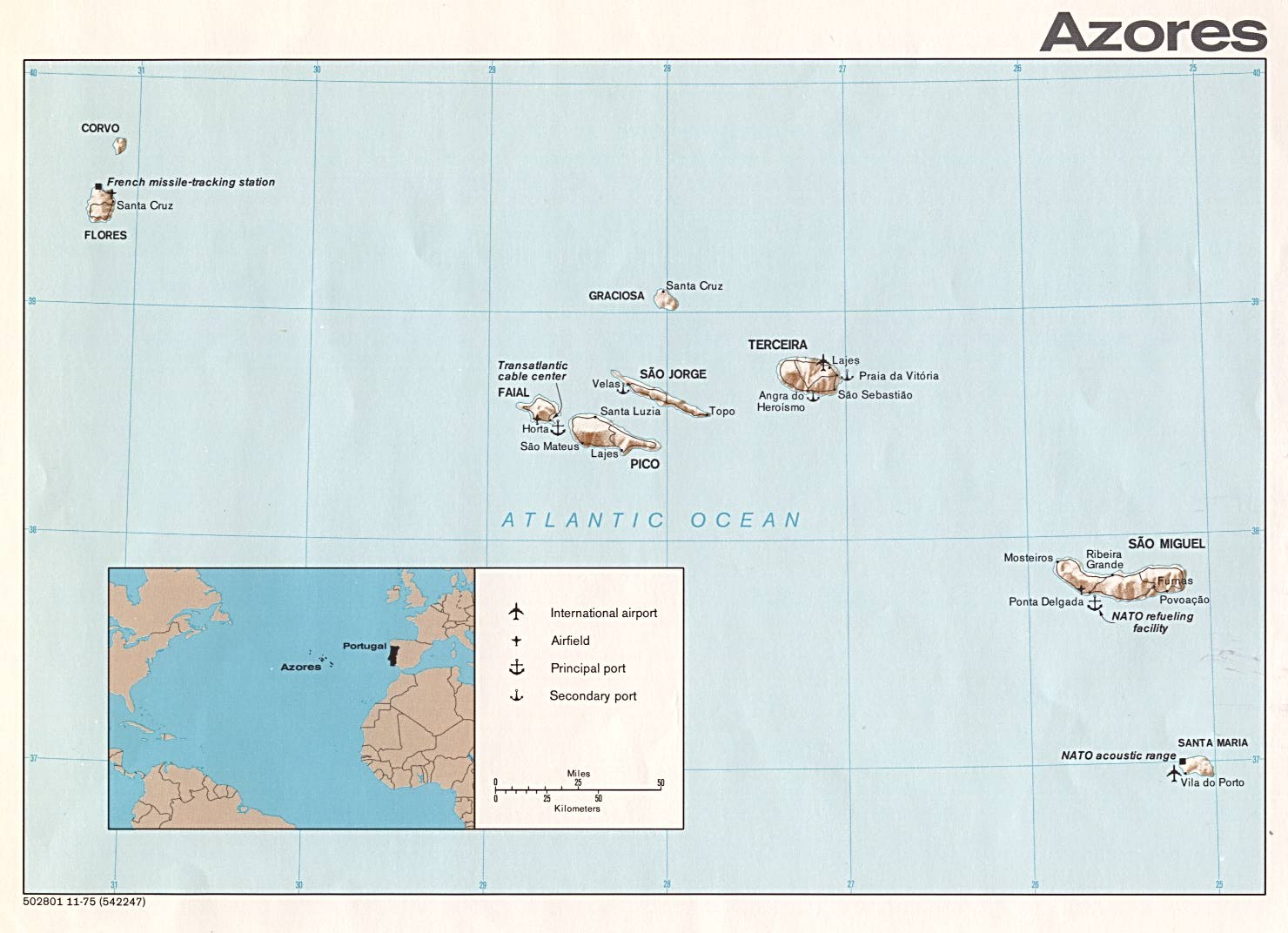
- Azores (Shaded Relief) 1975 (146K)
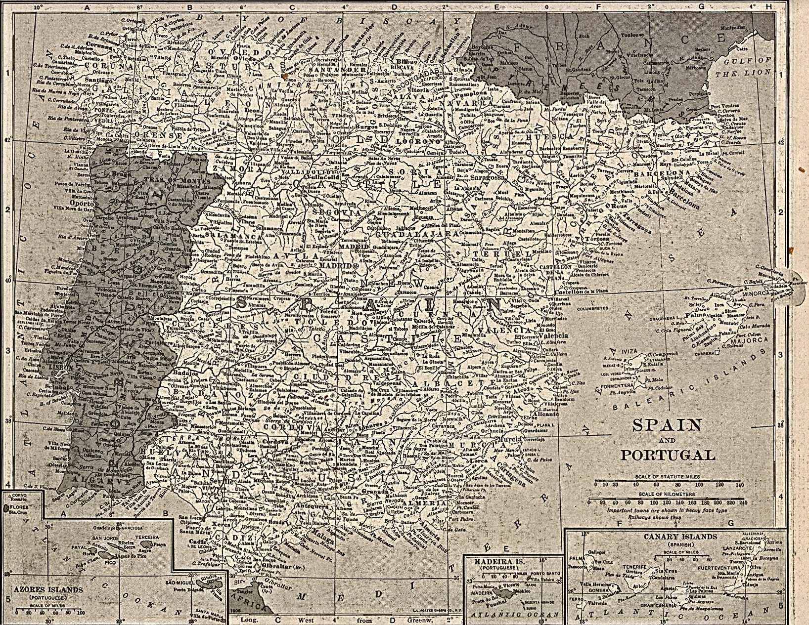
- Portugal and Spain 1917 (855K)
- From The New Encyclopedic Atlas & Gazetteer of the World, Edited & Revised by Frances J. Reynolds.
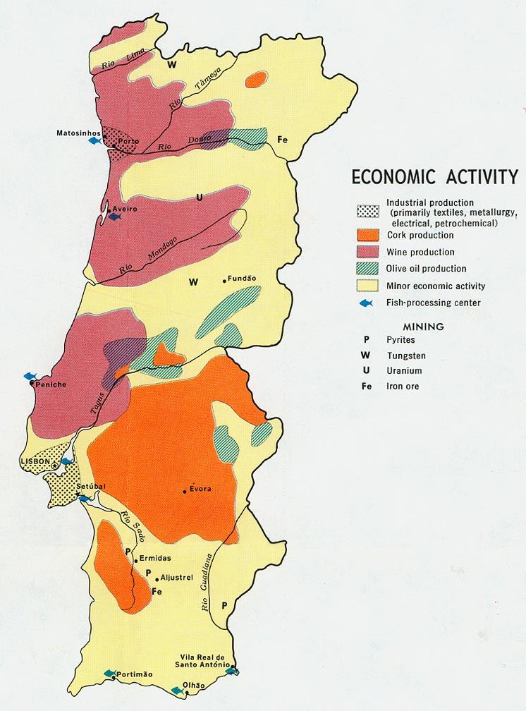
- Portugal - Economic Activity from Map No. 500530 1972 (156K)
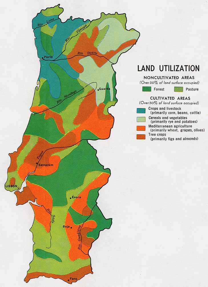
- Portugal - Land Use from Map No. 500530 1972 (192K)
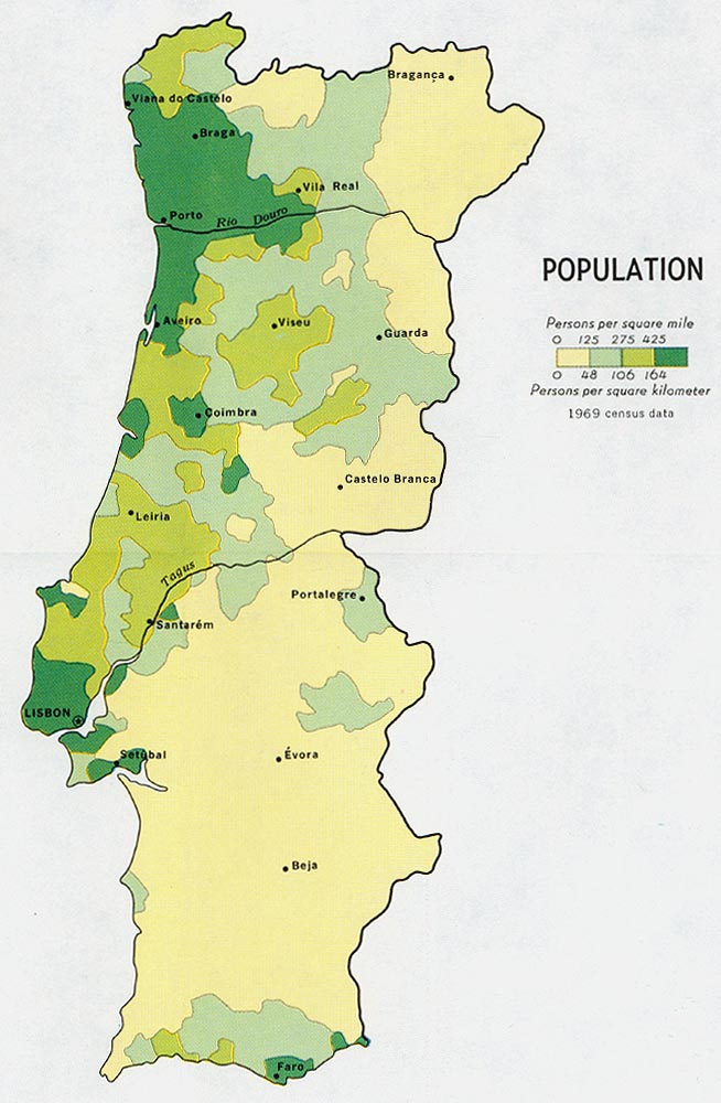
- Portugal - Population from Map No. 500530 1972 (192K)
- 1:1,000,000 - Operational Navigation Charts Series U.S. Defense Mapping Agency Aerospace Center Not for navigational use
- This series includes Portugal on sheets F-1 and G-1
- 1:600,000 - Portugal Series 4352, 1:600,000, U.S. Army Map Service, 1943
- This series covers Portugal
- 1:500,000 - Tactical Pilotage Charts U.S. National Imagery and Mapping Agency. Not for navigational use
- This series covers Portugal
- 1:500,000 - Europe Series M404 (4072), Great Britain War Office, 1942-
- This series covers all of Portugal
- 1:500,000 - World Series 1404, Great Britain. War Office and Air Ministry. 1958-
- This series covers parts of Portugal
- 1:400,000 Spain and Portugal Road Map Series M481, 1:400,000, U.S. Army Map Service, 1943-
- 1:50,000 Azores Series M789, 1:50,000, U.S. Army Map Service, 1943-
- 1:50,000 Portugal Series M780, 1:50,000, U.S. Army Map Service, 1948-
- 1:50,000 Portugal Series 4145, 1:50,000, U.S. Army Map Service, 1942-
- Madeira Maps (PCL Map Collection) Includes additional topographic maps
- This series includes Portugal on sheets F-1 and G-1
Maps on Other Web Sites