Perry-Castañeda Library
Map Collection
Hungary Maps
The following maps were produced by the U.S. Central Intelligence Agency, unless otherwise indicated.
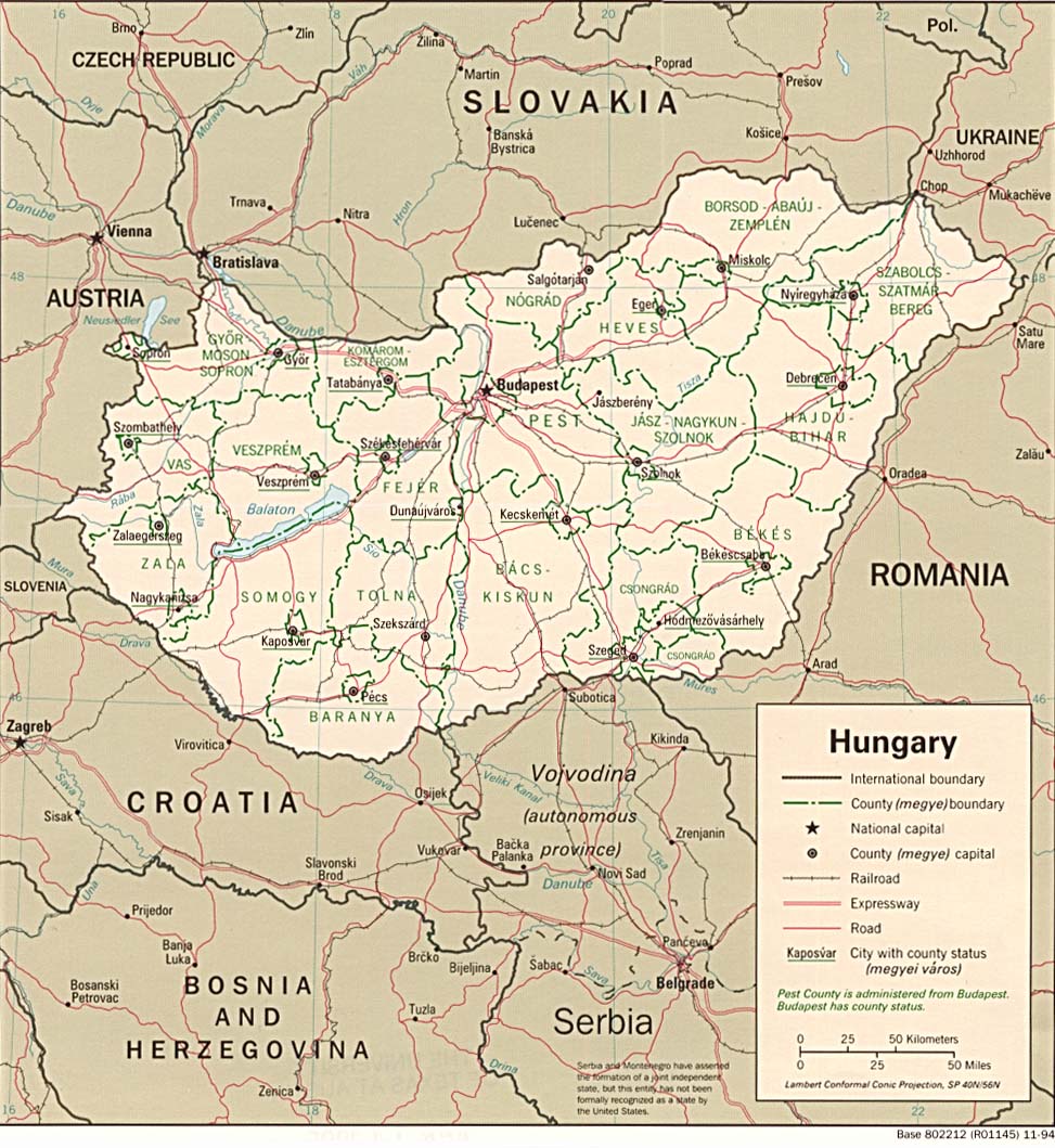
Country Maps- Hungary (Political) 1994 (224K) and pdf format (227K)
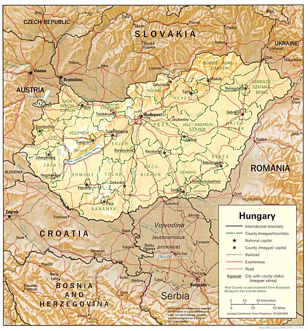
- Hungary (Shaded Relief) 1994 (336K) and pdf format (340K)
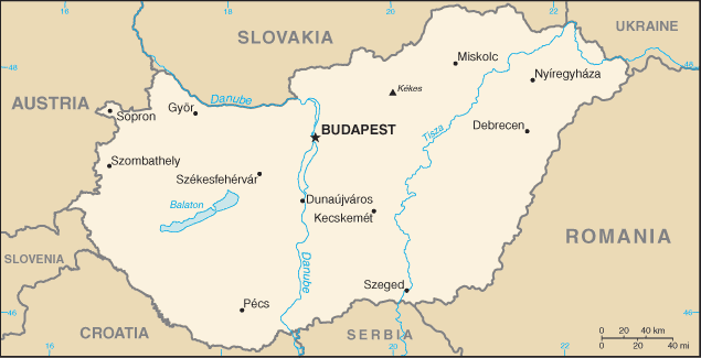
- Hungary (Small Map) 2016 (16.6K)
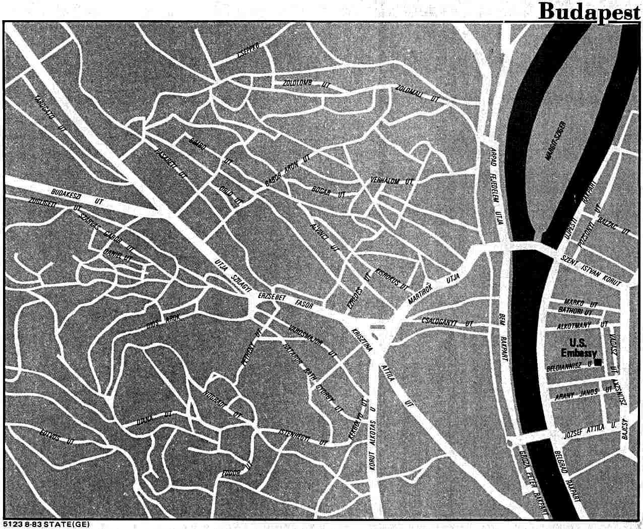
- Budapest U.S. Dept. of State 1983 (141K)
- Hungary and South East Europe Circa 900 A.D. - 1888 A.D. (16 Maps) From the Atlas to Freeman's Historical Geography, Edited by J.B. Bury, Longmans Green and Co. Third Edition 1903
- Hungary - Industry from Map No. 501074 1973 (147K)
- Hungary - Land Utilization from Map No. 501074 1973 (148K)
- Hungary - Population from Map No. 501074 1973 (143K)
- 1:1,000,000 - Operational Navigation Chart Series [aeronautical charts] U.S. Defense Mapping Agency Aerospace Center Not for navigational use
- This series covers all of Hungary on sheets E-3, F-2 and F-3 E-3 (North), F-2 (West) and F-3 (East)
- 1:500,000 - Europe Series M404 (4072), Great Britain War Office, 1942-
- This series covers all of Hungary
- 1:500,000 - Tactical Pilotage Charts U.S. National Imagery and Mapping Agency. Not for navigational use
- This series covers Hungary
- 1:500,000 - World Series 1404, Great Britain. War Office and Air Ministry. 1958-
- This series covers all of Hungary
- 1:250,000 - Balkans Series M506, U.S. Army Map Service, 1948-
- 1:250,000 - Central Europe Series M508, U.S. Army Map Service, 1942-
- This series covers Hungary
- 1:250,000 Western Europe Series M501, U.S. Army Map Service, 1959-
- This series covers all of Hungary
- 1:250,000 - Pecs (Joint Operations Graphic) U.S. National Imagery and Mapping Agency, Sheet NL 34-4 Pecs, Hungary; Yugoslavia, 1999 [GeoPDF] (8.9MB) Not for navigational use
- 1:100,000 - Middle Danube, Series M671 U.S. Army Map Service, 1943-
- This series covers all of Hungary on sheets E-3, F-2 and F-3 E-3 (North), F-2 (West) and F-3 (East)
- Hungary Published by the CIA August 1990
Maps on Other Web Sites