Perry-Castañeda Library
Map Collection
Germany Maps
The following maps were produced by the U.S. Central Intelligence Agency, unless otherwise indicated.
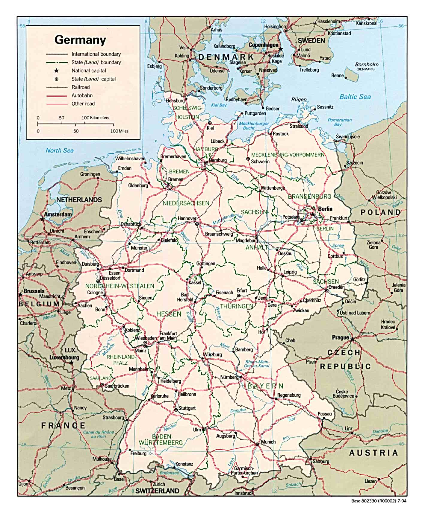
Country Maps- Germany (Political) 1994 (264K) and pdf format (325K)
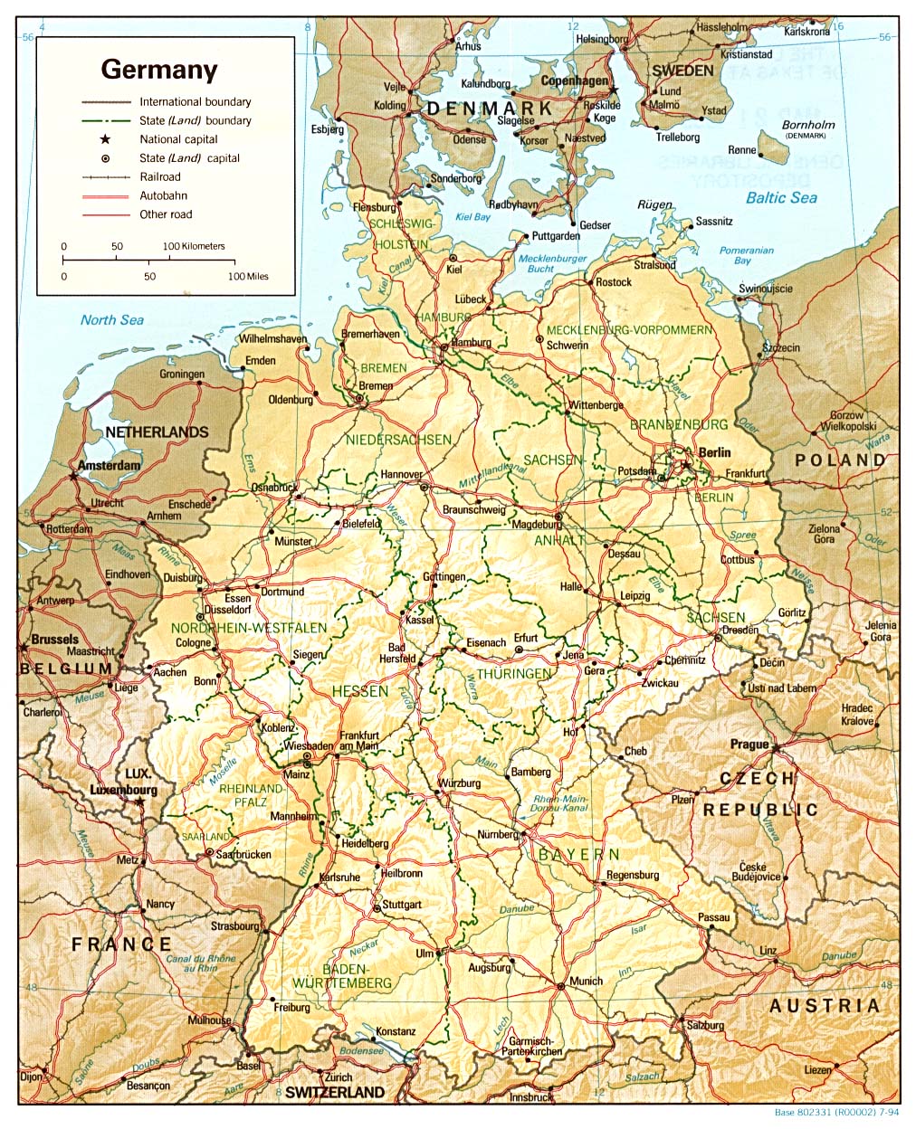
- Germany (Shaded Relief) 1994 (390K) and pdf format (411K)
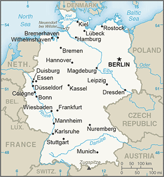
- Germany (Small Map) 2016 (30.4K)
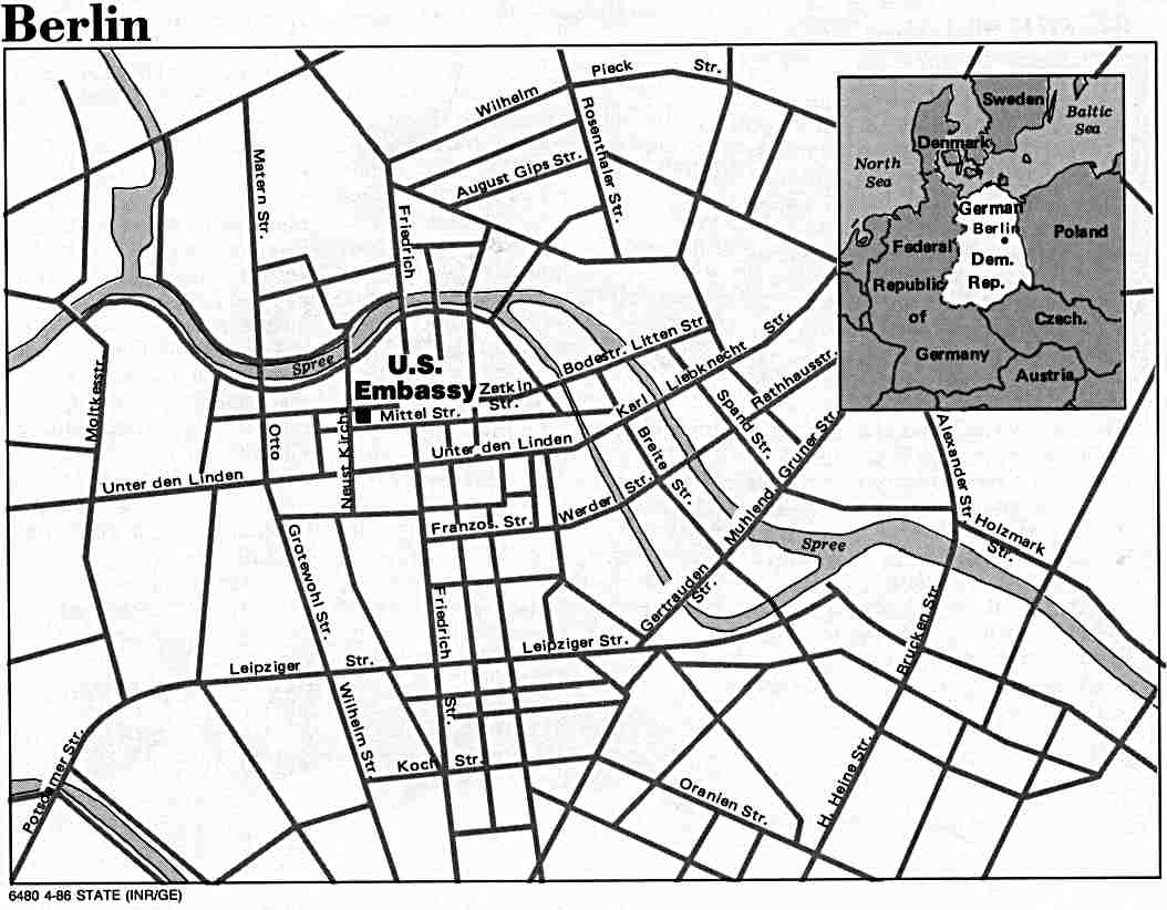
- Berlin (East) U.S. Dept. of State 1986 (74K)
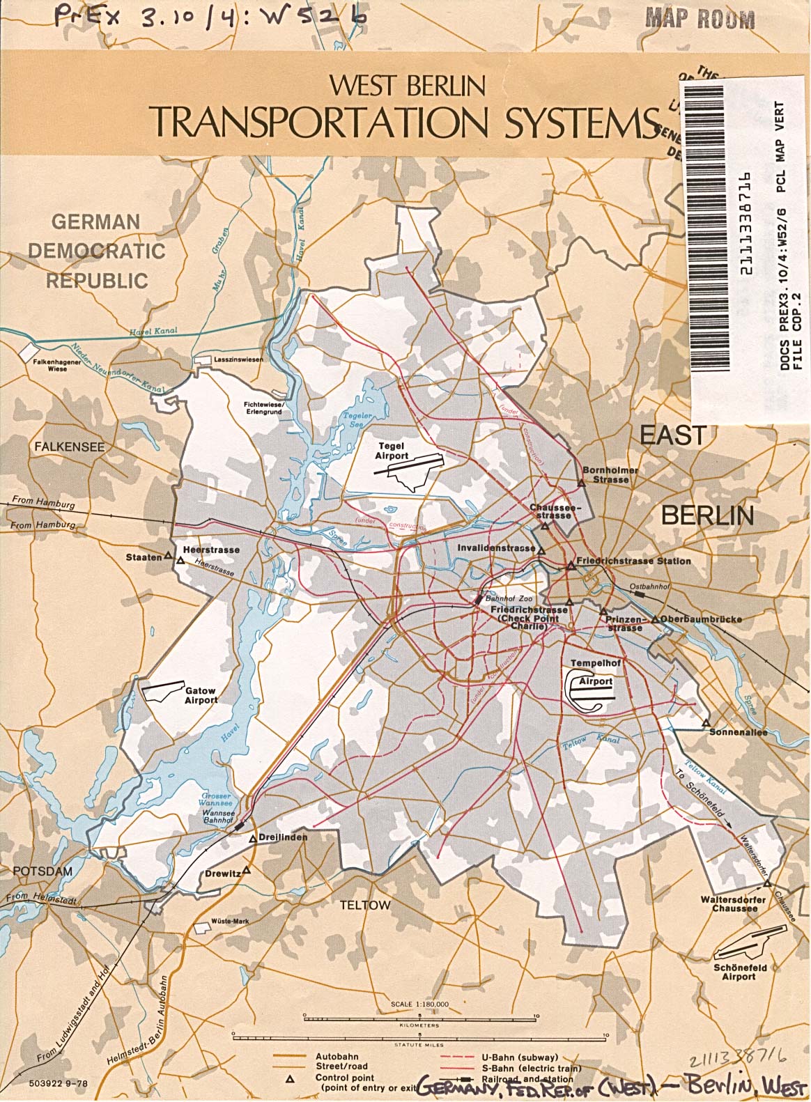
- Berlin (West) Transportation Systems U.S. Dept. of State 1978 (387K)
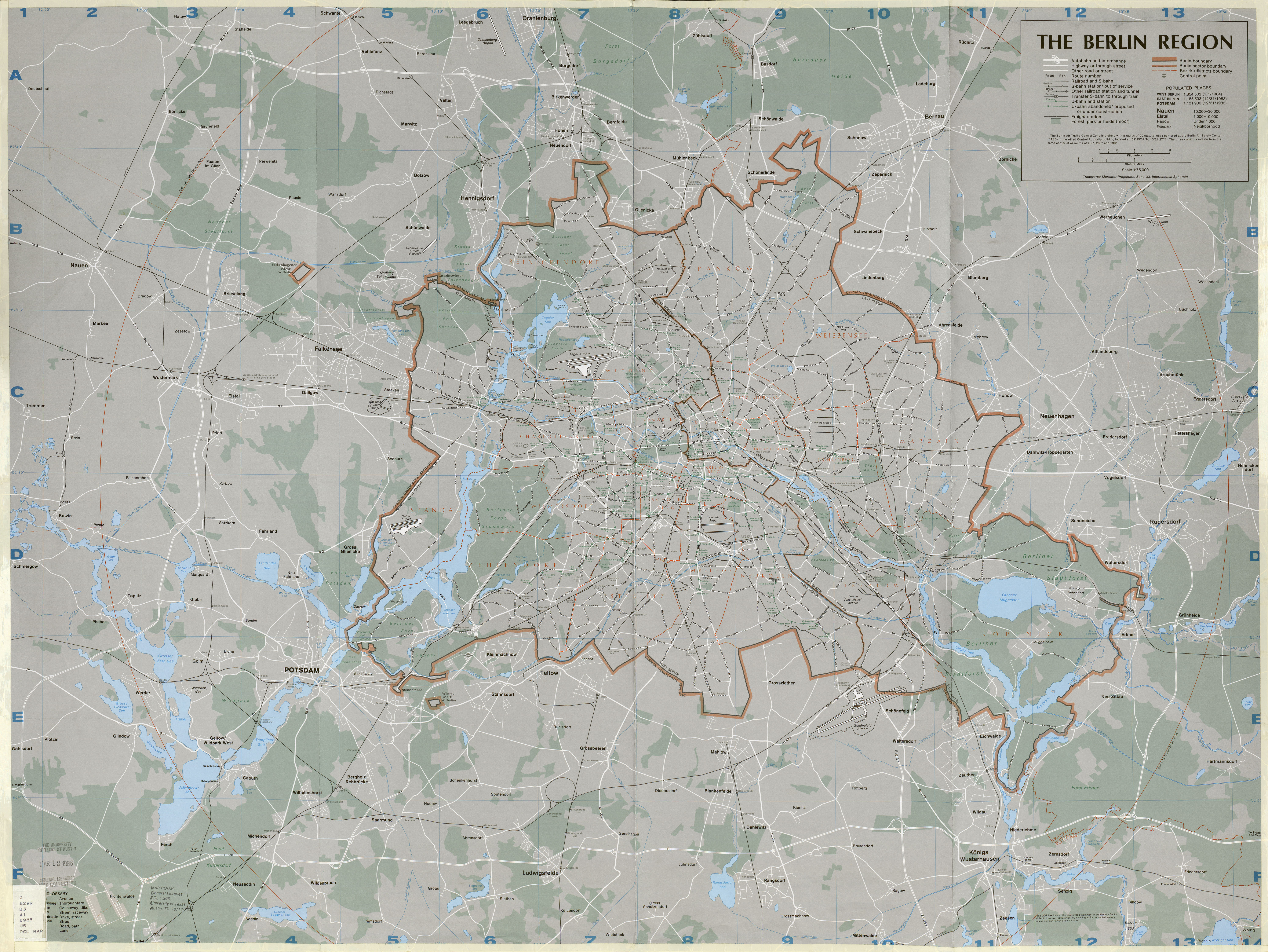
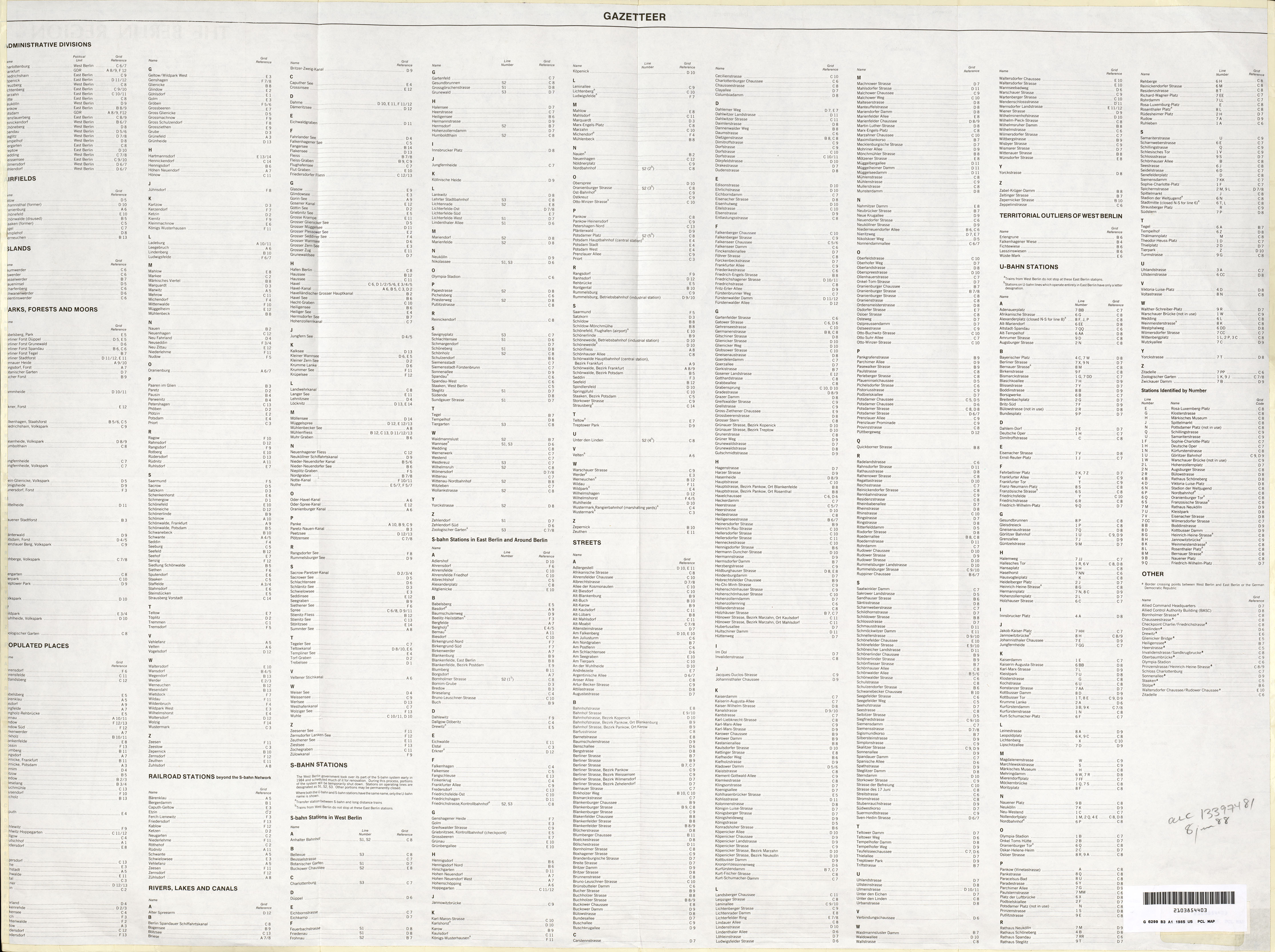
- Berlin Region 1:75,000 1985 (5.1 MB) and verso Berlin Region Gazetteer (3.1 MB)
- Germania [Ancient Germany] (843K) From A Classical Atlas of Ancient Geography by Alexander G. Findlay. New York: Harper and Brothers 1849.
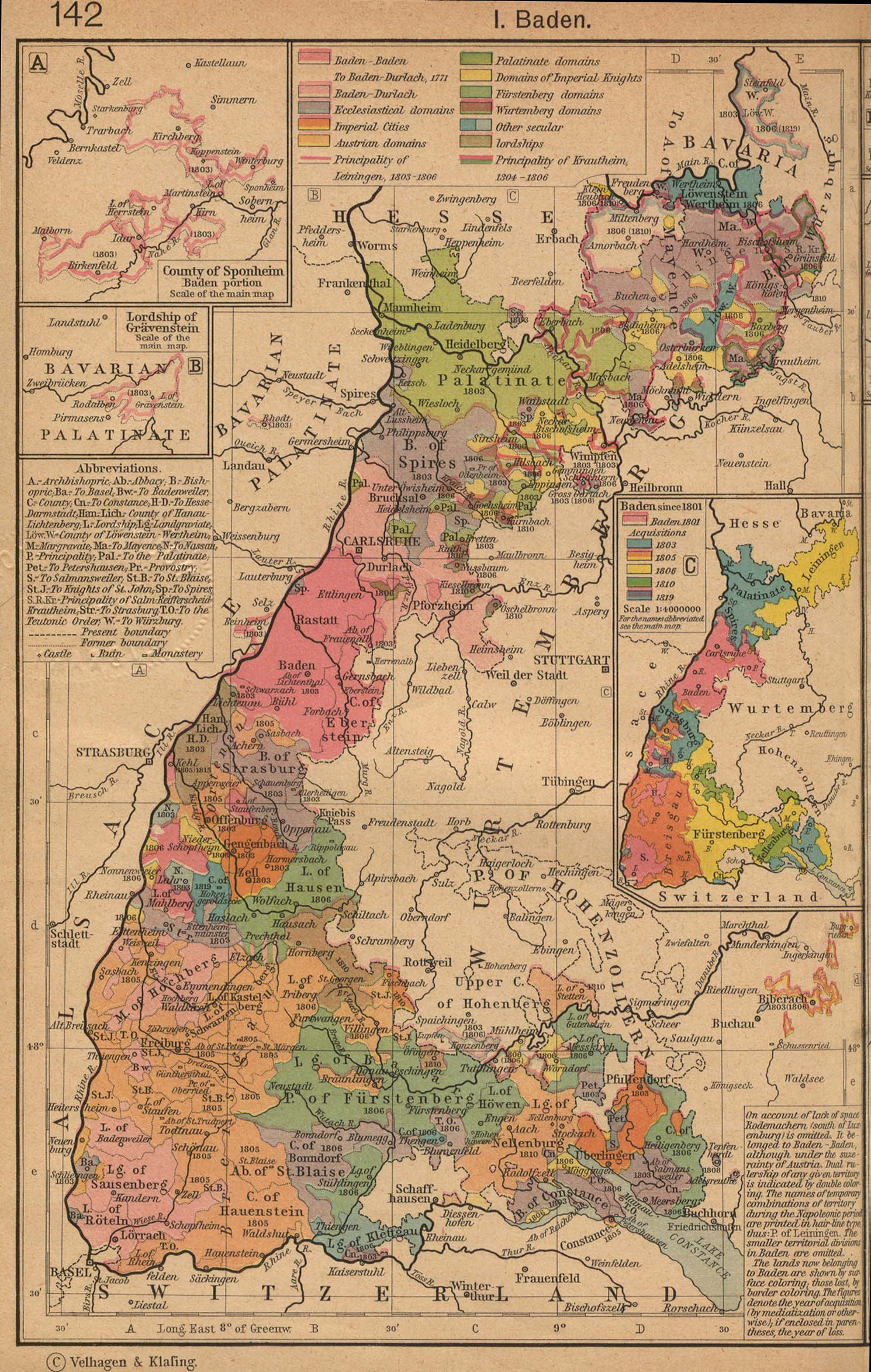
- Typical German States Before and since the French Revolution: I. Baden From A Historical Atlas by William R. Shepherd, 1923 (598K) Insets: The County of Sponheim. Lordship of Gravenstein. Baden since 1801.
- Typical German States Before and since the French Revolution: II. Wurtemberg From A Historical Atlas by William R. Shepherd, 1923 (698K) Insets: County of Horburg and Lordship of Reichenweier. Principality-County of Montbeliard. Wurtemberg since 1495.
- Munich 1858 (676K) From A Handbook for Travellers in Southern Germany, Eighth Edition. London: John Murray. 1858.
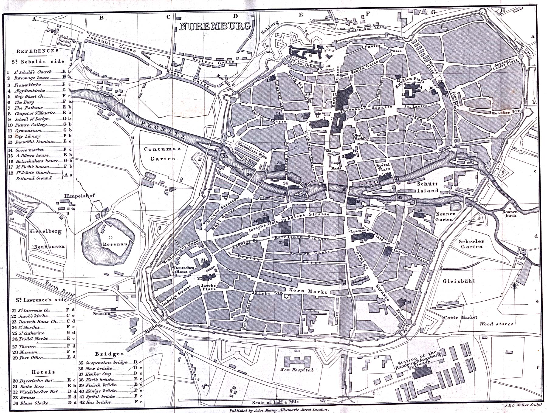
- Nuremberg 1858 (764K) From A Handbook for Travellers in Southern Germany, Eighth Edition. London: John Murray. 1858.
![Germania [Ancient Germany]](historical/ancient_germania.jpg)
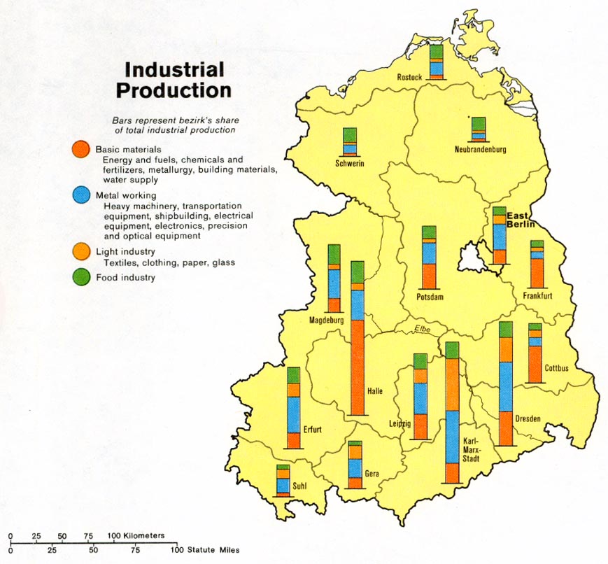
- Germany, Eastern - Industrial Production from Map No. 504708 1981 (131K)
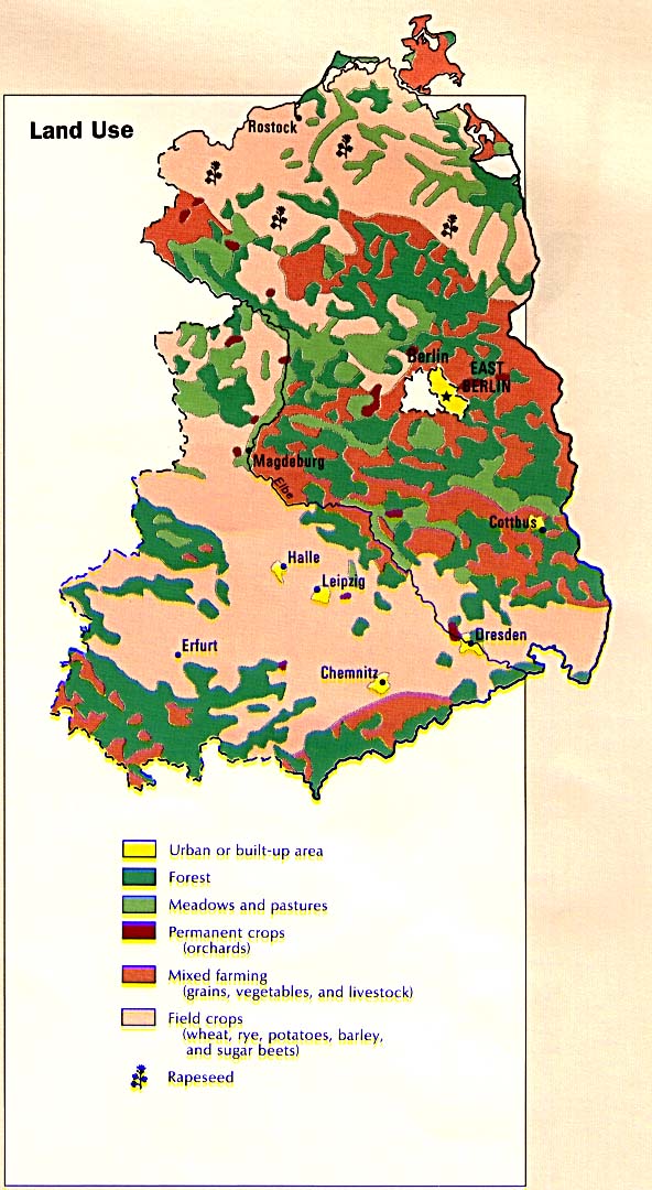
- Germany, Eastern - Land Use from the CIA Atlas of Eastern Europe 1990 (125K)
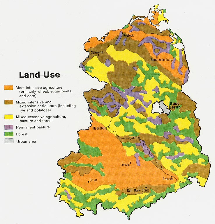
- Germany, Eastern - Land Use from Map No. 504708 1981 (131K)
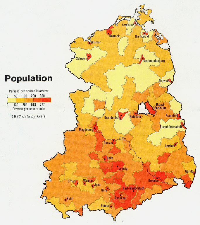
- Germany, Eastern - Population from Map No. 504708 1981 (131K)
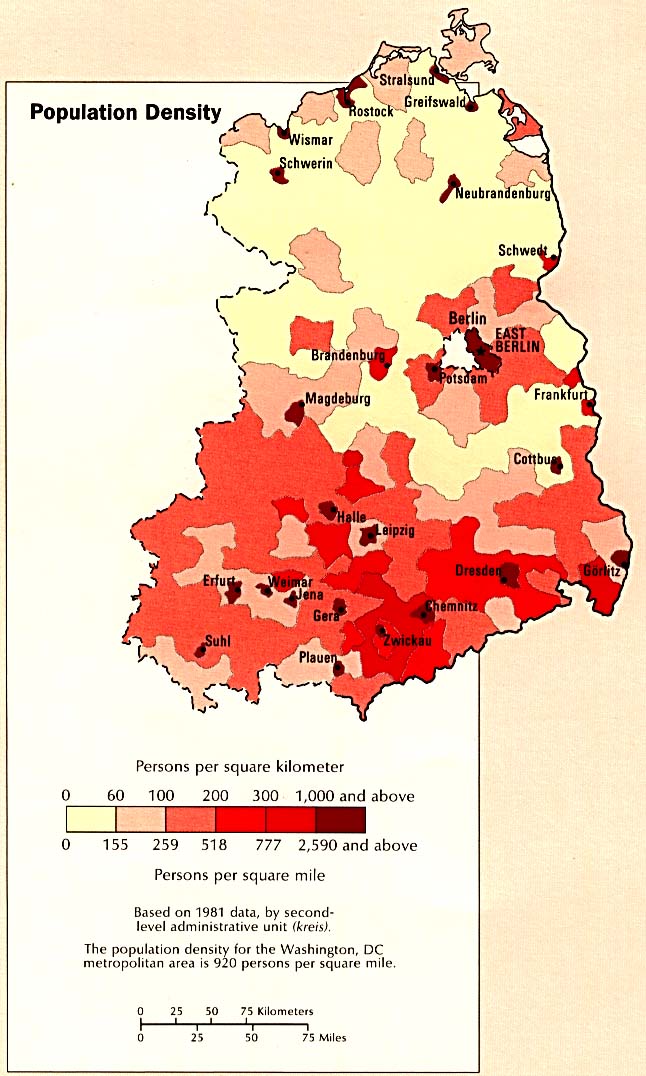
- Germany, Eastern - Population Density from the CIA Atlas of Eastern Europe 1990 (115K)
- Germany, Eastern - Resources and Processing from Map No. 504708 1981 (141K)
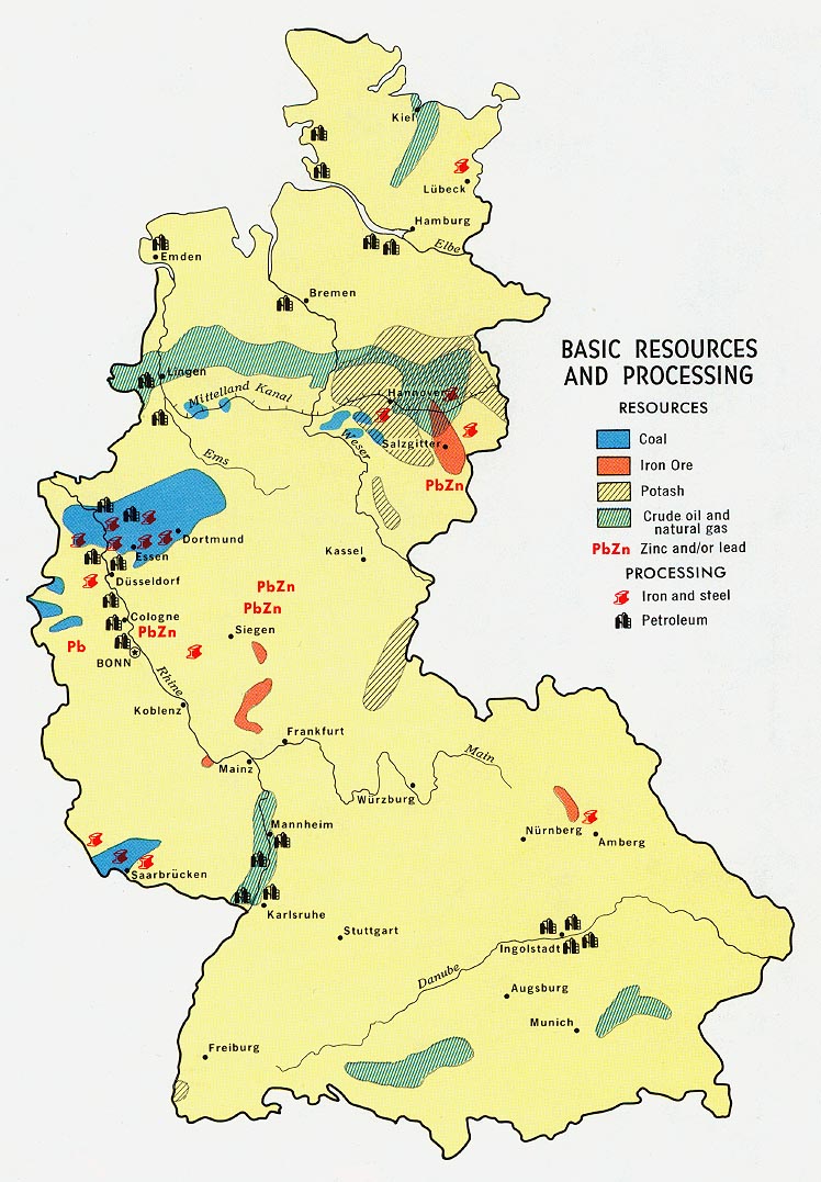
- Germany, Western - Basic Resources from Map No. 500470 1972 (216K)
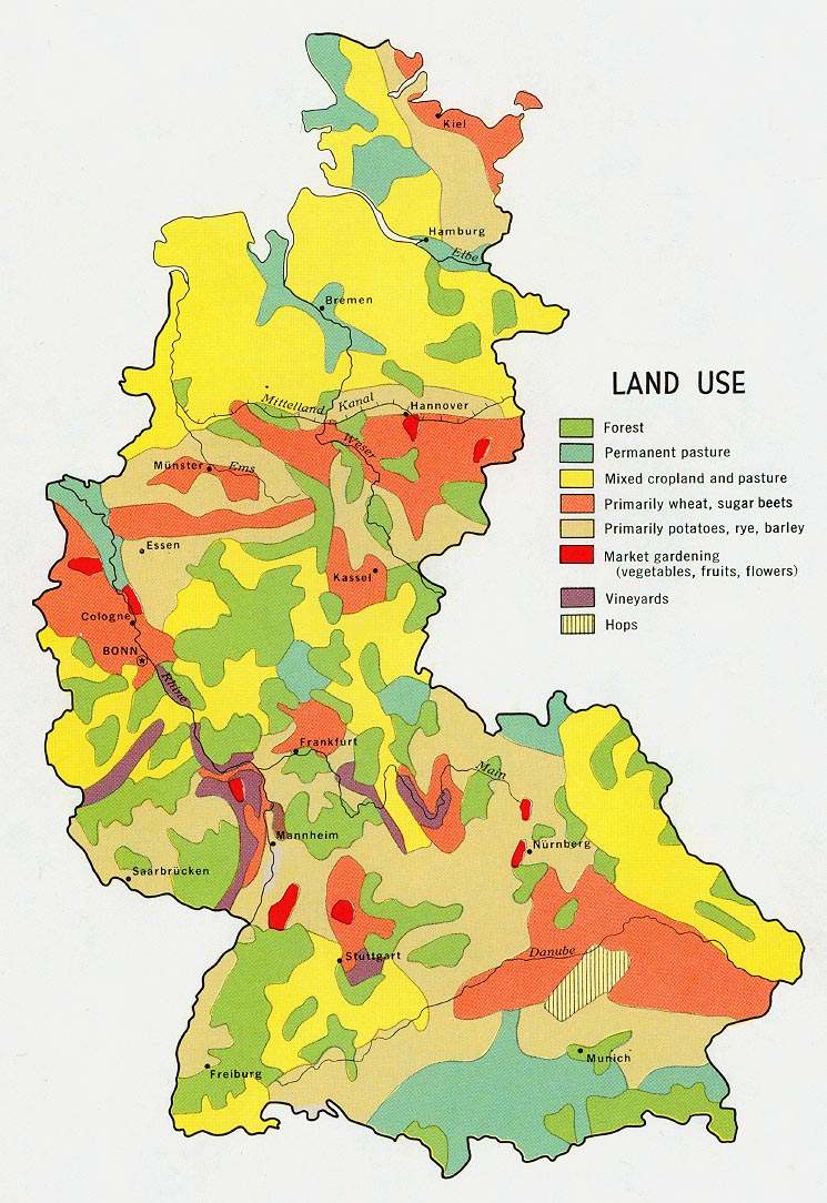
- Germany, Western - Land Use from Map No. 500470 1972 (216K)
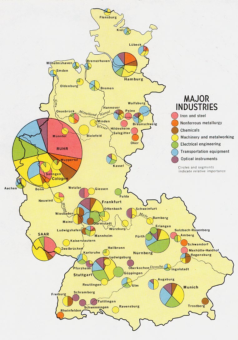
- Germany, Western - Major Industry from Map No. 500470 1972 (212K)
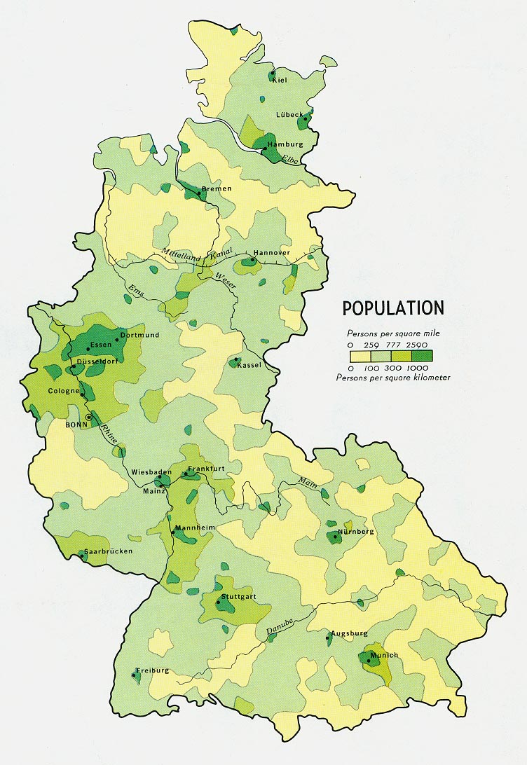
- Germany, Western - Population from Map No. 500470 1972 (186K)
- 1:1,000,000 - International Map of the World
- This series includes all of Germany. Clickable map
- 1:1,000,000 - Operational Navigation Charts Series U.S. Defense Mapping Agency Aerospace Center Not for navigational use
- This series includes all of Germany
- 1:500,000 - Europe Road Maps for Allied Forces Series M406 (GSGS 4798), Great Britain War Office, 1942-
- This series covers Germany
- 1:500,000 - Europe Series M404 (4072), Great Britain War Office, 1942-
- This series covers parts of Germany
- 1:500,000 - Tactical Pilotage Charts U.S. National Imagery and Mapping Agency. Not for navigational use
- This series covers Germany
- 1:500,000 - World Series 1404, Great Britain. War Office and Air Ministry. 1958-
- This series covers parts of Germany
- 1:500,000 - Europe Series M406 (4798), Great Britain War Office, 1942-
- This series covers Germany
- 1:250,000 - Central Europe Series M508, U.S. Army Map Service, 1942-
- This series covers Germany
- 1:250,000 - Western Europe Series M501, U.S. Army Map Service, 1959-
- This series covers only a few parts of Germany
- 1:100,000 - Central Europe Series M641, U.S. Army Map Service, 1943
- This series covers Germany
- 1:25,000 - Germany Series M841, U.S. Army Map Service, 1967-
- This series covers Germany
- This series includes all of Germany. Clickable map
Maps on Other Web Sites