Perry-Castañeda Library
Map Collection
Ethiopia Maps
The following maps were produced by the U.S. Central Intelligence Agency, unless otherwise indicated.
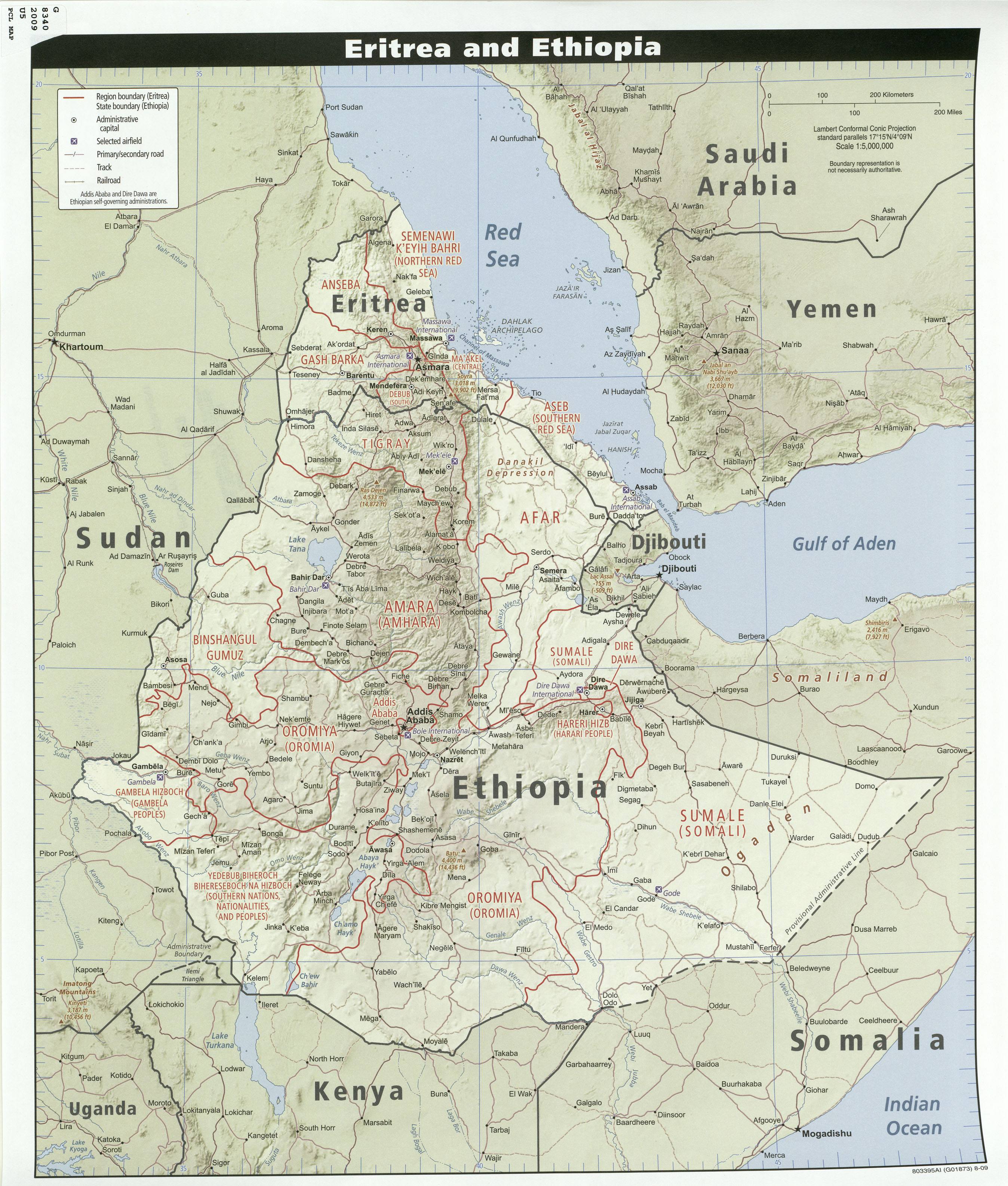
Country Maps- Eritrea and Ethiopia 2009 (1.73MB)
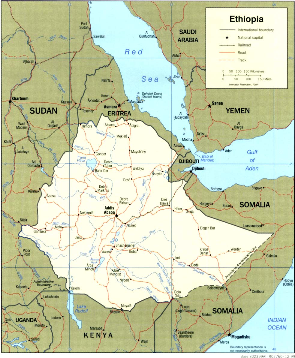
- Ethiopia (Political) 1999 (323K) and pdf format (202K)
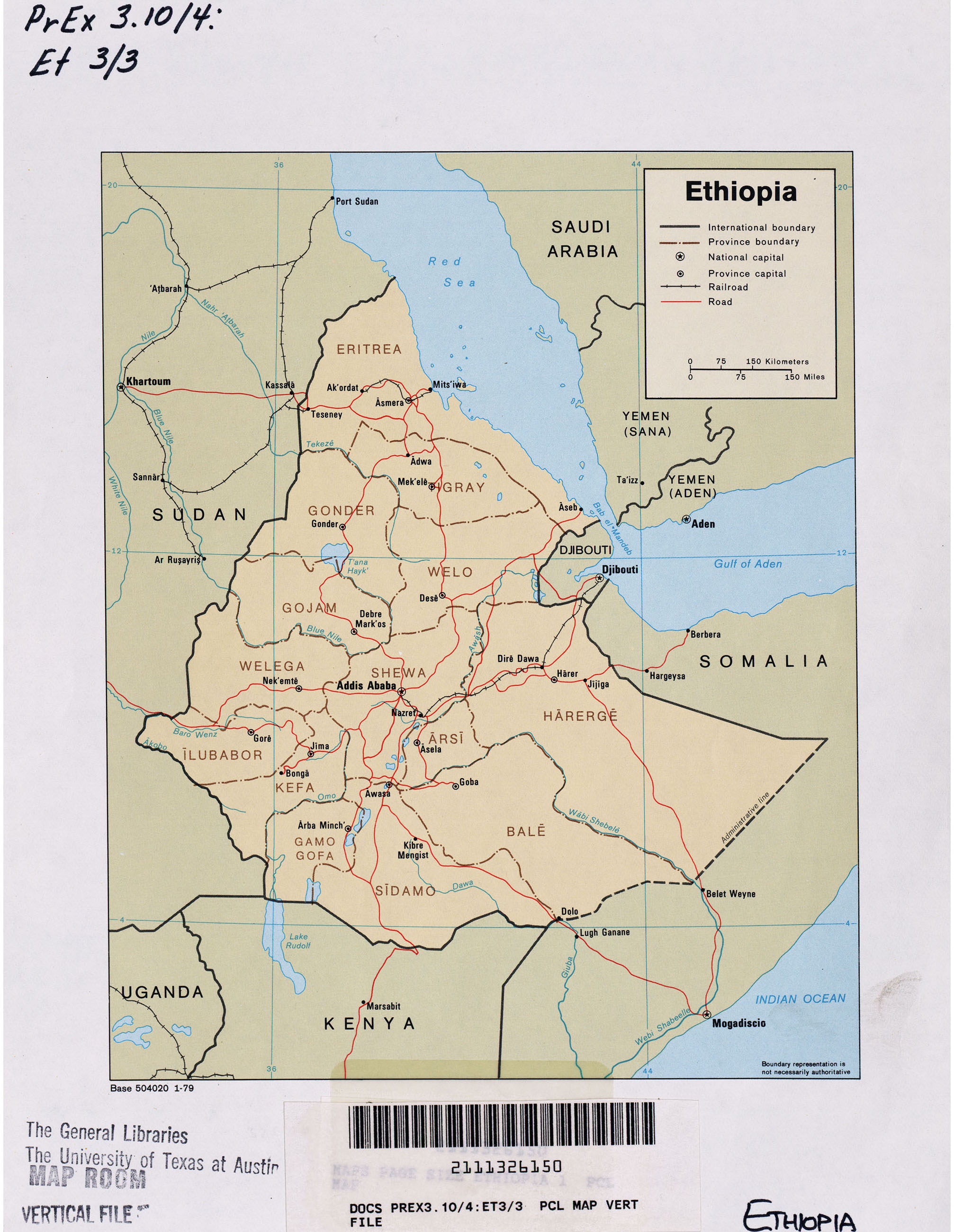
- Ethiopia (Political) 1979 (852K)
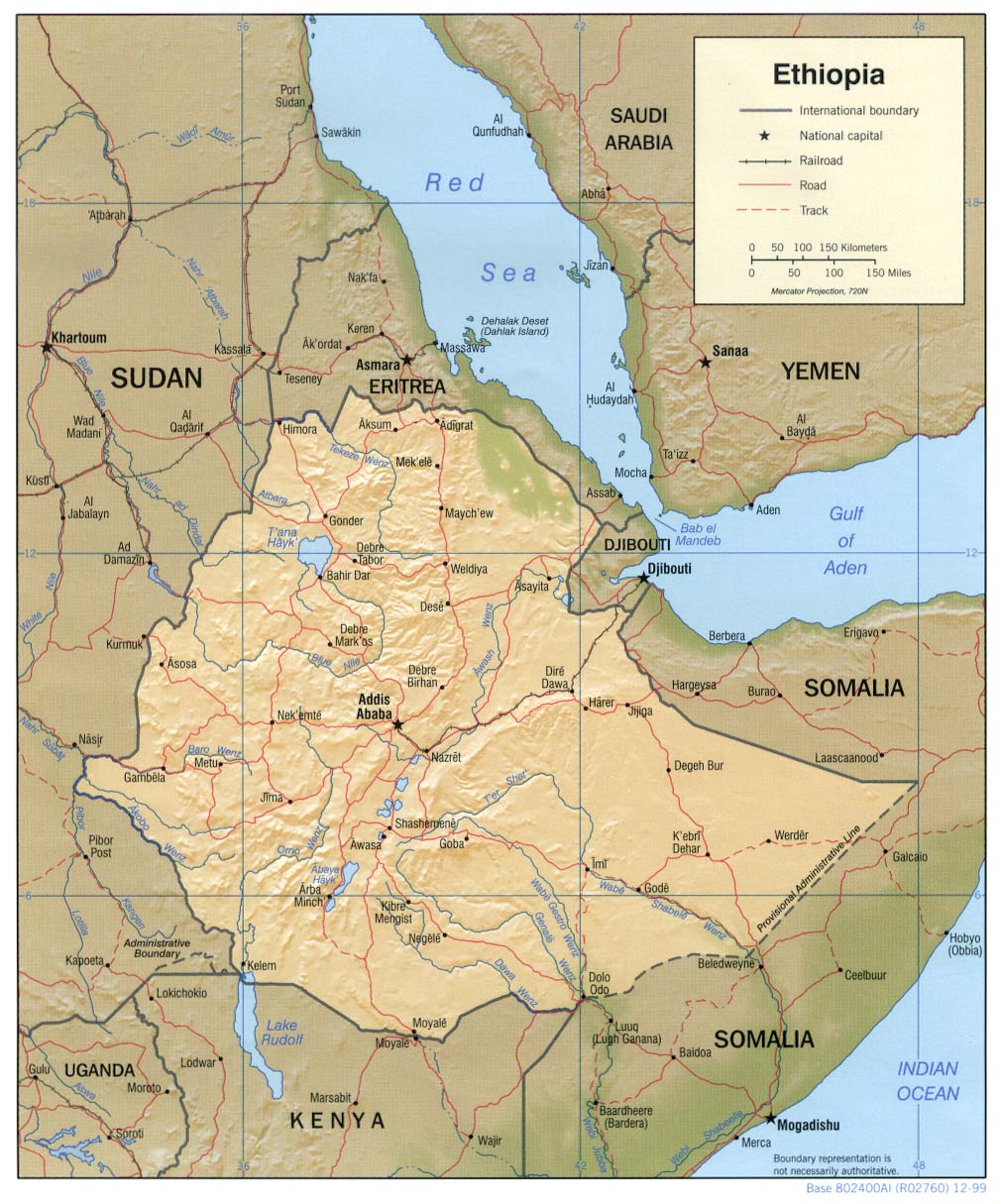
- Ethiopia (Shaded Relief) 1999 (223K) and pdf format (1.3MB)
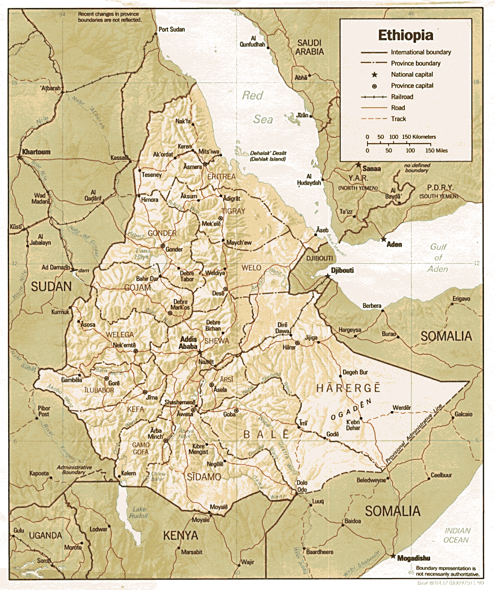
- Ethiopia (Shaded Relief) 1990 (317K) and pdf format (221K)
- Ethiopia (Small Map) 2016 (13.4K)
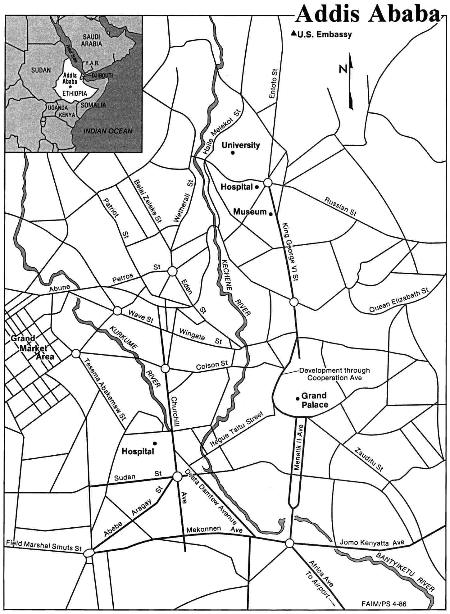
- Addis Ababa U.S. Dept. of State 1986 (157K)
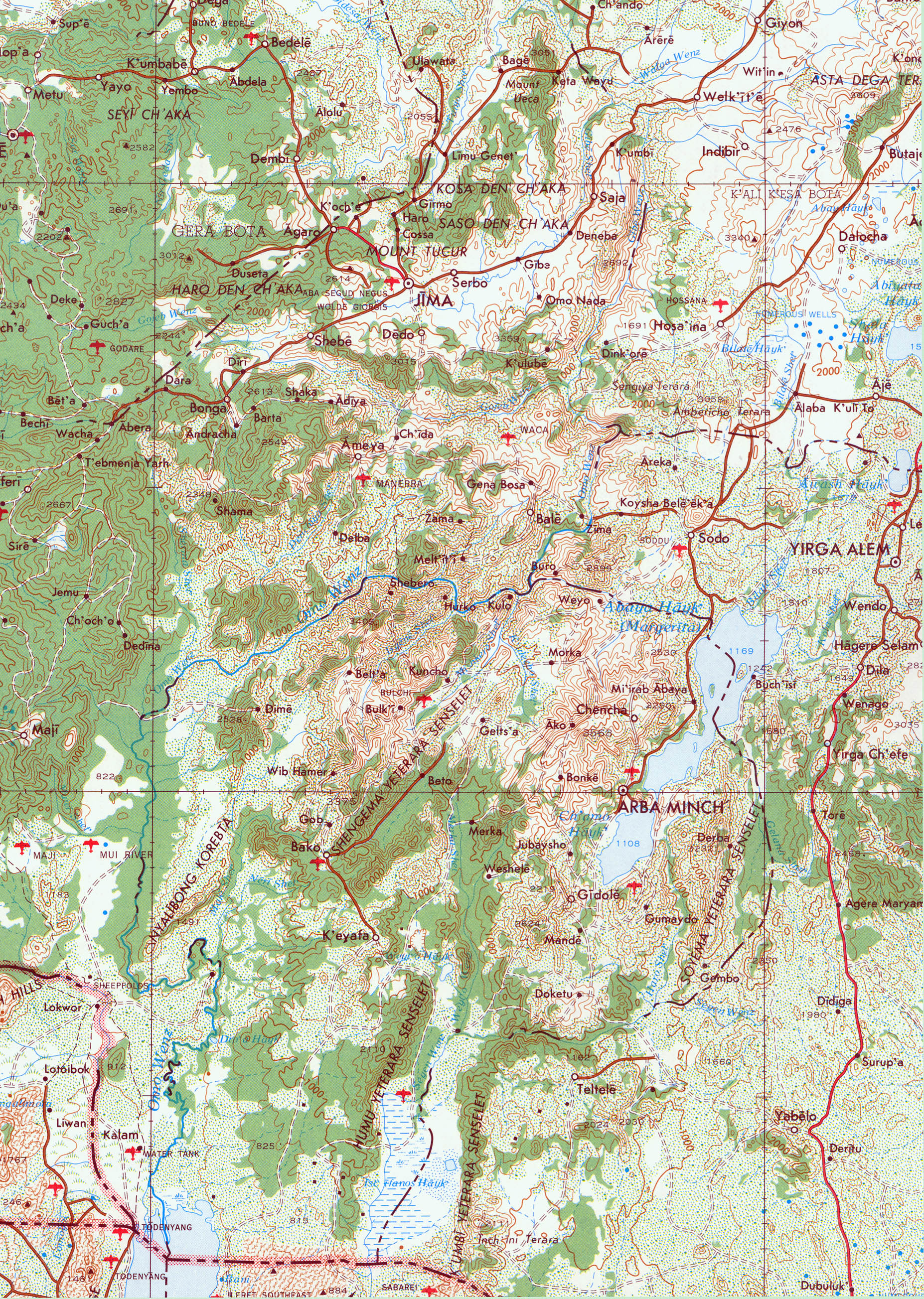
- Omo River Region Portion of U.S. Army Map Service Series 2201, Sheet 20, 1980, original scale 1:2,000,000 (2.7MB)
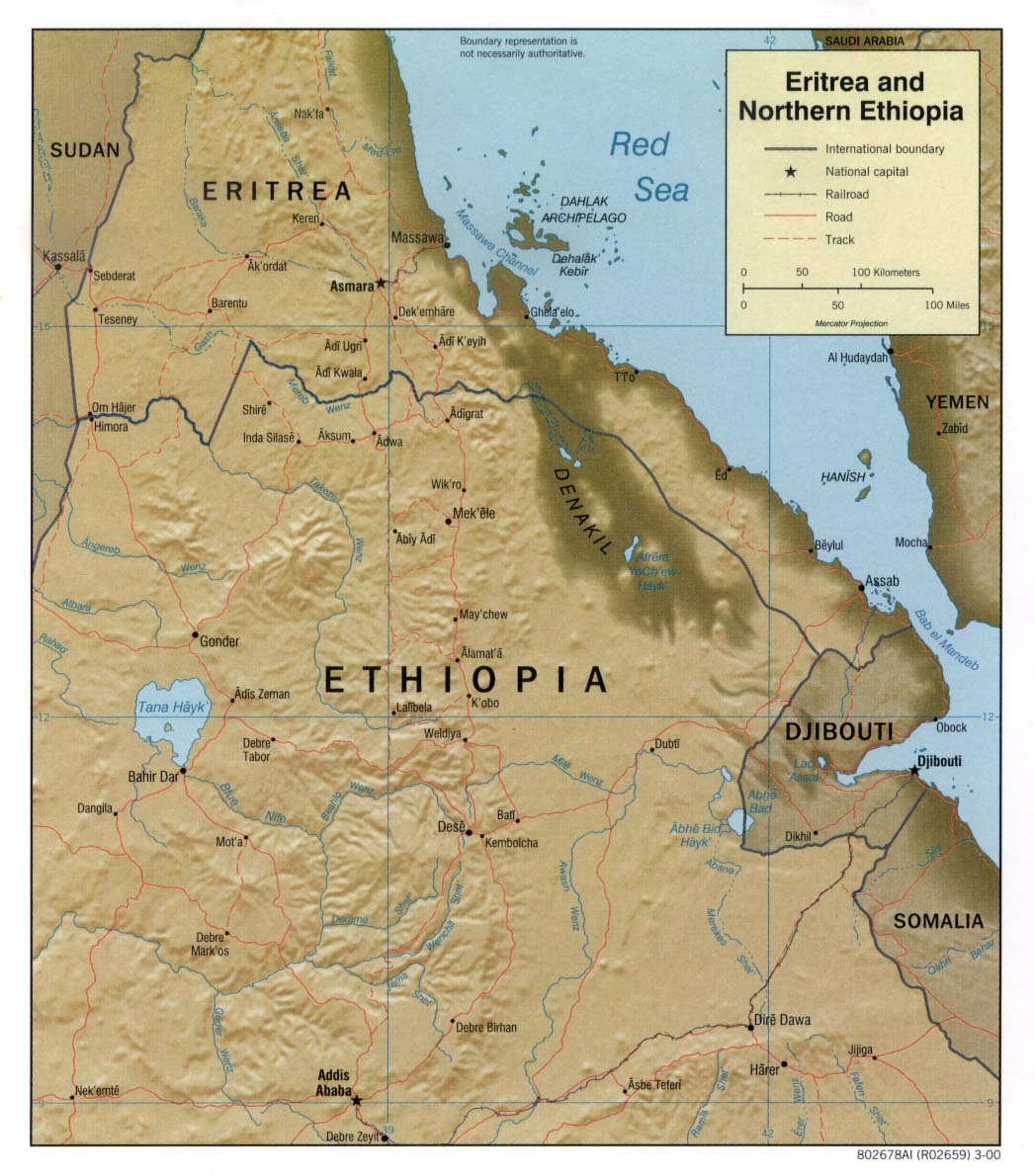
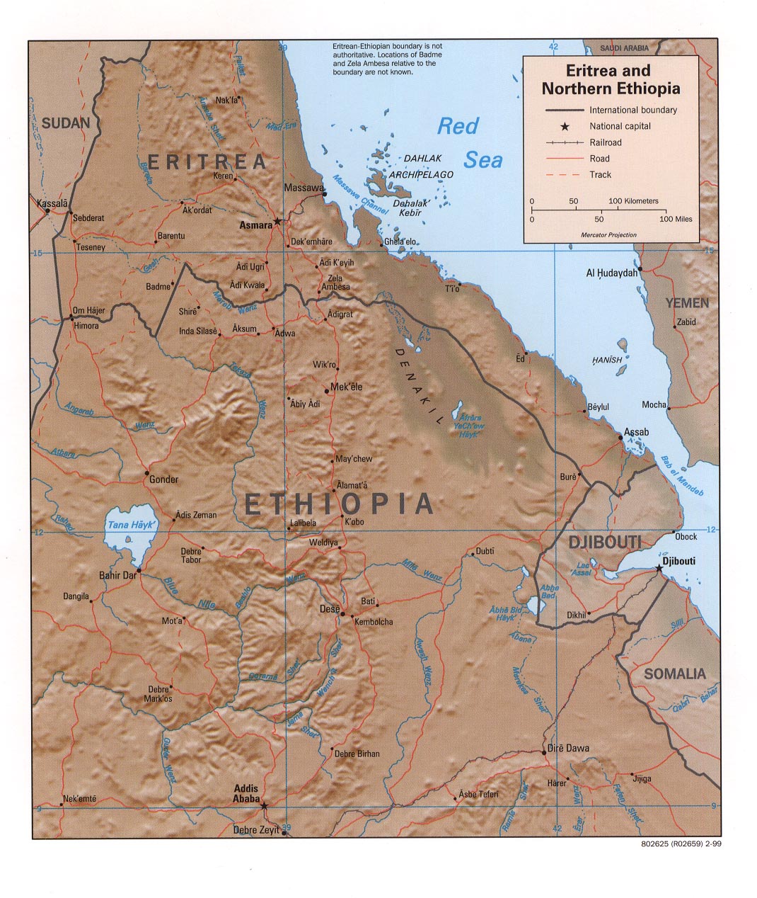
- Eritrea and Northern Ethiopia (Shaded Relief) 2000 (185K)
- Eritrea and Northern Ethiopia (Shaded Relief) 1999 (321K)
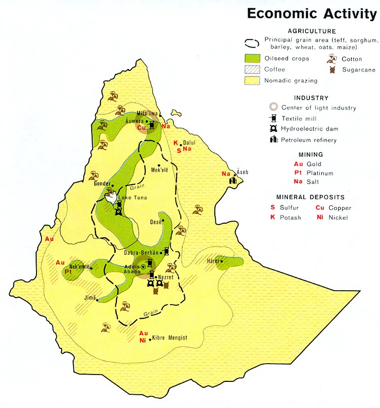
- Ethiopia - Economic Activity from Map No. 503188 1976 (138K)
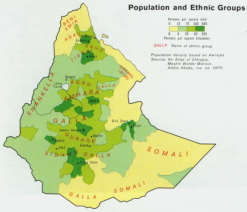
- Ethiopia - Population from Map No. 503188 1976 (127K)
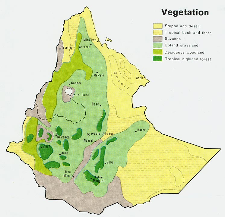
- Ethiopia - Vegetation from Map No. 503188 1976 (121K)
- 1:2,000,000 - Africa Topographic Maps U.S. Army Map Service, Series 2201
- This series covers all of Ethiopia
- 1:1,000,000 - International Map of the World U.S. Army Map Service
- This series covers all of Ethiopia
- 1:1,000,000 - Operational Navigation Chart Series [Aeronautical Charts] Not for navigational use
- Sheets K-5, K-6, L-5 and L-6 cover Ethiopia
- 1:500,000 - Tactical Pilotage Charts U.S. National Imagery and Mapping Agency. Not for navigational use
- This series covers Ethiopia
- 1:500,000 - East Africa Topographic Maps Series Y401 (GSGS 4335), U.S. Army Map Service, 1958-
- This series covers all of Ethiopia
- 1:500,000 - World Series 1404, Great Britain. War Office and Air Ministry. 1958-
- This series covers parts of Ethiopia
- 1:250,000 - East Africa Series Y503, U.S. Army Map Service, 1958-
- This series covers parts of Ethiopia
- This series covers all of Ethiopia
Maps on Other Web Sites