Perry-Castañeda Library
Map Collection
Armenia Maps
The following maps were produced by the U.S. Central Intelligence Agency, unless otherwise indicated.
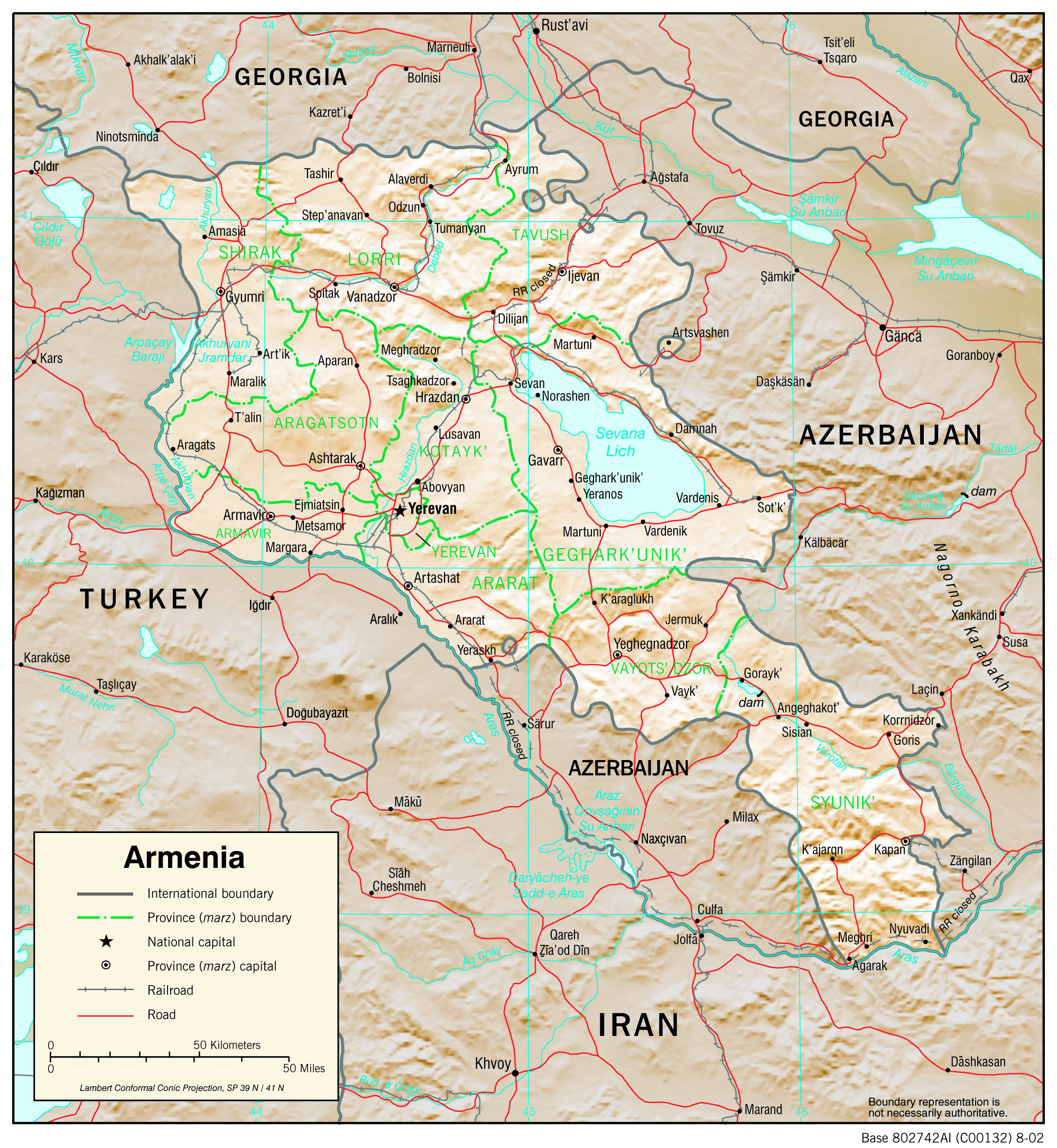
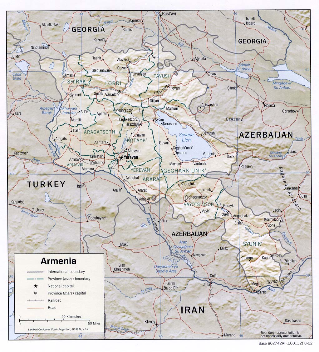
Country Maps- Armenia (Physiography) 2002 (2.9MB) and pdf format (5.3MB)
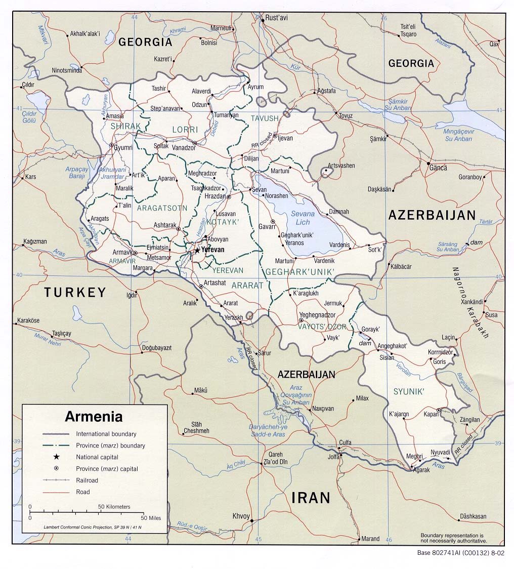
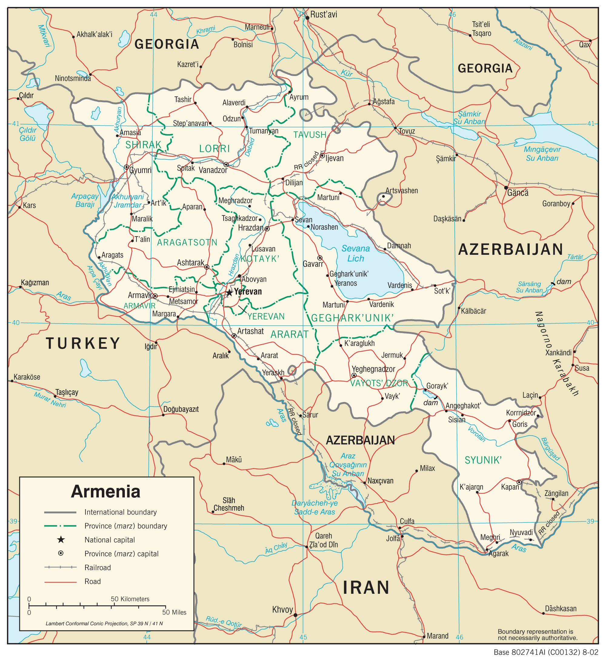
- Armenia (Political) 2002 (239K) and pdf format (314K)
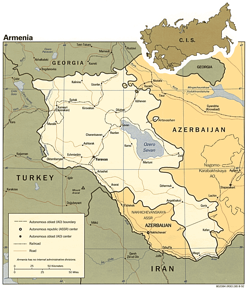
- Armenia (Political) 1992 (207K) and pdf format (214K)
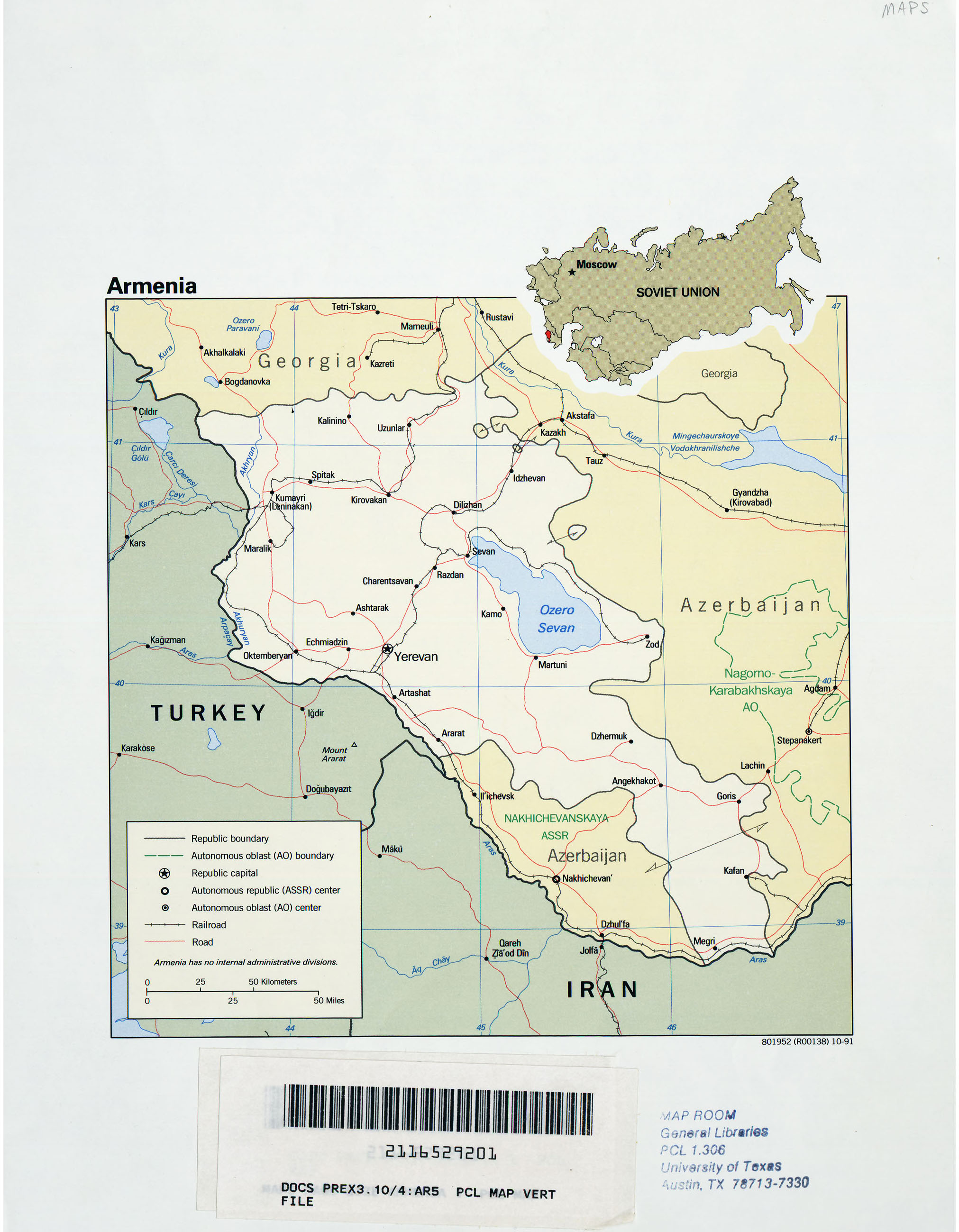
- Armenia (Political) 1991 (784K)
- Armenia (Shaded Relief) 2002 (268K) and pdf format (5.3MB)
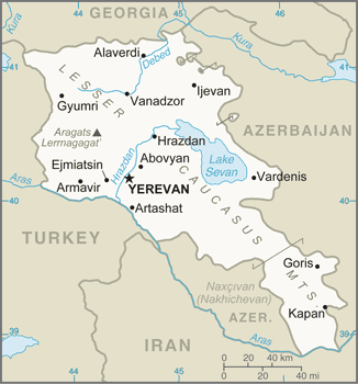
- Armenia (Small Map) 2016 (21.7K)
- Armenia (Transportation) 2002 (1.3MB) and pdf format (315K)
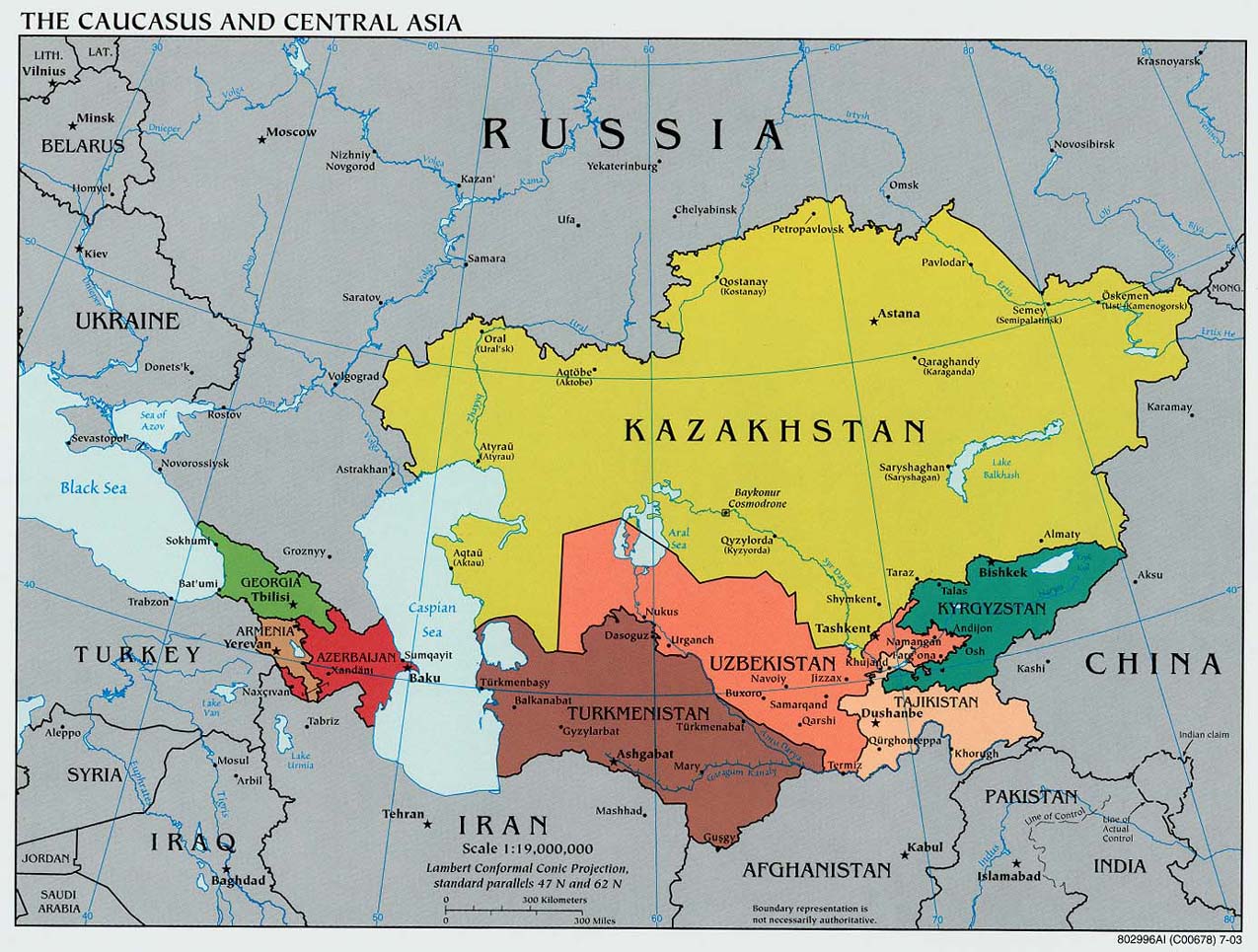
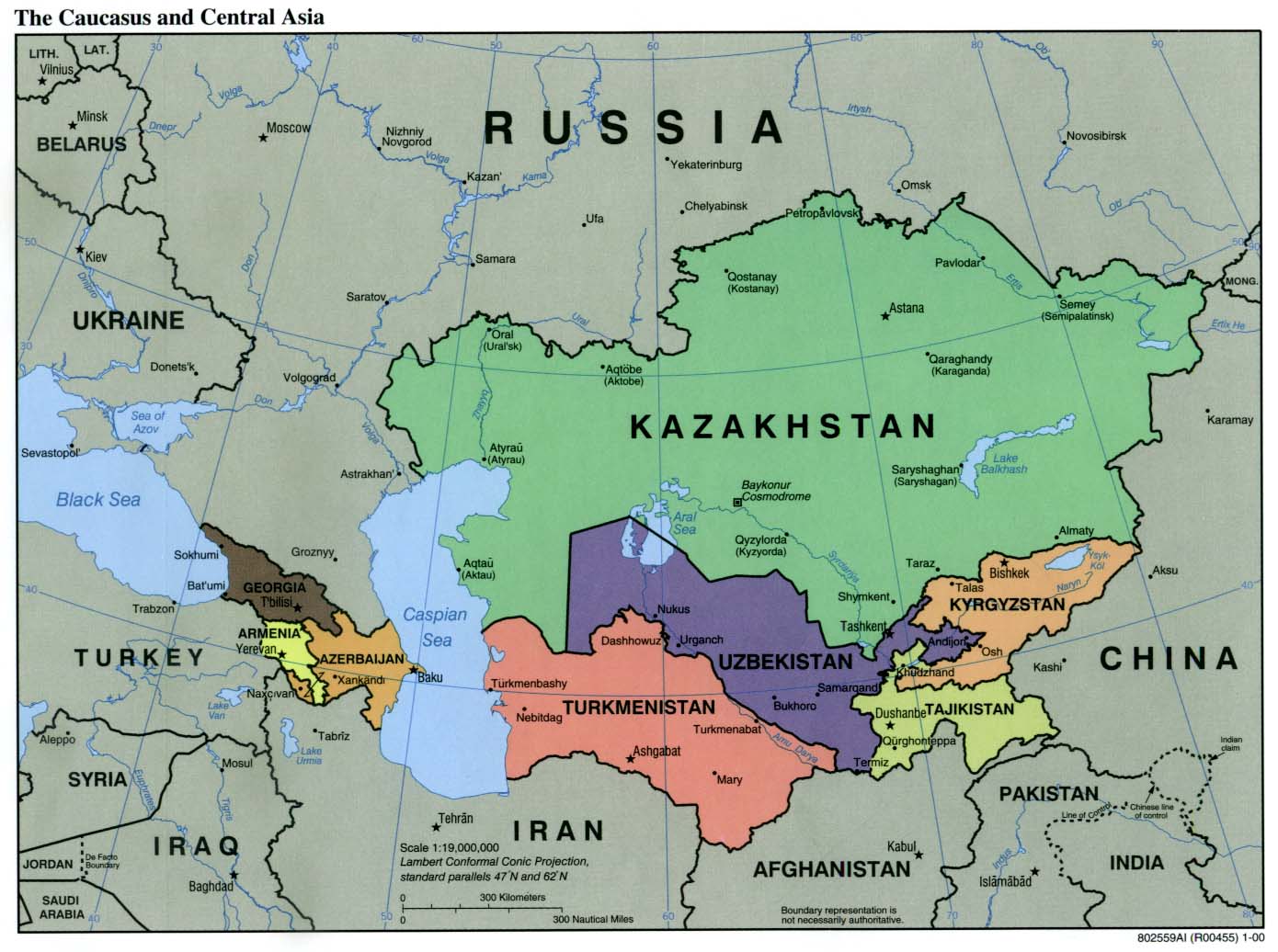
- Caucasus and Central Asia (Political) 2003 (255K) and pdf format (258K)
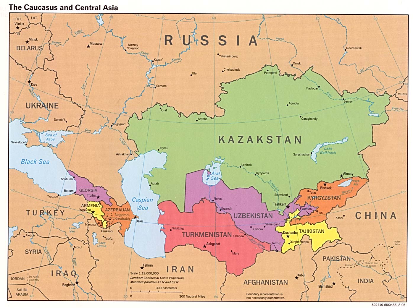
- Caucasus and Central Asia (Political) 2000 (171K) and pdf format (186K)
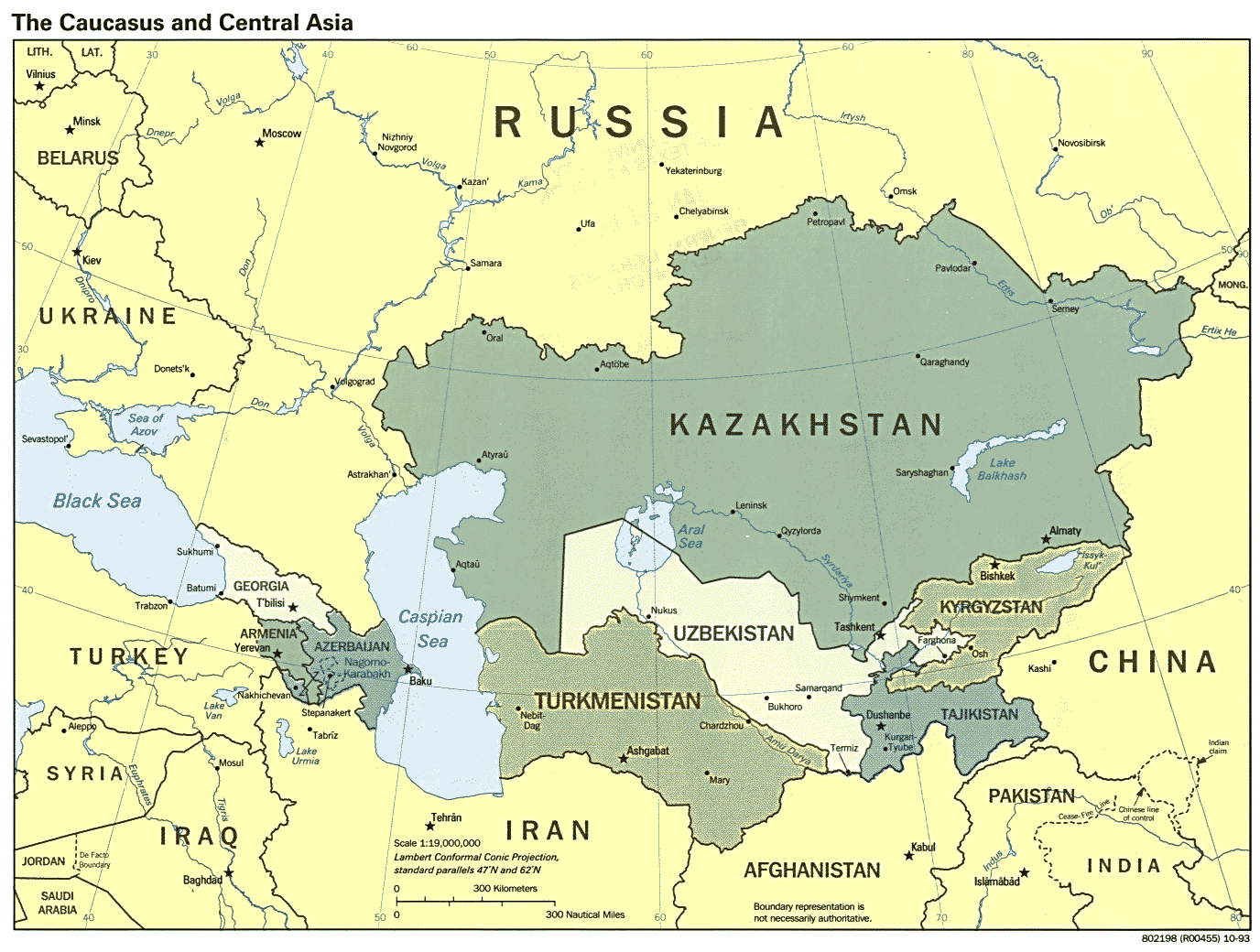
- Caucasus and Central Asia (Political) 1995 (231K)
- Caucasus and Central Asia (Political) 1993 (223K)
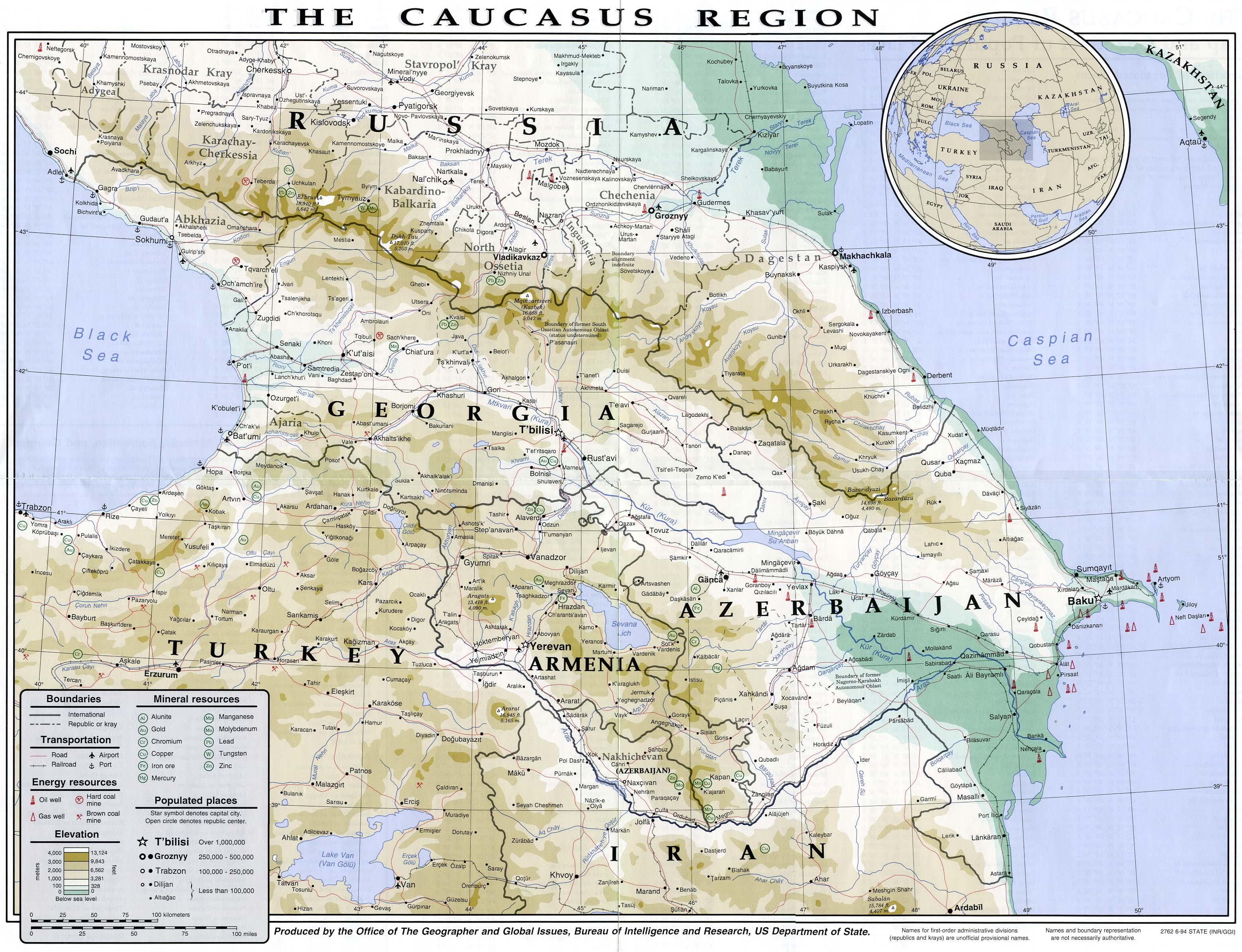
- Caucasus Region U.S.Department of State 1994 (1.2MB)
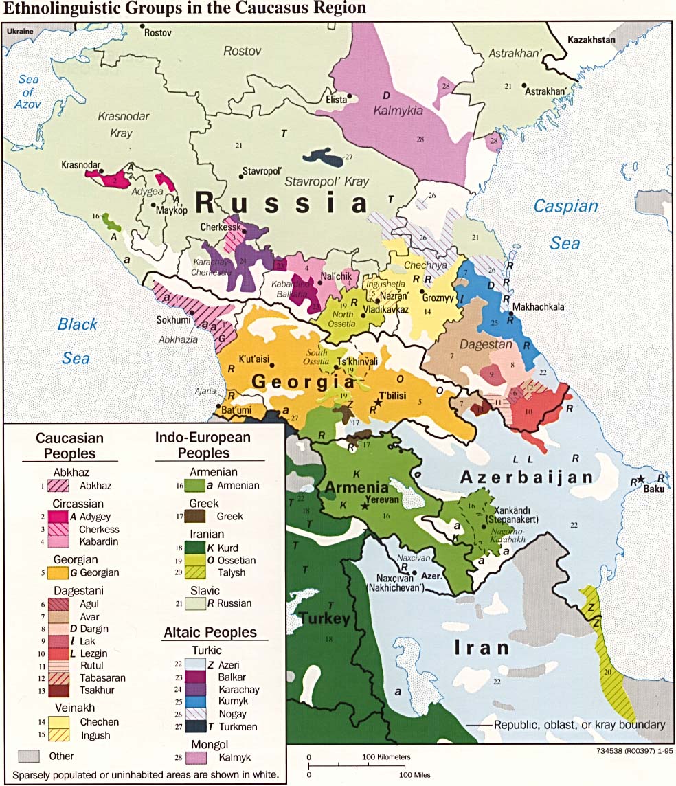
- Ethnolinguistic Groups in the Caucasus Region 1995 (255K)
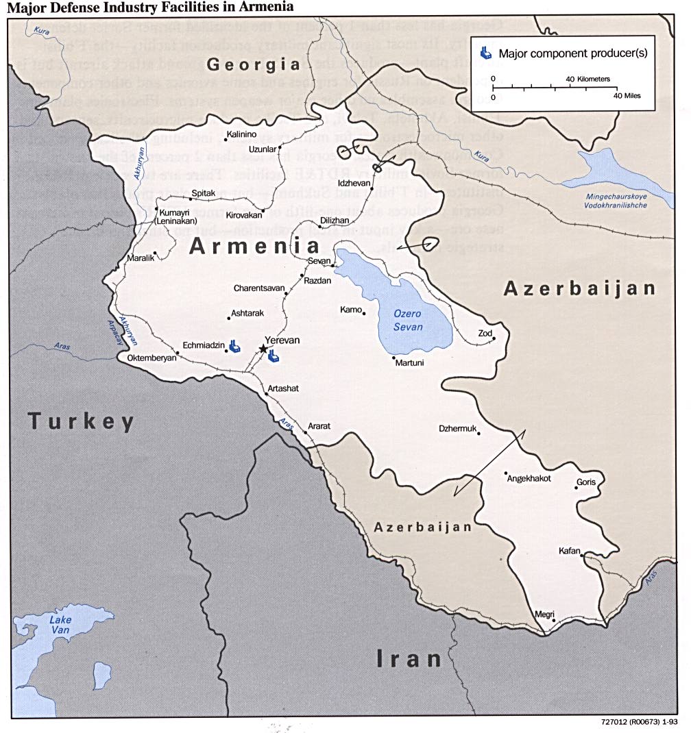
- Major Defense Industry Facilities in Armenia from Defense Industries of the Newly Independent States of Eurasia. 1993 (162K)
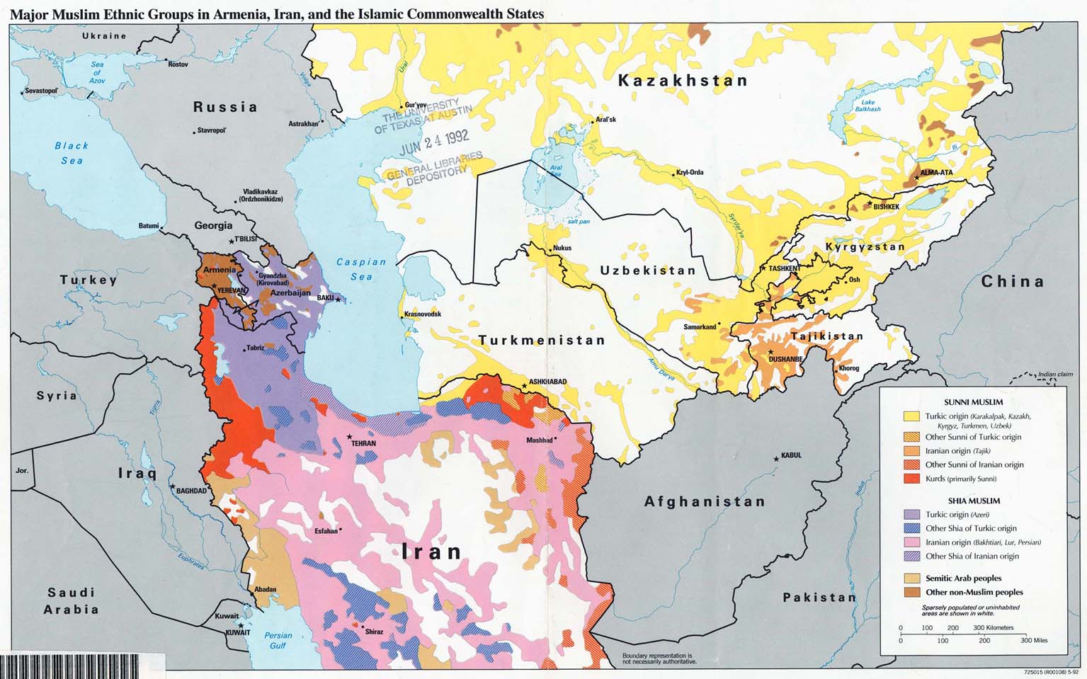
- Major Muslim Ethnic Groups in Armenia, Iran, and the Islamic Commonwealth States 1992 (203K)
- 1:1,000,000 - Operational Navigation Chart Series U.S. Defense Mapping Agency Aerospace Center. Not for navigational use
- Sheets F-4, G-4 and G-5 cover all of Armenia
- 1:500,000 - Tactical Pilotage Chart Series U.S. National Imagery and Mapping Agency. [Not for navigational use]
- This series covers all of Armenia
- 1:250,000 Eastern Europe Series N501, U.S. Army Map Service, 1954
- This series covers most of Armenia.
- 1:250,000 - Russia - Joint Operations Graphic Not for navigational use
- This series covers part of Armenia.
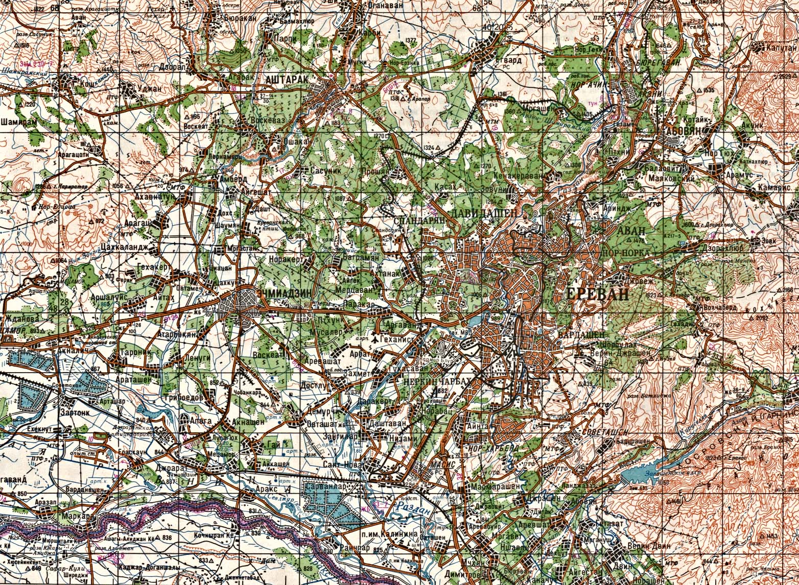
- 1:200,000 - Yerevan (topographic map in Russian) original scale 1:200,000 Portion of Soviet General Staff map K-38-XXXIII 1987 (440K)
- Sheets F-4, G-4 and G-5 cover all of Armenia
Maps on Other Web Sites